more stats
4,094 ft
Distance
19 ft
Climb
-206 ft
Descent
00:09:19
Avg time
-184 ft
Altitude change
346 ft
Altitude min
540 ft
Altitude max
540 ft
Altitude start
358 ft
Altitude end
-4.5%
Grade
-28.5%
Grade max
10.4%
Grade min
541 ft
Distance climb
2,077 ft
Distance down
1,407 ft
Distance flat
00:09:19
Avg time

Hootenanny Details

  • Activities
    • Mountain Bike
    • Hike
    • Trail Running
  • Riding Area
    The Abyss / Extension Ridge
    Nanaimo, British Columbia
  • Difficulty Rating
  • Local Popularity
    45 in Mountain Biking [+]
    • 45 in Trail Running
    • 55 in Hiking
  • Global Ranking
    #107128 in Mountain Biking [+]
    • #121146 in Trail Running
    • #104042 in Hiking
  • Trail Type
    Singletrack
  • Bike Type
    AM, XC
  • Direction
    Both Directions
    Popular Direction Shown
  • Climb Difficulty
    Black Diamond
  • Physical Rating
    Hard
  • Dogs Allowed
    Yes
  • Ride in Rain
    Yes

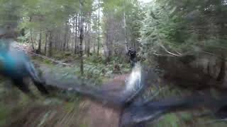
Two way trail that offers challenging climb when travelling west and a fun down when heading east. Hootenanny connects to both Humility and the Abyss which allows the rider to avoid the lower pipeline road which is generally muddy and filled with massive puddles.

Access Info

From the east off of Pot Sticker you turn right where it crosses the gravel road under the power lines or if you are coming from the parking place on Extension Road you turn left where it crosses the gravel road under the power lines. Go up the gravel road under power lines for about 140 meters and the trail head is visible to the left.
From the Abyss you end up at a gravel road, turn left on it and go up the hill, turn right at the first spur road you see. follow it for 100 meters or so and then turn right on a small spur road. The trail is at the end.
From Humility and Easy Peasy you follow the trail down until you can see a trail crossing the trail, turn left to go downhill to bottom or turn right to go up to the Abyss

This trail is unsanctioned.

Traditionally Indigenous Territory

Recent Activity on Trail

Past Week
  • 0 rides
  •  
6 Months
  • 14 rides
  • 8 miles avg distance
All
  • 232 rides
  • Last: Jun 2, 2026
c1c2c3c4
January
February
March
April
May
June
July
August
September
October
November
December
update trails status or condition

Hootenanny Trail Reports

statusdatedescription
Oct 16, 2024 @ 6:24pm
Oct 16, 2024
Aug 16, 2024 @ 3:16pm
Aug 16, 2024
Aug 22, 2022 @ 10:08pm
Aug 22, 2022
Rode Trail. It's in great shape.
Aug 18, 2022 @ 6:21pm
Aug 18, 2022
Very overgrown. Your arms will get extremely beat up, one portion has a log in the trail. Hazzard as it's so overgrown you can't see it.
Jun 1, 2022 @ 6:26pm
Jun 1, 2022
Couple of trees blocking the trail. Ride around possible. Went back later with chainsaw and cleared the trail.
more »
Status:
on Oct 16, 2024
Ideal
Avg: 3.99 (4 votes)
Your vote: 0

view (774)
close
3D
Trail Conditions
  • Unknown
  • Snow Groomed
  • Snow Packed
  • Snow Covered
  • Snow Cover Partial
  • Freeze/thaw Cycle
  • Icy
  • Prevalent Mud
  • Wet
  • Variable
  • Ideal
  • Dry
  • Very Dry
Trail Flow (Ridden Direction)
Trailforks scans users ridelogs to determine the most popular direction each trail is ridden. A good flowing trail network will have most trails flowing in a single direction according to their intension.
The colour categories are based on what percentage of riders are riding a trail in its intended direction.
  • > 96%
  • > 90%
  • > 80%
  • > 70%
  • > 50%
  • < 50%
  • bi-directional trail
  • no data
Trail Last Ridden
Trailforks scans ridelogs to determine the last time a trail was ridden.
  • < 2 days
  • < 1 week
  • < 2 weeks
  • < 1 month
  • < 6 months
  • > 6 months
Trail Ridden Direction
The intended direction a trail should be ridden.
  • Downhill Only
  • Downhill Primary
  • Both Directions
  • Uphill Primary
  • Uphill Only
  • One Direction
Contribute Details
Colors indicate trail is missing specified detail.
  • Description
  • Photos
  • Description & Photos
  • Videos
Trail Popularity ?
Trailforks scans ridelogs to determine which trails are ridden the most in the last 9 months. Trails are compared with nearby trails in the same city region with a possible 25 colour shades. Think of this as a heatmap, more rides = more kinetic energy = warmer colors.
  • most popular
  • popular
  • less popular
  • not popular
ATV/ORV/OHV Filter
Max Vehicle Width
inches
US Cell Coverage
Legend
cell carrier legend

Radar Time
Activity Recordings
Trailforks uses anonymized public activity data. ?
Activity Recordings
Trailforks uses anonymized public activity data. ?
Personal Heatmap
Activity Types
all / none
Options
2
Date range month
Winter Trails
Warning A routing network for winter maps does not exist. Selecting trails using the winter trails layer has been disabled.
Missing Trails
Most Popular
Least Popular
Trails are colored based on popularity. The more popular a trail is, the more red. Less popular trails trend towards green.
Jump Magnitude Heatmap
Heatmap of where riders jump on trails. Zoom in to see individual jumps, click circles to view jump details.
BC Backroad Status

Service Road Atlas is a free to use, community-driven service for viewing and creating reports on the numerous back-country service roads around B.C. and Alberta.

map legend
Slope Aspect
Direction the slope faces
Flat N NE E SE S SW W NW
Trails Deemphasized
Trails are shown in grey.
disable
Only show trails with no bike usage.
Enable
Suggested Layers
Based on selected activity type

    Save the current map location and zoom level as your default home location whenever this page is loaded.

    Save
        Directions to hootenanny trailhead (49.107160, -123.949340)

        Photos

        10 more »
        75 |
        Sep 4, 2021 @ 8:57am
        Sep 4, 2021
        72 |
        Sep 4, 2021 @ 8:57am
        Sep 4, 2021
        63 |
        Feb 17, 2020 @ 3:41pm
        Feb 17, 2020
        288 |
        Apr 7, 2016 @ 12:53pm
        Apr 7, 2016

        Videos

        1 more »
        Bottom Hootenany Mountain Bike Trail
        5:22 | 122 | Feb 16, 2023 , Nanaimo

        Routes with this trail

        123 miles 18,870 ft 510 Loop Race
        This event route is a fundraiser for Nanaimo Loaves and Fishes. Robin Dutton and Peter Sinclair will see...

        4 Reviews & Comments


        We hope you've been enjoying Trailforks!

        Create a FREE account to view trail comments and much more.

        • #16514 - 3,028 views

        Frequently Asked Questions About Hootenanny

        Where is Hootenanny located?
        Hootenanny is located in The Abyss / Extension Ridge, Nanaimo, British Columbia, Canada. It is part of the The Abyss / Extension Ridge trail network. The trailhead is located at coordinates 49.10716, -123.94934.
        How hard is Hootenanny?
        Hootenanny is rated as Blue difficulty. The physical rating is Hard. The average grade is 4.5%. The climb difficulty is rated Black Diamond.
        What is the elevation gain for Hootenanny?
        Hootenanny has 6 m of elevation gain. The trail has 63 m of elevation descent. The elevation ranges from 105 m to 165 m.
        Is Hootenanny a point to point trail?
        Hootenanny is not a point to point trail. The direction is Both Directions. The trail type is singletrack.

        Hit the Trail

        Open in App

        Get this trail on your phone instantly.
        open trail in app

        Download Trail

        Save to wishlist, Garmin & download.
        save the trail

        Find Related Routes

        Find routes and users activities that include this trail.
        find routes for this trail

        You must enter a description before submitting.