more stats
1,312 ft
Distance
-247 ft
Descent
00:02:14
Avg time
-247 ft
Altitude change
918 ft
Altitude min
1,166 ft
Altitude max
1,166 ft
Altitude start
919 ft
Altitude end
-18.9%
Grade
-36.8%
Grade max
-8.1%
Grade min
1,312 ft
Distance down
00:02:14
Avg time

Hoots Details

  • Activities
    • Mountain Bike
    • Hike
    • Trail Running
  • Riding Area
    Woodlot
    Maple Ridge, British Columbia
  • Difficulty Rating
  • Voted Difficulty
    Black Diamond (3 votes)
  • Local Popularity
    80 in Mountain Biking [+]
    • 40 in Trail Running
    • 60 in Hiking
  • Global Ranking
    #30570 in Mountain Biking [+]
    • #114096 in Trail Running
    • #83020 in Hiking
  • Trail Type
    Singletrack
  • Bike Type
    DH, AM
  • Dogs Allowed
    Yes
  • eBike Allowed
  • TTFs on Trail
    A-Frame, Berm, Bridge, Drop, Jump, Ladder Bridge, Rock Face, Rock Garden

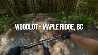
Starts at the end of Giant Killer and flows back into the skidder road at 6 corners.

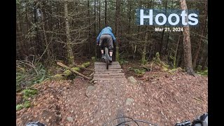
Hoots has a little bit of everything from tech corner sections, small sender jumps, drops, rock rolls, and new features in the lower clearcut area.

Hoots is a black diamond-rated trail and not suitable for new riders**

Access Info

Starts at the end of Giant Killer off of the Stovetop road.

Trail Supporters
Local Trail Association

Recent Activity on Trail

Past Week
  • 3 rides
  • 8 miles average
6 Months
  • 82 rides
  • 8 miles avg distance
All
  • 1,242 rides
  • Last: Jun 20, 2026
c1c2c3c4
January
February
March
April
May
June
July
August
September
October
November
December
update trails status or condition

Hoots Trail Reports

statusdatedescription
Jun 16, 2026 @ 11:28am (America/Vancouver)
Jun 16, 2026
May 2, 2026 @ 9:51am (America/Vancouver)
May 2, 2026
Mar 21, 2026 @ 9:33am (America/Vancouver)
Mar 21, 2026
In great shape!
Feb 24, 2026 @ 6:45pm (America/Vancouver)
Feb 24, 2026
reporter
Feb 21, 2026 @ 4:36pm (America/Vancouver)
Feb 21, 2026
The staring wood rolldown is snowy and icy, do not brake. Then it gets better until you get out into the open and there is all the wooden...
more »
Status:
on Jun 16, 2026
Ideal
Avg: 4.32 (31 votes)
Your vote: 0

view (6,109)
close
3D
Trail Conditions
  • Unknown
  • Snow Groomed
  • Snow Packed
  • Snow Covered
  • Snow Cover Partial
  • Freeze/thaw Cycle
  • Icy
  • Prevalent Mud
  • Wet
  • Variable
  • Ideal
  • Dry
  • Very Dry
Trail Flow (Ridden Direction)
Trailforks scans users ridelogs to determine the most popular direction each trail is ridden. A good flowing trail network will have most trails flowing in a single direction according to their intension.
The colour categories are based on what percentage of riders are riding a trail in its intended direction.
  • > 96%
  • > 90%
  • > 80%
  • > 70%
  • > 50%
  • < 50%
  • bi-directional trail
  • no data
Trail Last Ridden
Trailforks scans ridelogs to determine the last time a trail was ridden.
  • < 2 days
  • < 1 week
  • < 2 weeks
  • < 1 month
  • < 6 months
  • > 6 months
Trail Ridden Direction
The intended direction a trail should be ridden.
  • Downhill Only
  • Downhill Primary
  • Both Directions
  • Uphill Primary
  • Uphill Only
  • One Direction
Contribute Details
Colors indicate trail is missing specified detail.
  • Description
  • Photos
  • Description & Photos
  • Videos
Trail Popularity ?
Trailforks scans ridelogs to determine which trails are ridden the most in the last 9 months. Trails are compared with nearby trails in the same city region with a possible 25 colour shades. Think of this as a heatmap, more rides = more kinetic energy = warmer colors.
  • most popular
  • popular
  • less popular
  • not popular
ATV/ORV/OHV Filter
Max Vehicle Width
inches
US Cell Coverage
Legend
cell carrier legend

Radar Time
Activity Recordings
Trailforks uses anonymized public activity data. ?
Activity Recordings
Trailforks uses anonymized public activity data. ?
Personal Heatmap
Activity Types
all / none
Options
2
Date range month
Winter Trails
Warning A routing network for winter maps does not exist. Selecting trails using the winter trails layer has been disabled.
Missing Trails
Most Popular
Least Popular
Trails are colored based on popularity. The more popular a trail is, the more red. Less popular trails trend towards green.
Jump Magnitude Heatmap
Heatmap of where riders jump on trails. Zoom in to see individual jumps, click circles to view jump details.
BC Backroad Status

Service Road Atlas is a free to use, community-driven service for viewing and creating reports on the numerous back-country service roads around B.C. and Alberta.

map legend
Slope Aspect
Direction the slope faces
Flat N NE E SE S SW W NW
Trails Deemphasized
Trails are shown in grey.
disable
Only show trails with no bike usage.
Enable
Suggested Layers
Based on selected activity type

    Save the current map location and zoom level as your default home location whenever this page is loaded.

    Save
        Directions to hoots trailhead (49.233950, -122.432990)

        Photos

        86 more »
        605 |
        May 16, 2013 @ 11:50pm
        May 16, 2013
        1,746 |
        Mar 24, 2011 @ 12:37am
        Mar 24, 2011
        46 |
        Nov 3, 2023 @ 12:29pm
        Nov 3, 2023
        51 |
        Nov 3, 2023 @ 12:29pm
        Nov 3, 2023

        Videos

        29 more »
        Hoots - Woodlot MTB - Maple Ridge, BC | Full...
        0:24 | 14 | Jun 5, 2026 , Maple Ridge
        Trimming Hoots
        0:46 | 7 | May 22, 2026 , Maple Ridge
        GIANT KILLER + HOOTS | Single Black trail |...
        3:01 | 121 | Oct 24, 2024 , Maple Ridge
        Hoots Mar 21, 2024
        0:24 | 155 | Mar 24, 2024 , Maple Ridge

        Routes with this trail

        12 miles 3,146 ft 17
        Fraser Valley Woodlot Epic Fraser Valley Relive Your Ride For other ride suggestions for this and other...
        5 miles 1,438 ft 16
        A short lap of some of the best this zone has to offer in a Blue category.

        Trail Products

        9 Reviews & Comments


        We hope you've been enjoying Trailforks!

        Create a FREE account to view trail comments and much more.

        • By BCpovTF Pro & contributors
        • #99 - 6,447 views

        Frequently Asked Questions About Hoots

        Where is Hoots located?
        Hoots is located in Woodlot, Maple Ridge, British Columbia, Canada. It is part of the Woodlot trail network. The trailhead is located at coordinates 49.23395, -122.43299.
        How hard is Hoots?
        Hoots is rated as Black Diamond difficulty. The average grade is 18.9%.
        What is the elevation gain for Hoots?
        The trail has 247 ft of elevation descent. The elevation ranges from 918 ft to 1,166 ft.
        How long is Hoots?
        Hoots is 1,312 ft long. The trail type is singletrack.

        Hit the Trail

        Open in App

        Get this trail on your phone instantly.
        open trail in app

        Download Trail

        Save to wishlist, Garmin & download.
        save the trail

        Find Related Routes

        Find routes and users activities that include this trail.
        find routes for this trail

        You must enter a description before submitting.