more stats
682 ft
Distance
-81 ft
Descent
00:00:37
Avg time
-82 ft
Altitude change
2,331 ft
Altitude min
2,413 ft
Altitude max
2,413 ft
Altitude start
2,329 ft
Altitude end
-12%
Grade
-33.5%
Grade max
1.4%
Grade min
587 ft
Distance down
95 ft
Distance flat
00:00:37
Avg time

Hornet Details

  • Activities
    • Mountain Bike
  • Riding Area
    Whistler Mountain Bike Park
    Whistler, British Columbia
  • Difficulty Rating
  • Voted Difficulty
    Blue (1 vote)
  • Local Popularity
    100 in Mountain Biking
  • Global Ranking
    #161 in Mountain Biking
  • Trail Type
    Singletrack
  • Bike Type
    DH, AM
  • Season
    May - October
  • Land Owner

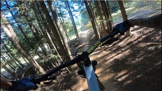
Short technical trail in the Fitzsimmons area of the Bike Park. Rated between Wednesday Night Delight and Lower Angry Pirate on Whistler's trail progression chart - about half way through the blue technical trails. It ends with two high-speed doubles.

Access Info

The start is off Lower A-Line (black freeride trail), but the lower half of Hornet can be accessed from Lower EZ Does It, making for a more interesting section on the way to the village.

Disclaimer

Trail is a part of the Whistler Bike Park. Contact patrol at +16049355555

Bike Park

Recent Activity on Trail

Past Week
  • 146 rides
  • 21 miles average
6 Months
  • 662 rides
  • 22 miles avg distance
All
  • 11,338 rides
  • Last: Jun 23, 2026
c1c2c3c4
January
February
March
April
May
June
July
August
September
October
November
December
Status:
on May 31, 2026
Dry
Avg: 3.61 (53 votes)
Your vote: 0

view (119,734)
close
3D
Trail Conditions
  • Unknown
  • Snow Groomed
  • Snow Packed
  • Snow Covered
  • Snow Cover Partial
  • Freeze/thaw Cycle
  • Icy
  • Prevalent Mud
  • Wet
  • Variable
  • Ideal
  • Dry
  • Very Dry
Trail Flow (Ridden Direction)
Trailforks scans users ridelogs to determine the most popular direction each trail is ridden. A good flowing trail network will have most trails flowing in a single direction according to their intension.
The colour categories are based on what percentage of riders are riding a trail in its intended direction.
  • > 96%
  • > 90%
  • > 80%
  • > 70%
  • > 50%
  • < 50%
  • bi-directional trail
  • no data
Trail Last Ridden
Trailforks scans ridelogs to determine the last time a trail was ridden.
  • < 2 days
  • < 1 week
  • < 2 weeks
  • < 1 month
  • < 6 months
  • > 6 months
Trail Ridden Direction
The intended direction a trail should be ridden.
  • Downhill Only
  • Downhill Primary
  • Both Directions
  • Uphill Primary
  • Uphill Only
  • One Direction
Contribute Details
Colors indicate trail is missing specified detail.
  • Description
  • Photos
  • Description & Photos
  • Videos
Trail Popularity ?
Trailforks scans ridelogs to determine which trails are ridden the most in the last 9 months. Trails are compared with nearby trails in the same city region with a possible 25 colour shades. Think of this as a heatmap, more rides = more kinetic energy = warmer colors.
  • most popular
  • popular
  • less popular
  • not popular
ATV/ORV/OHV Filter
Max Vehicle Width
inches
US Cell Coverage
Legend
cell carrier legend

Radar Time
Activity Recordings
Trailforks uses anonymized public activity data. ?
Activity Recordings
Trailforks uses anonymized public activity data. ?
Personal Heatmap
Activity Types
all / none
Options
2
Date range month
Winter Trails
Warning A routing network for winter maps does not exist. Selecting trails using the winter trails layer has been disabled.
Missing Trails
Most Popular
Least Popular
Trails are colored based on popularity. The more popular a trail is, the more red. Less popular trails trend towards green.
Jump Magnitude Heatmap
Heatmap of where riders jump on trails. Zoom in to see individual jumps, click circles to view jump details.
BC Backroad Status

Service Road Atlas is a free to use, community-driven service for viewing and creating reports on the numerous back-country service roads around B.C. and Alberta.

map legend
Slope Aspect
Direction the slope faces
Flat N NE E SE S SW W NW
Trails Deemphasized
Trails are shown in grey.
disable
Only show trails with no bike usage.
Enable
Suggested Layers
Based on selected activity type

    Save the current map location and zoom level as your default home location whenever this page is loaded.

    Save
        Directions to hornet trailhead (50.110210, -122.955660)

        Photos

        1 more »
        48 |
        Jan 31, 2025 @ 11:17pm
        Jan 31, 2025

        Videos

        12 more »
        youtuber HORNET | Blue trail | Whistler Bikepark
        0:43 | 221 | Nov 27, 2023 , Whistler
        youtuber 3 Best Blue Routes Down The Whistler Bike...
        31:44 | 65 | Oct 7, 2025 , Whistler
        youtuber Whistler Bike Park's Mens Night Sends.
        30:53 | 187 | Oct 10, 2023 , Whistler
        youtuber That Escalated Quickly! Went For A Mellow Blue...
        8:33 | 189 | Sep 10, 2023 , Whistler

        Routes with this trail

        4 miles 887 ft 6
        Thursday, September 11, 2025 | Sign-in @ 5:00pm Ride begins @ 6:00pm Après hosted by GLC Prizing by...
        2 miles 28 ft 6
        Brake Test Lap
        4.0 34 miles 13,279 ft 25 Point to Point Race
        Riding clean and fast on showcase trails with friends and legends is the order of the day in Enduro...

        Reviews / Comments

        No reviews yet, be the first to write a review or ask a question.
        Use trail reports to comment on trail conditions.


        We hope you've been enjoying Trailforks!

        Create a FREE account to view trail comments and much more.

        • By canadakaTF Pro Trailforks & contributors
        • #6315 - 6,705 views

        Frequently Asked Questions About Hornet

        Where is Hornet located?
        Hornet is located in Whistler Mountain Bike Park, Whistler, British Columbia, Canada. It is part of the Whistler Mountain Bike Park trail network. The trailhead is located at coordinates 50.11021, -122.95566.
        How hard is Hornet?
        Hornet is rated as Blue difficulty. The average grade is 12%.
        What is the elevation gain for Hornet?
        The trail has 25 m of elevation descent. The elevation ranges from 710 m to 736 m.
        How long is Hornet?
        Hornet is 208.0 m long. The trail type is singletrack.

        Hit the Trail

        Open in App

        Get this trail on your phone instantly.
        open trail in app

        Download Trail

        Save to wishlist, Garmin & download.
        save the trail

        Find Related Routes

        Find routes and users activities that include this trail.
        find routes for this trail

        You must enter a description before submitting.