more stats
2,474 ft
Distance
3 ft
Climb
-348 ft
Descent
00:05:49
Avg time
-344 ft
Altitude change
1,354 ft
Altitude min
1,698 ft
Altitude max
1,698 ft
Altitude start
1,355 ft
Altitude end
-13.9%
Grade
-65.5%
Grade max
5.1%
Grade min
66 ft
Distance climb
2,070 ft
Distance down
223 ft
Distance flat
00:05:49
Avg time

Hybrid Details

  • Activities
    • Mountain Bike
    • E-Bike
  • Riding Area
    Diamond Head
    Squamish, British Columbia
  • Difficulty Rating
  • Voted Difficulty
    Black Diamond (2 votes)
  • Local Popularity
    90 in Mountain Biking [+]
    • 85 in E-Biking
  • Global Ranking
    #19482 in Mountain Biking [+]
    • #15020 in E-Biking
  • Trail Type
    Singletrack
  • Bike Type
    DH, AM
  • Direction
    Downhill Only
  • Physical Rating
    Moderate
  • Trail Visibility
    Always easy to follow
  • Dogs Allowed
    Yes
  • eBike Allowed
    Yes up to Class 1
  • TTFs on Trail
    Jump
  • Ride in Rain
    Yes

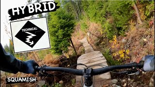
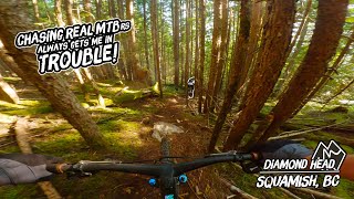
A classic lap starting in mature second growth and finishing in forrest logged in 2014. The upper half features some moderately steep single track and an optional drop and step down. The lower half was fully rebuilt in the fall of 2020 by Ride BC supported by the Pamplemousse Pale Ale fund. A great mix of single track, rollers, doubles and jumps. Thanks to SORCA for building the boardwalk over the creek and helping with some of the dirt work, along with the many volunteers. Enjoy

Local Trail Association
Traditionally Indigenous Territory

Recent Activity on Trail

Past Week
  • 9 rides
  • 10 miles average
6 Months
  • 131 rides
  • 9 miles avg distance
All
  • 1,229 rides
  • Last: Jun 22, 2026
c1c2c3c4
January
February
March
April
May
June
July
August
September
October
November
December
Status:
on Jun 12, 2026
Dry
Avg: 4.25 (39 votes)
Your vote: 0

view (7,806)
close
3D
Trail Conditions
  • Unknown
  • Snow Groomed
  • Snow Packed
  • Snow Covered
  • Snow Cover Partial
  • Freeze/thaw Cycle
  • Icy
  • Prevalent Mud
  • Wet
  • Variable
  • Ideal
  • Dry
  • Very Dry
Trail Flow (Ridden Direction)
Trailforks scans users ridelogs to determine the most popular direction each trail is ridden. A good flowing trail network will have most trails flowing in a single direction according to their intension.
The colour categories are based on what percentage of riders are riding a trail in its intended direction.
  • > 96%
  • > 90%
  • > 80%
  • > 70%
  • > 50%
  • < 50%
  • bi-directional trail
  • no data
Trail Last Ridden
Trailforks scans ridelogs to determine the last time a trail was ridden.
  • < 2 days
  • < 1 week
  • < 2 weeks
  • < 1 month
  • < 6 months
  • > 6 months
Trail Ridden Direction
The intended direction a trail should be ridden.
  • Downhill Only
  • Downhill Primary
  • Both Directions
  • Uphill Primary
  • Uphill Only
  • One Direction
Contribute Details
Colors indicate trail is missing specified detail.
  • Description
  • Photos
  • Description & Photos
  • Videos
Trail Popularity ?
Trailforks scans ridelogs to determine which trails are ridden the most in the last 9 months. Trails are compared with nearby trails in the same city region with a possible 25 colour shades. Think of this as a heatmap, more rides = more kinetic energy = warmer colors.
  • most popular
  • popular
  • less popular
  • not popular
ATV/ORV/OHV Filter
Max Vehicle Width
inches
US Cell Coverage
Legend
cell carrier legend

Radar Time
Activity Recordings
Trailforks uses anonymized public activity data. ?
Activity Recordings
Trailforks uses anonymized public activity data. ?
Personal Heatmap
Activity Types
all / none
Options
2
Date range month
Winter Trails
Warning A routing network for winter maps does not exist. Selecting trails using the winter trails layer has been disabled.
Missing Trails
Most Popular
Least Popular
Trails are colored based on popularity. The more popular a trail is, the more red. Less popular trails trend towards green.
Jump Magnitude Heatmap
Heatmap of where riders jump on trails. Zoom in to see individual jumps, click circles to view jump details.
BC Backroad Status

Service Road Atlas is a free to use, community-driven service for viewing and creating reports on the numerous back-country service roads around B.C. and Alberta.

map legend
Slope Aspect
Direction the slope faces
Flat N NE E SE S SW W NW
Trails Deemphasized
Trails are shown in grey.
disable
Only show trails with no bike usage.
Enable
Suggested Layers
Based on selected activity type

    Save the current map location and zoom level as your default home location whenever this page is loaded.

    Save
        Directions to hybrid trailhead (49.746400, -123.073810)

        Photos

        49 more »
        709 |
        Dec 3, 2014 @ 5:04pm
        Dec 3, 2014
        1,408 |
        Dec 3, 2014 @ 5:08pm
        Dec 3, 2014
        47 |
        Jan 6, 2025 @ 9:58am
        Jan 6, 2025
        110 |
        Apr 26, 2024 @ 9:57pm
        Apr 26, 2024

        Videos

        15 more »
        youtuber Hybrid & Brodown - Squamish Mountain Biking
        2:24 | 899 | Jun 13, 2022 , Squamish
        youtuber HYBRID | Black trail | Squamish - University
        2:20 | 464 | Dec 27, 2023 , Squamish
        This YouTuber Knows How to Push My Comfort Zone
        22:57 | 184 | Oct 16, 2024 , Squamish
        Winter Time Blues
        2:05 | 243 | Feb 4, 2024 , Squamish

        Trail Lists

        Routes with this trail

        3 miles 896 ft 4
        Legacy Climb-Ring Creek - - - Pseudo 3
        27 miles 5,170 ft 24 Loop
        Set in the BC coast mountain rain forest, the Squamish Enduro showcases some of the best, and most...
        4 miles 1,223 ft 6
        Legacy Climb > > > > > > Psuedo-Tsuga - Part 3

        6 Reviews & Comments


        We hope you've been enjoying Trailforks!

        Create a FREE account to view trail comments and much more.

        • By BCpovTF Pro & contributors
        • #1638 - 14,628 views

        Frequently Asked Questions About Hybrid

        Where is Hybrid located?
        Hybrid is located in Diamond Head, Squamish, British Columbia, Canada. It is part of the Diamond Head trail network. The trailhead is located at coordinates 49.7464, -123.07381.
        How hard is Hybrid?
        Hybrid is rated as Black Diamond difficulty. The physical rating is Moderate. The average grade is 13.9%.
        What is the elevation gain for Hybrid?
        Hybrid has 1 m of elevation gain. The trail has 106 m of elevation descent. The elevation ranges from 413 m to 518 m.
        Is Hybrid a point to point trail?
        Yes, Hybrid is a point to point trail. The direction is Downhill Only. The trail type is singletrack.

        Hit the Trail

        Open in App

        Get this trail on your phone instantly.
        open trail in app

        Download Trail

        Save to wishlist, Garmin & download.
        save the trail

        Find Related Routes

        Find routes and users activities that include this trail.
        find routes for this trail

        You must enter a description before submitting.