more stats
1.1 miles
Distance
-1,159 ft
Descent
00:11:42
Avg time
-1,159 ft
Altitude change
3,969 ft
Altitude min
5,128 ft
Altitude max
5,128 ft
Altitude start
3,970 ft
Altitude end
-19.6%
Grade
-65.1%
Grade max
-1.3%
Grade min
1 mile
Distance down
89 ft
Distance flat
00:11:42
Avg time

Insanity Details

  • Activities
    • Mountain Bike
    • E-Bike
  • Riding Area
    Panorama Mountain Resort
    Panorama, British Columbia
  • Difficulty Rating
  • Voted Difficulty
    Double Black Diamond (4 votes)
  • Local Popularity
    80 in Mountain Biking [+]
    • 75 in E-Biking
  • Global Ranking
    #61142 in Mountain Biking [+]
    • #69428 in E-Biking
  • Trail Type
    Singletrack
  • Bike Type
    DH
  • Trail Visibility
    Always easy to follow
  • eBike Allowed
    Yes up to Class 1
  • TTFs on Trail
    Berm, Bridge, Drop, Jump, Gap Jump, Rock Face, Rock Garden
  • Land Owner

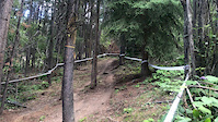
Ride the famous Canadian Nationals DH race course and see if you match up to the pros. This run has it all - jumps, drops, flow, roots, steeps, and technical challenges. Includes the renowned "Cliffs of Insanity" and "Wall Street" which are steep rocky sections that are the main spectacles on race day. The clue is in the name.. You'd be insane not to ride this if you like a challenge

Bike Park

Recent Activity on Trail

Past Week
  • 0 rides
  •  
6 Months
  • 0 rides
  •  
All
  • 103 rides
  • Last: Feb 21, 2026
c1c2c3c4
January
February
March
April
May
June
July
August
September
October
November
December
update trails status or condition

Insanity Trail Reports

Status:
on Sep 2, 2025
Dry
Avg: 4.19 (17 votes)
Your vote: 0

view (1,248)
close
3D
Trail Conditions
  • Unknown
  • Snow Groomed
  • Snow Packed
  • Snow Covered
  • Snow Cover Partial
  • Freeze/thaw Cycle
  • Icy
  • Prevalent Mud
  • Wet
  • Variable
  • Ideal
  • Dry
  • Very Dry
Trail Flow (Ridden Direction)
Trailforks scans users ridelogs to determine the most popular direction each trail is ridden. A good flowing trail network will have most trails flowing in a single direction according to their intension.
The colour categories are based on what percentage of riders are riding a trail in its intended direction.
  • > 96%
  • > 90%
  • > 80%
  • > 70%
  • > 50%
  • < 50%
  • bi-directional trail
  • no data
Trail Last Ridden
Trailforks scans ridelogs to determine the last time a trail was ridden.
  • < 2 days
  • < 1 week
  • < 2 weeks
  • < 1 month
  • < 6 months
  • > 6 months
Trail Ridden Direction
The intended direction a trail should be ridden.
  • Downhill Only
  • Downhill Primary
  • Both Directions
  • Uphill Primary
  • Uphill Only
  • One Direction
Contribute Details
Colors indicate trail is missing specified detail.
  • Description
  • Photos
  • Description & Photos
  • Videos
Trail Popularity ?
Trailforks scans ridelogs to determine which trails are ridden the most in the last 9 months. Trails are compared with nearby trails in the same city region with a possible 25 colour shades. Think of this as a heatmap, more rides = more kinetic energy = warmer colors.
  • most popular
  • popular
  • less popular
  • not popular
ATV/ORV/OHV Filter
Max Vehicle Width
inches
US Cell Coverage
Legend
cell carrier legend

Radar Time
Activity Recordings
Trailforks uses anonymized public activity data. ?
Activity Recordings
Trailforks uses anonymized public activity data. ?
Personal Heatmap
Activity Types
all / none
Options
2
Date range month
Winter Trails
Warning A routing network for winter maps does not exist. Selecting trails using the winter trails layer has been disabled.
Missing Trails
Most Popular
Least Popular
Trails are colored based on popularity. The more popular a trail is, the more red. Less popular trails trend towards green.
Jump Magnitude Heatmap
Heatmap of where riders jump on trails. Zoom in to see individual jumps, click circles to view jump details.
BC Backroad Status

Service Road Atlas is a free to use, community-driven service for viewing and creating reports on the numerous back-country service roads around B.C. and Alberta.

map legend
Slope Aspect
Direction the slope faces
Flat N NE E SE S SW W NW
Trails Deemphasized
Trails are shown in grey.
disable
Only show trails with no bike usage.
Enable
Suggested Layers
Based on selected activity type

    Save the current map location and zoom level as your default home location whenever this page is loaded.

    Save
        Directions to insanity trailhead (50.444950, -116.230130)

        Photos

        99 more »
        92 |
        Jul 25, 2023 @ 11:29am
        Jul 25, 2023
        145 |
        Jul 25, 2023 @ 11:29am
        Jul 25, 2023
        82 |
        Jul 25, 2023 @ 11:29am
        Jul 25, 2023
        63 |
        Sep 18, 2022 @ 2:58pm
        Sep 18, 2022

        Videos

        28 more »
        Insanity Trail / Panorama, BC
        7:44 | 280 | Sep 12, 2023 , Panorama
        Helmet Cam BC CUP #4 Panorama 2022 Gopro POV...
        5:00 | 309 | Nov 3, 2022 , Panorama
        Panorama Race Track Friday Fail
        0:18 | 362 | Dec 20, 2019 , Panorama
        2019 Canadian National Championship Course Preview
        4:53 | 2837 | Jul 25, 2019 , Panorama

        Trail Lists

        Routes with this trail

        1 mile 4 Point to Point Race
        Race Course for 2015. Several new sections have been added including off camber natural section, drops,...
        4.0 1 mile 9 ft 2 Point to Point Race
        Race Course for 2016 BC and Canada Cup - Dunbar Summer Series.
        2 miles 800 ft 6 Point to Point Race
        ● This eventis for EXPERT riders only, not suitable for beginners. ● Due to COVID there is no Racer...

        1 Review & Comments


        We hope you've been enjoying Trailforks!

        Create a FREE account to view trail comments and much more.

        • By Tekmisfit & contributors
        • #2448 - 5,482 views

        Frequently Asked Questions About Insanity

        Where is Insanity located?
        Insanity is located in Panorama Mountain Resort, Panorama, British Columbia, Canada. It is part of the Panorama Mountain Resort trail network. The trailhead is located at coordinates 50.44495, -116.23013.
        How hard is Insanity?
        Insanity is rated as Double Black Diamond difficulty. The average grade is 19.6%.
        What is the elevation gain for Insanity?
        The trail has 1,159 ft of elevation descent. The elevation ranges from 3,969 ft to 5,128 ft.
        How long is Insanity?
        Insanity is 1.1 miles long. The trail type is singletrack.

        Hit the Trail

        Open in App

        Get this trail on your phone instantly.
        open trail in app

        Download Trail

        Save to wishlist, Garmin & download.
        save the trail

        Find Related Routes

        Find routes and users activities that include this trail.
        find routes for this trail

        You must enter a description before submitting.