more stats
2,336 ft
Distance
-323 ft
Descent
2,257 ft
High Point
-323 ft
Altitude change
1,934 ft
Altitude min
2,257 ft
Altitude start
1,936 ft
Altitude end
-13.8%
Grade
-39.5%
Grade max
0.5%
Grade min
2,211 ft
Distance down
59 ft
Distance flat

Jack Details

  • Activities
    • Mountain Bike
    • E-Bike
  • Riding Area
    Rocallaura Bikepark
    Rocallaura
  • Difficulty Rating
  • Voted Difficulty
    Blue (1 vote)
  • Local Popularity
    90 in Mountain Biking [+]
    • 90 in E-Biking
  • Global Ranking
    #6034 in Mountain Biking [+]
    • #219 in E-Biking
  • Trail Type
    Singletrack
  • Bike Type
    AM
  • Direction
    Downhill Only
    Popular Direction Shown
  • Trail Visibility
    Always easy to follow
  • eBike Allowed
    Yes up to Class 1
  • TTFs on Trail
    Berm, Drop, Jump, Gap Jump
  • Year Opened
    2024

El nom de Jack ve del nostre amic que ens va deixar fa molt poc temps i era el guardià del nostre park.
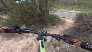
Baixada ràpida i senzilla en general on trobarem multitud de salts mitjans i petits així com nombrosos apoios. L'únic punt més complicat seria el rock garden que hi ha a la meitat quan es creua amb Remuntada però té chicken line per l'esquerra.

Local Trail Association

Recent Activity on Trail

Past Week
  • 1 rides
  • 10 miles average
6 Months
  • 27 rides
  • 13 miles avg distance
All
  • 88 rides
  • Last: Jun 14, 2026
c1c2c3c4
January
February
March
April
May
June
July
August
September
October
November
December
update trails status or condition

Jack Trail Reports

Status:
on May 29, 2026
Dry
Avg: 4.39 (6 votes)
Your vote: 0

view (1,122)
close
3D
Trail Conditions
  • Unknown
  • Snow Groomed
  • Snow Packed
  • Snow Covered
  • Snow Cover Partial
  • Freeze/thaw Cycle
  • Icy
  • Prevalent Mud
  • Wet
  • Variable
  • Ideal
  • Dry
  • Very Dry
Trail Flow (Ridden Direction)
Trailforks scans users ridelogs to determine the most popular direction each trail is ridden. A good flowing trail network will have most trails flowing in a single direction according to their intension.
The colour categories are based on what percentage of riders are riding a trail in its intended direction.
  • > 96%
  • > 90%
  • > 80%
  • > 70%
  • > 50%
  • < 50%
  • bi-directional trail
  • no data
Trail Last Ridden
Trailforks scans ridelogs to determine the last time a trail was ridden.
  • < 2 days
  • < 1 week
  • < 2 weeks
  • < 1 month
  • < 6 months
  • > 6 months
Trail Ridden Direction
The intended direction a trail should be ridden.
  • Downhill Only
  • Downhill Primary
  • Both Directions
  • Uphill Primary
  • Uphill Only
  • One Direction
Contribute Details
Colors indicate trail is missing specified detail.
  • Description
  • Photos
  • Description & Photos
  • Videos
Trail Popularity ?
Trailforks scans ridelogs to determine which trails are ridden the most in the last 9 months. Trails are compared with nearby trails in the same city region with a possible 25 colour shades. Think of this as a heatmap, more rides = more kinetic energy = warmer colors.
  • most popular
  • popular
  • less popular
  • not popular
ATV/ORV/OHV Filter
Max Vehicle Width
inches
US Cell Coverage
Legend
cell carrier legend

Radar Time
Activity Recordings
Trailforks uses anonymized public activity data. ?
Activity Recordings
Trailforks uses anonymized public activity data. ?
Personal Heatmap
Activity Types
all / none
Options
2
Date range month
Winter Trails
Warning A routing network for winter maps does not exist. Selecting trails using the winter trails layer has been disabled.
Missing Trails
Most Popular
Least Popular
Trails are colored based on popularity. The more popular a trail is, the more red. Less popular trails trend towards green.
Jump Magnitude Heatmap
Heatmap of where riders jump on trails. Zoom in to see individual jumps, click circles to view jump details.
BC Backroad Status

Service Road Atlas is a free to use, community-driven service for viewing and creating reports on the numerous back-country service roads around B.C. and Alberta.

map legend
Slope Aspect
Direction the slope faces
Flat N NE E SE S SW W NW
Trails Deemphasized
Trails are shown in grey.
disable
Only show trails with no bike usage.
Enable
Suggested Layers
Based on selected activity type

    Save the current map location and zoom level as your default home location whenever this page is loaded.

    Save
        Directions to jack-757083 trailhead (41.512030, 1.138400)

        Photos

        0 more »
        26 |
        May 22, 2024 @ 11:14pm
        May 22, 2024
        33 |
        May 22, 2024 @ 11:14pm
        May 22, 2024

        Videos

        1 more »
        Rocallaura - Jack
        2:13 | 170 | Jun 27, 2024 , Rocallaura

        1 Review & Comments


        We hope you've been enjoying Trailforks!

        Create a FREE account to view trail comments and much more.

        • By snaker4TF Pro TFSPAIN & contributors
        • #757083 - 474 views

        Frequently Asked Questions About Jack

        Where is Jack located?
        Jack is located in Rocallaura Bikepark, Rocallaura, Spain. It is part of the Rocallaura Bikepark trail network. The trailhead is located at coordinates 41.51203, 1.1384.
        How hard is Jack?
        Jack is rated as Blue difficulty. The average grade is 13.8%.
        What is the elevation gain for Jack?
        The trail has 323 ft of elevation descent. The elevation ranges from 1,934 ft to 2,257 ft.
        Is Jack a point to point trail?
        Yes, Jack is a point to point trail. The direction is Downhill Only. The trail type is singletrack.

        Hit the Trail

        Open in App

        Get this trail on your phone instantly.
        open trail in app

        Download Trail

        Save to wishlist, Garmin & download.
        save the trail

        Find Related Routes

        Find routes and users activities that include this trail.
        find routes for this trail

        You must enter a description before submitting.