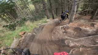
more stats
778 ft
Distance
-205 ft
Descent
00:03:02
Avg time
-205 ft
Altitude change
565 ft
Altitude min
770 ft
Altitude max
770 ft
Altitude start
565 ft
Altitude end
-26.382%
Grade
-50.531%
Grade max
-7.434%
Grade min
778 ft
Distance down
00:03:02
Avg time

Jackasaurus Details

  • Activities
    • Mountain Bike
    • Hike
    • Trail Running
  • Riding Area
    Urumau Reserve
    Lyttelton
  • Difficulty Rating
  • Local Popularity
    95 in Mountain Biking [+]
    • 50 in Trail Running
    • 65 in Hiking
  • Global Ranking
    #47192 in Mountain Biking [+]
    • #134849 in Trail Running
    • #89541 in Hiking
  • Trail Type
    Singletrack
  • Bike Type
    AM
  • Direction
    Downhill Primary
  • Dogs Allowed
    Yes
  • TTFs on Trail
    Drop, Jump, Ladder Bridge, Rock Face
  • Ride in Rain
    Yes
  • OSM Way

Jackasaurus starts at the top of the Urumau Reserve hill and descends the ridge, dropping over large rock drops you can roll or huck, to meet the traverse track. Eventually, once it's open, this track will continue down the ridge to meet Sumner road.

Access Info

From the end of the benched track across LPC land, head straight ahead (towards the sea) and up hill, veering onto a track on the left to find yourself on the top of the Urumau reserve hill.

Local Trail Association
Traditionally Indigenous Territory

Recent Activity on Trail

Past Week
  • 0 rides
  •  
6 Months
  • 15 rides
  • 8 miles avg distance
All
  • 171 rides
  • Last: Jun 12, 2026
c1c2c3c4
January
February
March
April
May
June
July
August
September
October
November
December
update trails status or condition

Jackasaurus Trail Reports

Status:
on Apr 9, 2025
Ideal
Avg: 3.99 (6 votes)
Your vote: 0

view (2,020)
close
3D
Trail Conditions
  • Unknown
  • Snow Groomed
  • Snow Packed
  • Snow Covered
  • Snow Cover Partial
  • Freeze/thaw Cycle
  • Icy
  • Prevalent Mud
  • Wet
  • Variable
  • Ideal
  • Dry
  • Very Dry
Trail Flow (Ridden Direction)
Trailforks scans users ridelogs to determine the most popular direction each trail is ridden. A good flowing trail network will have most trails flowing in a single direction according to their intension.
The colour categories are based on what percentage of riders are riding a trail in its intended direction.
  • > 96%
  • > 90%
  • > 80%
  • > 70%
  • > 50%
  • < 50%
  • bi-directional trail
  • no data
Trail Last Ridden
Trailforks scans ridelogs to determine the last time a trail was ridden.
  • < 2 days
  • < 1 week
  • < 2 weeks
  • < 1 month
  • < 6 months
  • > 6 months
Trail Ridden Direction
The intended direction a trail should be ridden.
  • Downhill Only
  • Downhill Primary
  • Both Directions
  • Uphill Primary
  • Uphill Only
  • One Direction
Contribute Details
Colors indicate trail is missing specified detail.
  • Description
  • Photos
  • Description & Photos
  • Videos
Trail Popularity ?
Trailforks scans ridelogs to determine which trails are ridden the most in the last 9 months. Trails are compared with nearby trails in the same city region with a possible 25 colour shades. Think of this as a heatmap, more rides = more kinetic energy = warmer colors.
  • most popular
  • popular
  • less popular
  • not popular
ATV/ORV/OHV Filter
Max Vehicle Width
inches
US Cell Coverage
Legend
cell carrier legend

Radar Time
Activity Recordings
Trailforks uses anonymized public activity data. ?
Activity Recordings
Trailforks uses anonymized public activity data. ?
Personal Heatmap
Activity Types
all / none
Options
2
Date range month
Winter Trails
Warning A routing network for winter maps does not exist. Selecting trails using the winter trails layer has been disabled.
Missing Trails
Most Popular
Least Popular
Trails are colored based on popularity. The more popular a trail is, the more red. Less popular trails trend towards green.
Jump Magnitude Heatmap
Heatmap of where riders jump on trails. Zoom in to see individual jumps, click circles to view jump details.
BC Backroad Status

Service Road Atlas is a free to use, community-driven service for viewing and creating reports on the numerous back-country service roads around B.C. and Alberta.

map legend
Slope Aspect
Direction the slope faces
Flat N NE E SE S SW W NW
Trails Deemphasized
Trails are shown in grey.
disable
Only show trails with no bike usage.
Enable
Suggested Layers
Based on selected activity type

    Save the current map location and zoom level as your default home location whenever this page is loaded.

    Save
        Directions to jackasaurus trailhead (-43.602600, 172.730110)

        Photos

        21 more »
        117 |
        Oct 1, 2022 @ 8:19pm
        Oct 1, 2022
        135 |
        Oct 1, 2022 @ 3:40pm
        Oct 1, 2022
        172 |
        Aug 5, 2021 @ 3:11pm
        Aug 5, 2021
        229 |
        Apr 19, 2019 @ 7:12pm
        Apr 19, 2019

        Videos

        4 more »
        youtuber The Trails Get Savage in Christchurch!
        18:34 | 259 | Dec 18, 2022 , Lyttelton
        Weekend Round Up Episode 19- Lapping the Park...
        9:50 | 283 | Oct 16, 2022 , Lyttelton
        youtuber Jackasaurus | Lyttelton MTB TRAILS | Mtb EDIT...
        4:51 | 345 | Aug 15, 2021 , Lyttelton
        Lyttelton MTB Trails / Urumau Reserve MTB...
        16:16 | 487 | Mar 22, 2020 , Lyttelton

        Routes with this trail

        6 miles 1,383 ft 4 Loop
        Loop from Windy point, roads to top of Mt Pleasant and then back down on singletrack through Urumau reserve

        Reviews / Comments

        No reviews yet, be the first to write a review or ask a question.
        Use trail reports to comment on trail conditions.


        We hope you've been enjoying Trailforks!

        Create a FREE account to view trail comments and much more.

        • By nakinoahTF Pro & contributors
        • #48133 - 2,366 views

        Frequently Asked Questions About Jackasaurus

        Where is Jackasaurus located?
        Jackasaurus is located in Urumau Reserve, Lyttelton, New Zealand. It is part of the Urumau Reserve trail network. The trailhead is located at coordinates -43.6026, 172.73011.
        How hard is Jackasaurus?
        Jackasaurus is rated as Black Diamond difficulty. The average grade is 26.382%.
        What is the elevation gain for Jackasaurus?
        The trail has 205 ft of elevation descent. The elevation ranges from 565 ft to 770 ft.
        Is Jackasaurus a point to point trail?
        Jackasaurus is not a point to point trail. The direction is Downhill Primary. The trail type is singletrack.

        Hit the Trail

        Open in App

        Get this trail on your phone instantly.
        open trail in app

        Download Trail

        Save to wishlist, Garmin & download.
        save the trail

        Find Related Routes

        Find routes and users activities that include this trail.
        find routes for this trail

        You must enter a description before submitting.