more stats
1,837 ft
Distance
42 ft
Climb
-39 ft
Descent
00:04:54
Avg time
1 ft
Altitude change
6,330 ft
Altitude min
6,369 ft
Altitude max
6,335 ft
Altitude start
6,335 ft
Altitude end
0.1%
Grade
-14.5%
Grade max
18.9%
Grade min
568 ft
Distance climb
1,050 ft
Distance down
223 ft
Distance flat
00:04:54
Avg time

Jackass Point Details

  • Activities
    • Mountain Bike
    • E-Bike
    • Hike
    • Trail Running
  • Riding Area
    Donkey Town
    Truckee, California
  • Difficulty Rating
  • Voted Difficulty
    Blue (1 vote)
  • Local Popularity
    100 in Mountain Biking [+]
    • 100 in E-Biking
    • 65 in Trail Running
    • 70 in Hiking
  • Global Ranking
    #36503 in Mountain Biking [+]
    • #7881 in E-Biking
    • #86902 in Trail Running
    • #83552 in Hiking
  • Hiking SAC Scale
    T1 Hiking
  • Trail Type
    Singletrack
  • Bike Type
    AM
  • Direction
    Downhill Primary
  • Climb Difficulty
    Blue
  • Physical Rating
    Moderate
  • Trail Visibility
    Always easy to follow
  • Season
    April - October
  • Dogs Allowed
    Yes
  • eBike Allowed
    Yes up to Class 1
  • TTFs on Trail
    Berm, Drop, Jump, Gap Jump
  • Ride in Rain
    Yes
  • Year Opened
    2018
  • Land Owner
    USFS - Truckee Ranger District

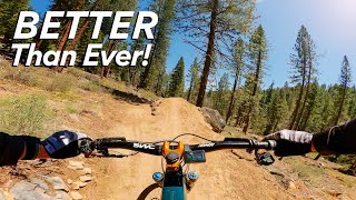
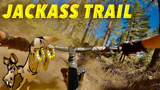
Loop to the top of Jackass Point with berms and jumps. Makeshift rest area at top. The loop strongly runs clockwise.

Access Info

Shortly after you get on the singletrack for Jackass there will be a dirt pathway to the left, the loop connects back to the same point along Jackass.

This trail is unsanctioned.

Traditionally Indigenous Territory

Recent Activity on Trail

Past Week
  • 16 rides
  • 8 miles average
6 Months
  • 204 rides
  • 9 miles avg distance
All
  • 1,836 rides
  • Last: Jun 20, 2026
c1c2c3c4
January
February
March
April
May
June
July
August
September
October
November
December
Status:
on Sep 16, 2025
Dry
Avg: 4.61 (12 votes)
Your vote: 0

view (22,396)
close
3D
Trail Conditions
  • Unknown
  • Snow Groomed
  • Snow Packed
  • Snow Covered
  • Snow Cover Partial
  • Freeze/thaw Cycle
  • Icy
  • Prevalent Mud
  • Wet
  • Variable
  • Ideal
  • Dry
  • Very Dry
Trail Flow (Ridden Direction)
Trailforks scans users ridelogs to determine the most popular direction each trail is ridden. A good flowing trail network will have most trails flowing in a single direction according to their intension.
The colour categories are based on what percentage of riders are riding a trail in its intended direction.
  • > 96%
  • > 90%
  • > 80%
  • > 70%
  • > 50%
  • < 50%
  • bi-directional trail
  • no data
Trail Last Ridden
Trailforks scans ridelogs to determine the last time a trail was ridden.
  • < 2 days
  • < 1 week
  • < 2 weeks
  • < 1 month
  • < 6 months
  • > 6 months
Trail Ridden Direction
The intended direction a trail should be ridden.
  • Downhill Only
  • Downhill Primary
  • Both Directions
  • Uphill Primary
  • Uphill Only
  • One Direction
Contribute Details
Colors indicate trail is missing specified detail.
  • Description
  • Photos
  • Description & Photos
  • Videos
Trail Popularity ?
Trailforks scans ridelogs to determine which trails are ridden the most in the last 9 months. Trails are compared with nearby trails in the same city region with a possible 25 colour shades. Think of this as a heatmap, more rides = more kinetic energy = warmer colors.
  • most popular
  • popular
  • less popular
  • not popular
ATV/ORV/OHV Filter
Max Vehicle Width
inches
US Cell Coverage
Legend
cell carrier legend

Radar Time
Activity Recordings
Trailforks uses anonymized public activity data. ?
Activity Recordings
Trailforks uses anonymized public activity data. ?
Personal Heatmap
Activity Types
all / none
Options
2
Date range month
Winter Trails
Warning A routing network for winter maps does not exist. Selecting trails using the winter trails layer has been disabled.
Missing Trails
Most Popular
Least Popular
Trails are colored based on popularity. The more popular a trail is, the more red. Less popular trails trend towards green.
Jump Magnitude Heatmap
Heatmap of where riders jump on trails. Zoom in to see individual jumps, click circles to view jump details.
BC Backroad Status

Service Road Atlas is a free to use, community-driven service for viewing and creating reports on the numerous back-country service roads around B.C. and Alberta.

map legend
Slope Aspect
Direction the slope faces
Flat N NE E SE S SW W NW
Trails Deemphasized
Trails are shown in grey.
disable
Only show trails with no bike usage.
Enable
Suggested Layers
Based on selected activity type

    Save the current map location and zoom level as your default home location whenever this page is loaded.

    Save
        Directions to jackass-point trailhead (39.309930, -120.229520)

        Photos

        9 more »
        63 |
        Sep 22, 2025 @ 6:46pm
        Sep 22, 2025
        60 |
        May 16, 2025 @ 2:13pm
        May 16, 2025
        50 |
        May 16, 2025 @ 2:13pm
        May 16, 2025
        195 |
        Jun 25, 2020 @ 1:48pm
        Jun 25, 2020

        Videos

        6 more »
        MTB Mud, Snow, and Falling Off the Log Ride |...
        19:31 | 30 | Dec 4, 2025 , Truckee
        youtuber Jackass Point
        11:38 | 105 | May 25, 2025 , Truckee
        Tahoe - Jackass 8.22.2023
        7:27 | 172 | Oct 30, 2023 , Truckee
        Jackass Trail, Truckee CA | Vacation Adventure...
        12:40 | 390 | Jan 17, 2022 , Truckee

        Routes with this trail

        4.5 4 miles 701 ft 3 Loop
        The standard jackass loop route for the 2020 season.
        7 miles 1,121 ft 7 Loop
        Complete Jackass Loop, re-climb the road and finish to the bottom on A1.
        7 miles 1,103 ft 7 Loop
        Complete Jackass Loop, re-climb the road and finish to the bottom on A1.

        Reviews / Comments

        No reviews yet, be the first to write a review or ask a question.
        Use trail reports to comment on trail conditions.


        We hope you've been enjoying Trailforks!

        Create a FREE account to view trail comments and much more.

        • #137765 - 8,867 views

        Frequently Asked Questions About Jackass Point

        Where is Jackass Point located?
        Jackass Point is located in Donkey Town, Truckee, California, United States. It is part of the Donkey Town trail network. The trailhead is located at coordinates 39.30993, -120.22952.
        How hard is Jackass Point?
        Jackass Point is rated as Blue difficulty. The physical rating is Moderate. The average grade is 0.1%. The climb difficulty is rated Blue.
        What is the elevation gain for Jackass Point?
        Jackass Point has 42 ft of elevation gain. The trail has 39 ft of elevation descent. The elevation ranges from 6,330 ft to 6,369 ft.
        Is Jackass Point a point to point trail?
        Jackass Point is not a point to point trail. The direction is Downhill Primary. The trail type is singletrack.

        Hit the Trail

        Open in App

        Get this trail on your phone instantly.
        open trail in app

        Download Trail

        Save to wishlist, Garmin & download.
        save the trail

        Find Related Routes

        Find routes and users activities that include this trail.
        find routes for this trail

        You must enter a description before submitting.