more stats
3,274 ft
Distance
-726 ft
Descent
00:05:36
Avg time
-726 ft
Altitude change
1,210 ft
Altitude min
1,936 ft
Altitude max
1,936 ft
Altitude start
1,211 ft
Altitude end
-22.2%
Grade
-62.5%
Grade max
-6%
Grade min
3,245 ft
Distance down
30 ft
Distance flat
00:05:36
Avg time

Jaga Baba 2.0 Details

  • Activities
    • Mountain Bike
    • Hike
    • Trail Running
  • Riding Area
    Trailandija
    Grosuplje
  • Difficulty Rating
  • Local Popularity
    65 in Mountain Biking [+]
    • 5 in Trail Running
    • 80 in Hiking
  • Global Ranking
    #38225 in Mountain Biking [+]
    • #138795 in Trail Running
    • #51206 in Hiking
  • Trail Type
    Singletrack
  • Bike Type
    AM
  • Dogs Allowed
    Yes
  • eBike Allowed
  • Ride in Rain
    Yes
  • Year Opened
    2021

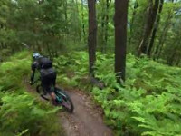
Old and beautiful forest singletrack, 0% mtb trailbuilt but very nice for MTB descent. Remote location, not likely to meet any hikers here.

Trail published on Trailforks in March 2021, but due to MX agression on the trail, the new trail was set on different terrain in Februar 2026.

Enjoy

This trail is unsanctioned.

Disclaimer

Caution - after 100 m of the trail turn hard right off the straight line!

Recent Activity on Trail

Past Week
  • 0 rides
  •  
6 Months
  • 7 rides
  • 27 miles avg distance
All
  • 12 rides
  • Last: Jun 9, 2026
c1c2c3c4
January
February
March
April
May
June
July
August
September
October
November
December
update trails status or condition

Jaga Baba 2.0 Trail Reports

statusdatedescription
Jun 9, 2026 @ 6:25pm (Europe/Ljubljana)
Jun 9, 2026
All good.
May 26, 2026 @ 3:09pm (Europe/Ljubljana)
May 26, 2026
All good. New big jump!
May 5, 2026 @ 8:21am (Europe/Ljubljana)
May 4, 2026
Running great!
Apr 22, 2026 @ 1:17pm (Europe/Ljubljana)
Apr 22, 2026
Log over the trail is removed, trail is clear.
Apr 16, 2026 @ 6:52am (Europe/Ljubljana)
Apr 15, 2026
All good, except for a log over top part of the trail, can go over.
more »
Status:
on Jun 9, 2026
Dry
Avg: 4.45 (5 votes)
Your vote: 0

view (101)
close
3D
Trail Conditions
  • Unknown
  • Snow Groomed
  • Snow Packed
  • Snow Covered
  • Snow Cover Partial
  • Freeze/thaw Cycle
  • Icy
  • Prevalent Mud
  • Wet
  • Variable
  • Ideal
  • Dry
  • Very Dry
Trail Flow (Ridden Direction)
Trailforks scans users ridelogs to determine the most popular direction each trail is ridden. A good flowing trail network will have most trails flowing in a single direction according to their intension.
The colour categories are based on what percentage of riders are riding a trail in its intended direction.
  • > 96%
  • > 90%
  • > 80%
  • > 70%
  • > 50%
  • < 50%
  • bi-directional trail
  • no data
Trail Last Ridden
Trailforks scans ridelogs to determine the last time a trail was ridden.
  • < 2 days
  • < 1 week
  • < 2 weeks
  • < 1 month
  • < 6 months
  • > 6 months
Trail Ridden Direction
The intended direction a trail should be ridden.
  • Downhill Only
  • Downhill Primary
  • Both Directions
  • Uphill Primary
  • Uphill Only
  • One Direction
Contribute Details
Colors indicate trail is missing specified detail.
  • Description
  • Photos
  • Description & Photos
  • Videos
Trail Popularity ?
Trailforks scans ridelogs to determine which trails are ridden the most in the last 9 months. Trails are compared with nearby trails in the same city region with a possible 25 colour shades. Think of this as a heatmap, more rides = more kinetic energy = warmer colors.
  • most popular
  • popular
  • less popular
  • not popular
ATV/ORV/OHV Filter
Max Vehicle Width
inches
US Cell Coverage
Legend
cell carrier legend

Radar Time
Activity Recordings
Trailforks uses anonymized public activity data. ?
Activity Recordings
Trailforks uses anonymized public activity data. ?
Personal Heatmap
Activity Types
all / none
Options
2
Date range month
Winter Trails
Warning A routing network for winter maps does not exist. Selecting trails using the winter trails layer has been disabled.
Missing Trails
Most Popular
Least Popular
Trails are colored based on popularity. The more popular a trail is, the more red. Less popular trails trend towards green.
Jump Magnitude Heatmap
Heatmap of where riders jump on trails. Zoom in to see individual jumps, click circles to view jump details.
BC Backroad Status

Service Road Atlas is a free to use, community-driven service for viewing and creating reports on the numerous back-country service roads around B.C. and Alberta.

map legend
Slope Aspect
Direction the slope faces
Flat N NE E SE S SW W NW
Trails Deemphasized
Trails are shown in grey.
disable
Only show trails with no bike usage.
Enable
Suggested Layers
Based on selected activity type

    Save the current map location and zoom level as your default home location whenever this page is loaded.

    Save
        Directions to jaga-baba-2-0 trailhead (46.018170, 14.658630)

        Photos

        2 more »
        121 |
        May 6, 2021 @ 11:56pm
        May 6, 2021
        218 |
        Mar 13, 2021 @ 10:18pm
        Mar 13, 2021

        Videos

        3 more »
        Grosuplje - Jaga Baba  30. svibnja 2026.
        13 | Jun 1, 2026 , Grosuplje
        JAGA BABA 2.0 2026
        4:05 | 83 | Apr 2, 2026 , Grosuplje
        Jaga Baba  2022
        3:54 | 630 | May 21, 2022 , Grosuplje

        Routes with this trail

        5.0 14 miles 3,021 ft 7 Loop
        Route with three beautiful natural trails from the same trail head on Na lanišču hill. Two uphills...
        5.0 18 miles 3,333 ft 13 Loop
        Route with some finest and beautiful trails in Trailandija that will take you to three hill tops - , and ....

        2 Reviews & Comments


        We hope you've been enjoying Trailforks!

        Create a FREE account to view trail comments and much more.

        • #417525 - 2,428 views

        Frequently Asked Questions About Jaga Baba 2.0

        Where is Jaga Baba 2.0 located?
        Jaga Baba 2.0 is located in Trailandija, Grosuplje, Slovenia. It is part of the Trailandija trail network. The trailhead is located at coordinates 46.01817, 14.65863.
        How hard is Jaga Baba 2.0?
        Jaga Baba 2.0 is rated as Blue difficulty. The average grade is 22.2%.
        What is the elevation gain for Jaga Baba 2.0?
        The trail has 726 ft of elevation descent. The elevation ranges from 1,210 ft to 1,936 ft.
        How long is Jaga Baba 2.0?
        Jaga Baba 2.0 is 3,274 ft long. The trail type is singletrack.

        Hit the Trail

        Open in App

        Get this trail on your phone instantly.
        open trail in app

        Download Trail

        Save to wishlist, Garmin & download.
        save the trail

        Find Related Routes

        Find routes and users activities that include this trail.
        find routes for this trail

        You must enter a description before submitting.