
Open in App
Get this trail on your phone instantly.

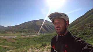
Bit of everything on this trail. The difficultly might be one more step up from Black Diamond in places, but in others, it's pretty flat and smooth. Probably best ridden downhill only, as there wouldn't be much time for someone going downhill to stop in time if you're hiking up one of the steep sections. The top is a very loose, free-ridey, steep as anything section. The middle is smooth and flowy, and the bottom is loose sand, tightly banked corners and then you're done. Rumored to have been made with the help of a local bike shop, this is definitely a fun experience.
The city has recently put up a chain link fence that prevents the lower use of this trail. You will have to find an exit before you reach the pond.
This trail is unsanctioned.
Might be more difficult than black diamond in a few places.
| c1 | c2 | c3 | c4 |
|---|---|---|---|
January | February | March | April |
May | June | July | August |
September | October | November | December |

Service Road Atlas is a free to use, community-driven service for viewing and creating reports on the numerous back-country service roads around B.C. and Alberta.
Save the current map location and zoom level as your default home location whenever this page is loaded.
SaveWe hope you've been enjoying Trailforks!
Create a FREE account to view trail comments and much more.
You must enter a description before submitting.

