more stats
3,478 ft
Distance
12 ft
Climb
-563 ft
Descent
00:07:20
Avg time
-551 ft
Altitude change
730 ft
Altitude min
1,281 ft
Altitude max
1,281 ft
Altitude start
728 ft
Altitude end
-15.8%
Grade
-29.8%
Grade max
11.5%
Grade min
125 ft
Distance climb
3,314 ft
Distance down
39 ft
Distance flat
00:07:20
Avg time

John Deer Details

  • Activities
    • Mountain Bike
    • E-Bike
    • Hike
    • Trail Running
  • Riding Area
    Mount Seymour
    North Vancouver, British Columbia
  • AKA
    JD Red Truck
  • Difficulty Rating
  • Voted Difficulty
    Blue (7 votes)
  • Local Popularity
    95 in Mountain Biking [+]
    • 95 in E-Biking
    • 60 in Trail Running
    • 60 in Hiking
  • Global Ranking
    #52 in Mountain Biking [+]
    • #1671 in E-Biking
    • #1861 in Trail Running
    • #3084 in Hiking
  • Trail Type
    Singletrack
  • Bike Type
    DH, AM, XC
  • Dogs Allowed
    Yes
  • eBike Allowed
    Yes up to Class 1
  • TTFs on Trail
    A-Frame, Bridge, Jump
  • Land Owner
    CMHC

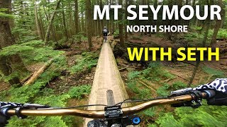
Fast flowy singletrack with lots of berms and a few small jumps. Optional black features. Please stay away when the ground is saturated.

The trail is downhill only for mountain bikers. Do not ride uphill.

Access Info

Accessed half way up Good Sir Martin where it crosses John Deer or also "Blue" access from Power Line Access/ via Upper Severed, Dickie, Severed D, Upper John Deer

Trail Supporters
Local Trail Association

Recent Activity on Trail

Past Week
  • 35 rides
  • 8 miles average
6 Months
  • 617 rides
  • 8 miles avg distance
All
  • 8,703 rides
  • Last: Jun 25, 2026
c1c2c3c4
January
February
March
April
May
June
July
August
September
October
November
December
update trails status or condition

John Deer Trail Reports

statusdatedescription
Jun 13, 2026 @ 11:20am (America/Vancouver)
Jun 13, 2026
Thank you to the trail builders! The fresh berms are amazing!
Jun 8, 2026 @ 10:35pm (America/Vancouver)
Jun 8, 2026
Running great! Amazing work its been done.
Jun 6, 2026 @ 1:26pm (America/Vancouver)
Jun 6, 2026
May 17, 2026 @ 10:58pm (America/Vancouver)
May 17, 2026
reporter
Lots of new gold. It’s very dry so please go gentle on the new dirt until it’s bedded in. Thank you
May 10, 2026 @ 11:12pm (America/Vancouver)
May 10, 2026
reporter
Lots of very dry new gold, please ride gently until it beds in
more »
Status:
on Jun 13, 2026
Ideal
Avg: 4.6 (130 votes)
Your vote: 0

view (52,231)
close
3D
Trail Conditions
  • Unknown
  • Snow Groomed
  • Snow Packed
  • Snow Covered
  • Snow Cover Partial
  • Freeze/thaw Cycle
  • Icy
  • Prevalent Mud
  • Wet
  • Variable
  • Ideal
  • Dry
  • Very Dry
Trail Flow (Ridden Direction)
Trailforks scans users ridelogs to determine the most popular direction each trail is ridden. A good flowing trail network will have most trails flowing in a single direction according to their intension.
The colour categories are based on what percentage of riders are riding a trail in its intended direction.
  • > 96%
  • > 90%
  • > 80%
  • > 70%
  • > 50%
  • < 50%
  • bi-directional trail
  • no data
Trail Last Ridden
Trailforks scans ridelogs to determine the last time a trail was ridden.
  • < 2 days
  • < 1 week
  • < 2 weeks
  • < 1 month
  • < 6 months
  • > 6 months
Trail Ridden Direction
The intended direction a trail should be ridden.
  • Downhill Only
  • Downhill Primary
  • Both Directions
  • Uphill Primary
  • Uphill Only
  • One Direction
Contribute Details
Colors indicate trail is missing specified detail.
  • Description
  • Photos
  • Description & Photos
  • Videos
Trail Popularity ?
Trailforks scans ridelogs to determine which trails are ridden the most in the last 9 months. Trails are compared with nearby trails in the same city region with a possible 25 colour shades. Think of this as a heatmap, more rides = more kinetic energy = warmer colors.
  • most popular
  • popular
  • less popular
  • not popular
ATV/ORV/OHV Filter
Max Vehicle Width
inches
US Cell Coverage
Legend
cell carrier legend

Radar Time
Activity Recordings
Trailforks uses anonymized public activity data. ?
Activity Recordings
Trailforks uses anonymized public activity data. ?
Personal Heatmap
Activity Types
all / none
Options
2
Date range month
Winter Trails
Warning A routing network for winter maps does not exist. Selecting trails using the winter trails layer has been disabled.
Missing Trails
Most Popular
Least Popular
Trails are colored based on popularity. The more popular a trail is, the more red. Less popular trails trend towards green.
Jump Magnitude Heatmap
Heatmap of where riders jump on trails. Zoom in to see individual jumps, click circles to view jump details.
BC Backroad Status

Service Road Atlas is a free to use, community-driven service for viewing and creating reports on the numerous back-country service roads around B.C. and Alberta.

map legend
Slope Aspect
Direction the slope faces
Flat N NE E SE S SW W NW
Trails Deemphasized
Trails are shown in grey.
disable
Only show trails with no bike usage.
Enable
Suggested Layers
Based on selected activity type

    Save the current map location and zoom level as your default home location whenever this page is loaded.

    Save
        Directions to john-deer trailhead (49.335430, -122.980400)

        Photos

        151 more »
        1,770 |
        Feb 4, 2018 @ 9:03am
        Feb 4, 2018
        1,988 |
        Feb 4, 2018 @ 9:05am
        Feb 4, 2018
        2,067 |
        Feb 4, 2018 @ 9:05am
        Feb 4, 2018
        29 |
        May 18, 2026 @ 5:09pm
        May 18, 2026

        Videos

        70 more »
        youtuber How Does An Old 2005 Norco A-line Ride With...
        18:25 | 1213 | Oct 12, 2021 , North Vancouver
        youtuber Old School North Shore Freeride with Seths...
        17:20 | 2530 | Aug 3, 2018 , North Vancouver
        youtuber John Deer - Mount Seymour Mountain Biking
        3:57 | 885 | Aug 9, 2021 , North Vancouver
        youtuber F O C U S || BRAIN vs BODY
        3:04 | 412 | Oct 28, 2022 , North Vancouver

        Trail Lists

        Routes with this trail

        3.0 4 miles 1,033 ft 4 Loop
        Quick Loop from Parking lot
        4.4 8 miles 2,159 ft 41 Loop
        This is the first ride of the First Time Visitor trip. Warm up with some good corners on , then head over...
        4.5 7 miles 1,703 ft 20
        Seymour Classic - Flavours of Flow North Shore Relive Your Ride For other ride suggestions for this and...

        Trail Events

        7 Reviews & Comments


        We hope you've been enjoying Trailforks!

        Create a FREE account to view trail comments and much more.

        • By canadakaTF Pro Trailforks & contributors
        • #3231 - 50,133 views

        Frequently Asked Questions About John Deer

        Where is John Deer located?
        John Deer is located in Mount Seymour, North Vancouver, British Columbia, Canada. It is part of the Mount Seymour trail network. The trailhead is located at coordinates 49.33543, -122.9804.
        How hard is John Deer?
        John Deer is rated as Blue difficulty. The average grade is 15.8%.
        What is the elevation gain for John Deer?
        John Deer has 12 ft of elevation gain. The trail has 563 ft of elevation descent. The elevation ranges from 730 ft to 1,281 ft.
        How long is John Deer?
        John Deer is 3,478 ft long. The trail type is singletrack.

        Hit the Trail

        Open in App

        Get this trail on your phone instantly.
        open trail in app

        Download Trail

        Save to wishlist, Garmin & download.
        save the trail

        Find Related Routes

        Find routes and users activities that include this trail.
        find routes for this trail

        You must enter a description before submitting.