
Open in App
Get this trail on your phone instantly.

The trail begins along the skid road on the left and the trailhead is clearly marked. The trail is both well used and obvious, with a blend of easy, moderate and steep sections to sustain interest. After 1 km, the trail is deep within a lush
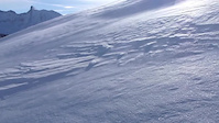
forest before tackling a small boulder field. After gaining 300 m, subalpine meadows will become prominent. When you get to a steep alpine creek, a square orange marker nailed to a tree indicates a sharp turn right (west) and across the creek. The dark-grey cliff s of Bastille Mountain are to your left. At 4 km, the trees start giving way to flower carpeted grassy meadows marking your arrival on to Jumbo Pass. At 5.2 km, a trail on your left meets the path – this is from the West Kootenay-Glacier Creek; continue your bearing and following the sign to the hut. The Jumbo Pass hut sits 0.9 km from this junction, below an inviting ridge that eventually leads to Mount Monica. The first peak in the ridge is enough to provide stunning panoramic views. The peaks of Bastille Mountain lie to the SW, the top of the Starbird Glacier (which runs down the other side of the ridge) to the north. Jumbo, the tallest peak in the area, lies to the NE.
From the north end of Invermere follow signs to Panorama Resort (18kms), and continue along the gravel Toby Creek road for 20 kms to the abandoned Mineral King mine. Just past the tailings field turn right and follow the Jumbo Creek Forest Service Road north. Park along the road at the 15.8 km mark where a signed old spur road will lead you to the trailhead.
Glacier Creek Access - Head north on the Duncan Lake FS Road for 11.8 kms from its junction with Hwy 31 just south of Cooper Creek. Turn right onto the Glacier Creek Road follow it for 23 kms to the 2nd bridge. Take the right fork for 4 kms to the trailhead on the left. Contact the Kootenay Lake Forest District (250-825-1100) for details on the 4.2 km trail.
| c1 | c2 | c3 | c4 |
|---|---|---|---|
January | February | March | April |
May | June | July | August |
September | October | November | December |

Service Road Atlas is a free to use, community-driven service for viewing and creating reports on the numerous back-country service roads around B.C. and Alberta.
Save the current map location and zoom level as your default home location whenever this page is loaded.
Save
No reviews yet, be the first to write a review or ask a question.
Use trail reports to comment on trail conditions.
We hope you've been enjoying Trailforks!
Create a FREE account to view trail comments and much more.
You must enter a description before submitting.

