more stats
2,825 ft
Distance
-585 ft
Descent
00:04:50
Avg time
-585 ft
Altitude change
1,587 ft
Altitude min
2,172 ft
Altitude max
2,172 ft
Altitude start
1,588 ft
Altitude end
-20.7%
Grade
-48.9%
Grade max
-1%
Grade min
2,825 ft
Distance down
00:04:50
Avg time

Kanal Details

  • Activities
    • Mountain Bike
    • E-Bike
    • Winter Fat Bike
    • Hike
    • Trail Running
  • Riding Area
  • Difficulty Rating
  • Local Popularity
    60 in Mountain Biking [+]
    • 60 in E-Biking
    • 100 in Trail Running
    • 5 in Hiking
  • Global Ranking
    #71018 in Mountain Biking [+]
    • #68946 in E-Biking
    • #1946 in Trail Running
    • #125490 in Hiking
  • Trail Type
    Singletrack
  • Bike Type
    DH, AM, Fat
  • Physical Rating
    Moderate
  • Alpine Trail
    Yes
  • Dogs Allowed
    Yes
  • eBike Allowed
    Yes up to Class 1
  • TTFs on Trail
    Jump, Gap Jump

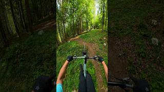
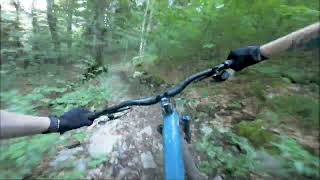
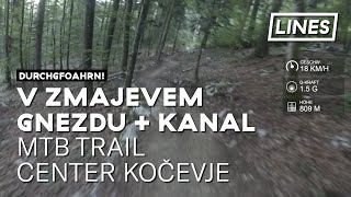
Kanal was one of the first trails in our neck of the woods. For the most part in follows the path of the gully and that is also where it got its name. At the bottom it joins the trail Home again.

Recent Activity on Trail

Past Week
  • 2 rides
  • 26 miles average
6 Months
  • 20 rides
  • 21 miles avg distance
All
  • 52 rides
  • Last: Jun 22, 2026
c1c2c3c4
January
February
March
April
May
June
July
August
September
October
November
December
Status:
on Jun 21, 2026
Ideal
Avg: 4.45 (7 votes)
Your vote: 0

view (542)
close
3D
Trail Conditions
  • Unknown
  • Snow Groomed
  • Snow Packed
  • Snow Covered
  • Snow Cover Partial
  • Freeze/thaw Cycle
  • Icy
  • Prevalent Mud
  • Wet
  • Variable
  • Ideal
  • Dry
  • Very Dry
Trail Flow (Ridden Direction)
Trailforks scans users ridelogs to determine the most popular direction each trail is ridden. A good flowing trail network will have most trails flowing in a single direction according to their intension.
The colour categories are based on what percentage of riders are riding a trail in its intended direction.
  • > 96%
  • > 90%
  • > 80%
  • > 70%
  • > 50%
  • < 50%
  • bi-directional trail
  • no data
Trail Last Ridden
Trailforks scans ridelogs to determine the last time a trail was ridden.
  • < 2 days
  • < 1 week
  • < 2 weeks
  • < 1 month
  • < 6 months
  • > 6 months
Trail Ridden Direction
The intended direction a trail should be ridden.
  • Downhill Only
  • Downhill Primary
  • Both Directions
  • Uphill Primary
  • Uphill Only
  • One Direction
Contribute Details
Colors indicate trail is missing specified detail.
  • Description
  • Photos
  • Description & Photos
  • Videos
Trail Popularity ?
Trailforks scans ridelogs to determine which trails are ridden the most in the last 9 months. Trails are compared with nearby trails in the same city region with a possible 25 colour shades. Think of this as a heatmap, more rides = more kinetic energy = warmer colors.
  • most popular
  • popular
  • less popular
  • not popular
ATV/ORV/OHV Filter
Max Vehicle Width
inches
US Cell Coverage
Legend
cell carrier legend

Radar Time
Activity Recordings
Trailforks uses anonymized public activity data. ?
Activity Recordings
Trailforks uses anonymized public activity data. ?
Personal Heatmap
Activity Types
all / none
Options
2
Date range month
Winter Trails
Warning A routing network for winter maps does not exist. Selecting trails using the winter trails layer has been disabled.
Missing Trails
Most Popular
Least Popular
Trails are colored based on popularity. The more popular a trail is, the more red. Less popular trails trend towards green.
Jump Magnitude Heatmap
Heatmap of where riders jump on trails. Zoom in to see individual jumps, click circles to view jump details.
BC Backroad Status

Service Road Atlas is a free to use, community-driven service for viewing and creating reports on the numerous back-country service roads around B.C. and Alberta.

map legend
Slope Aspect
Direction the slope faces
Flat N NE E SE S SW W NW
Trails Deemphasized
Trails are shown in grey.
disable
Only show trails with no bike usage.
Enable
Suggested Layers
Based on selected activity type

    Save the current map location and zoom level as your default home location whenever this page is loaded.

    Save
        Directions to kanal trailhead (45.615480, 14.867920)

        Photos

        47 more »
        204 |
        Jul 12, 2018 @ 2:01am
        Jul 12, 2018
        152 |
        Jan 1, 2017 @ 6:53am
        Jan 1, 2017
        195 |
        Jul 12, 2018 @ 2:01am
        Jul 12, 2018
        219 |
        Jan 1, 2017 @ 6:58am
        Jan 1, 2017

        Videos

        3 more »
        11 May 2026
        2:36 | 57 | May 10, 2026 , Kočevje
        Kocevje - YT Capra
        12:42 | 95 | Aug 27, 2024 , Kočevje
        V zmajevem gnezdu + Kanal - MTB trail center...
        7:32 | 489 | Nov 10, 2020 , Kočevje

        5 Reviews & Comments


        We hope you've been enjoying Trailforks!

        Create a FREE account to view trail comments and much more.

        • By janezdejak & contributors
        • #79001 - 3,809 views

        Frequently Asked Questions About Kanal

        Where is Kanal located?
        Kanal is located in Kočevje, Slovenia. It is part of the Kočevje trail network. The trailhead is located at coordinates 45.61548, 14.86792.
        How hard is Kanal?
        Kanal is rated as Red difficulty. The physical rating is Moderate. The average grade is 20.7%.
        What is the elevation gain for Kanal?
        The trail has 585 ft of elevation descent. The elevation ranges from 1,587 ft to 2,172 ft.
        How long is Kanal?
        Kanal is 2,825 ft long. The trail type is singletrack.

        Hit the Trail

        Open in App

        Get this trail on your phone instantly.
        open trail in app

        Download Trail

        Save to wishlist, Garmin & download.
        save the trail

        Find Related Routes

        Find routes and users activities that include this trail.
        find routes for this trail

        You must enter a description before submitting.