more stats
1,591 ft
Distance
-237 ft
Descent
00:02:07
Avg time
-238 ft
Altitude change
2,886 ft
Altitude min
3,124 ft
Altitude max
3,124 ft
Altitude start
2,887 ft
Altitude end
-14.9%
Grade
-40%
Grade max
2.6%
Grade min
16 ft
Distance climb
1,329 ft
Distance down
207 ft
Distance flat
00:02:07
Avg time

Karate Monkey Details

  • Activities
    • Mountain Bike
  • Riding Area
    Whistler Mountain Bike Park
    Whistler, British Columbia
  • Difficulty Rating
  • Local Popularity
    95 in Mountain Biking
  • Global Ranking
    #209 in Mountain Biking
  • Trail Type
    Singletrack
  • Bike Type
    DH, AM
  • Direction
    Downhill Only
    Popular Direction Shown
  • Family Friendly
    Yes
  • TTFs on Trail
    Bridge
  • Land Owner

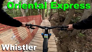
After you have defeated a ninja cougar what foe will stand before you? The Karate Monkey. This is a flow trail with a few rocky/tech sections and one wood bridge. You wont need to pedal or brake, the trail is that well though out. It is in the trees and offers a nice change of pace on the wet days at Whistler.

Bike Park

Recent Activity on Trail

Past Week
  • 79 rides
  • 23 miles average
6 Months
  • 518 rides
  • 24 miles avg distance
All
  • 6,943 rides
  • Last: Jun 26, 2026
c1c2c3c4
January
February
March
April
May
June
July
August
September
October
November
December
Status:
on Jun 21, 2026
Very Dry
Avg: 4.23 (95 votes)
Your vote: 0

view (52,054)
close
3D
Trail Conditions
  • Unknown
  • Snow Groomed
  • Snow Packed
  • Snow Covered
  • Snow Cover Partial
  • Freeze/thaw Cycle
  • Icy
  • Prevalent Mud
  • Wet
  • Variable
  • Ideal
  • Dry
  • Very Dry
Trail Flow (Ridden Direction)
Trailforks scans users ridelogs to determine the most popular direction each trail is ridden. A good flowing trail network will have most trails flowing in a single direction according to their intension.
The colour categories are based on what percentage of riders are riding a trail in its intended direction.
  • > 96%
  • > 90%
  • > 80%
  • > 70%
  • > 50%
  • < 50%
  • bi-directional trail
  • no data
Trail Last Ridden
Trailforks scans ridelogs to determine the last time a trail was ridden.
  • < 2 days
  • < 1 week
  • < 2 weeks
  • < 1 month
  • < 6 months
  • > 6 months
Trail Ridden Direction
The intended direction a trail should be ridden.
  • Downhill Only
  • Downhill Primary
  • Both Directions
  • Uphill Primary
  • Uphill Only
  • One Direction
Contribute Details
Colors indicate trail is missing specified detail.
  • Description
  • Photos
  • Description & Photos
  • Videos
Trail Popularity ?
Trailforks scans ridelogs to determine which trails are ridden the most in the last 9 months. Trails are compared with nearby trails in the same city region with a possible 25 colour shades. Think of this as a heatmap, more rides = more kinetic energy = warmer colors.
  • most popular
  • popular
  • less popular
  • not popular
ATV/ORV/OHV Filter
Max Vehicle Width
inches
US Cell Coverage
Legend
cell carrier legend

Radar Time
Activity Recordings
Trailforks uses anonymized public activity data. ?
Activity Recordings
Trailforks uses anonymized public activity data. ?
Personal Heatmap
Activity Types
all / none
Options
2
Date range month
Winter Trails
Warning A routing network for winter maps does not exist. Selecting trails using the winter trails layer has been disabled.
Missing Trails
Most Popular
Least Popular
Trails are colored based on popularity. The more popular a trail is, the more red. Less popular trails trend towards green.
Jump Magnitude Heatmap
Heatmap of where riders jump on trails. Zoom in to see individual jumps, click circles to view jump details.
BC Backroad Status

Service Road Atlas is a free to use, community-driven service for viewing and creating reports on the numerous back-country service roads around B.C. and Alberta.

map legend
Slope Aspect
Direction the slope faces
Flat N NE E SE S SW W NW
Trails Deemphasized
Trails are shown in grey.
disable
Only show trails with no bike usage.
Enable
Suggested Layers
Based on selected activity type

    Save the current map location and zoom level as your default home location whenever this page is loaded.

    Save
        Directions to karate-monkey trailhead (50.101220, -122.954690)

        Photos

        42 more »
        1,031 |
        Jun 24, 2009 @ 2:57pm
        Jun 24, 2009
        1,047 |
        Jun 5, 2014 @ 11:47am
        Jun 5, 2014
        202 |
        Oct 14, 2017 @ 2:48pm
        Oct 14, 2017
        2,098 |
        Aug 15, 2008 @ 9:30am
        Aug 15, 2008

        Videos

        32 more »
        Oriental Express - Whistler 2025
        6:38 | 31 | Nov 9, 2025 , Whistler
        youtuber 3 Best Blue Routes Down The Whistler Bike...
        31:44 | 71 | Oct 7, 2025 , Whistler
        B-Line, Ninja Cougar, Karate Monkey, Samurai...
        5:53 | 163 | Oct 17, 2024 , Whistler
        youtuber 13 of Whistler's Funnest Tech Trails -...
        18:59 | 150 | Feb 14, 2024 , Whistler

        Routes with this trail

        3.5 5 miles 1,113 ft 24 Point to Point
        Start your Whistler Bike Park day off by warming up on some mellower trails before dropping into the more...
        4 miles 887 ft 6
        Thursday, September 11, 2025 | Sign-in @ 5:00pm Ride begins @ 6:00pm Après hosted by GLC Prizing by...
        4 miles 898 ft 8
        Sponsored by Whistler Mountain Bike Park, GLC, Labatt - Register online before 5 PM on race day -...

        1 Review & Comments


        We hope you've been enjoying Trailforks!

        Create a FREE account to view trail comments and much more.

        • By Tekmisfit & contributors
        • #2483 - 9,643 views

        Frequently Asked Questions About Karate Monkey

        Where is Karate Monkey located?
        Karate Monkey is located in Whistler Mountain Bike Park, Whistler, British Columbia, Canada. It is part of the Whistler Mountain Bike Park trail network. The trailhead is located at coordinates 50.10122, -122.95469.
        How hard is Karate Monkey?
        Karate Monkey is rated as Blue difficulty. The average grade is 14.9%.
        What is the elevation gain for Karate Monkey?
        The trail has 237 ft of elevation descent. The elevation ranges from 2,886 ft to 3,124 ft.
        Is Karate Monkey a point to point trail?
        Yes, Karate Monkey is a point to point trail. The direction is Downhill Only. The trail type is singletrack.

        Hit the Trail

        Open in App

        Get this trail on your phone instantly.
        open trail in app

        Download Trail

        Save to wishlist, Garmin & download.
        save the trail

        Find Related Routes

        Find routes and users activities that include this trail.
        find routes for this trail

        You must enter a description before submitting.