more stats
5.3 miles
Distance
2,268 ft
Climb
-230 ft
Descent
01:12:57
Avg time
2,038 ft
Altitude change
805 ft
Altitude min
2,885 ft
Altitude max
808 ft
Altitude start
2,844 ft
Altitude end
7.2%
Grade
-28.8%
Grade max
53.9%
Grade min
4 miles
Distance climb
4,186 ft
Distance down
1,306 ft
Distance flat
01:12:57
Avg time

Kennedy Details

  • Activities
    • Mountain Bike
    • Gravel Bike
    • Adaptive Bike
    • Horse
    • Hike
    • Trail Running
  • Riding Area
    Sierra Azul Open Space Preserve
    Los Gatos, California
  • Difficulty Rating
  • Local Popularity
    60 in Mountain Biking [+]
    • 25 in Trail Running
    • 75 in Hiking
    • 5 in Horseback
  • Trail Type
    Dirt/Gravel Road
  • Bike Type
    AM, XC, Adaptive MTB, Gravel
  • Climb Difficulty
    Blue
  • Physical Rating
    Hard
  • Dogs Allowed
    Yes
  • eBike Allowed

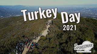
Very nice fireroad. Steep only at the summit near Priest Rock

Kennedy trail is a fairly steep fire road that stays dry / drains well after rain after the initial entry. Part of the Sierra Azul open space.

KENNEDY-LIMEKILN AREA
The most popular is the 2,920-acre Kennedy-Limekiln Area, accessible from Kennedy Road in Los Gatos, and from Highway 17, adjacent to Lexington Reservoir County Park and St. Joseph's Hill Open Space Preserve.

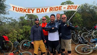
15 miles of trails, providing hikers, bicyclists, and equestrians with some excellent, strenuous loop trails.
Leashed dogs are allowed only on the trails in the Kennedy-Limekiln Area.
Bicyclists: there is a 15 mph trail speed limit and helmets are required at all times.
The popular Kennedy Trail/Limekiln Trail loop covers over 14 miles, and includes nearly 2,000 feet in elevation gain.

Local Trail Association
Traditionally Indigenous Territory

Recent Activity on Trail

Past Week
  • 2 rides
  • 12 miles average
6 Months
  • 16 rides
  • 16 miles avg distance
All
  • 138 rides
  • Last: Jun 27, 2026
c1c2c3c4
January
February
March
April
May
June
July
August
September
October
November
December
update trails status or condition

Kennedy Trail Reports

statusdatedescription
Jan 1, 2026 @ 2:24pm (America/Los_Angeles)
Jan 1, 2026
Some ruts from runoff erosion, a bit worse than last year.
Nov 26, 2024 @ 12:03pm
Nov 26, 2024
Damp but not sticky. Great confitions
Apr 7, 2024 @ 10:36am
Apr 7, 2024
Jun 19, 2022 @ 8:02am
Jun 19, 2022
May 25, 2022 @ 5:30am
May 25, 2022
more »
Status:
on Jan 1, 2026
Wet
Avg: 3.82 (6 votes)
Your vote: 0

view (2,648)
close
3D
Trail Conditions
  • Unknown
  • Snow Groomed
  • Snow Packed
  • Snow Covered
  • Snow Cover Partial
  • Freeze/thaw Cycle
  • Icy
  • Prevalent Mud
  • Wet
  • Variable
  • Ideal
  • Dry
  • Very Dry
Trail Flow (Ridden Direction)
Trailforks scans users ridelogs to determine the most popular direction each trail is ridden. A good flowing trail network will have most trails flowing in a single direction according to their intension.
The colour categories are based on what percentage of riders are riding a trail in its intended direction.
  • > 96%
  • > 90%
  • > 80%
  • > 70%
  • > 50%
  • < 50%
  • bi-directional trail
  • no data
Trail Last Ridden
Trailforks scans ridelogs to determine the last time a trail was ridden.
  • < 2 days
  • < 1 week
  • < 2 weeks
  • < 1 month
  • < 6 months
  • > 6 months
Trail Ridden Direction
The intended direction a trail should be ridden.
  • Downhill Only
  • Downhill Primary
  • Both Directions
  • Uphill Primary
  • Uphill Only
  • One Direction
Contribute Details
Colors indicate trail is missing specified detail.
  • Description
  • Photos
  • Description & Photos
  • Videos
Trail Popularity ?
Trailforks scans ridelogs to determine which trails are ridden the most in the last 9 months. Trails are compared with nearby trails in the same city region with a possible 25 colour shades. Think of this as a heatmap, more rides = more kinetic energy = warmer colors.
  • most popular
  • popular
  • less popular
  • not popular
ATV/ORV/OHV Filter
Max Vehicle Width
inches
US Cell Coverage
Legend
cell carrier legend

Radar Time
Activity Recordings
Trailforks uses anonymized public activity data. ?
Activity Recordings
Trailforks uses anonymized public activity data. ?
Personal Heatmap
Activity Types
all / none
Options
2
Date range month
Winter Trails
Warning A routing network for winter maps does not exist. Selecting trails using the winter trails layer has been disabled.
Missing Trails
Most Popular
Least Popular
Trails are colored based on popularity. The more popular a trail is, the more red. Less popular trails trend towards green.
Jump Magnitude Heatmap
Heatmap of where riders jump on trails. Zoom in to see individual jumps, click circles to view jump details.
BC Backroad Status

Service Road Atlas is a free to use, community-driven service for viewing and creating reports on the numerous back-country service roads around B.C. and Alberta.

map legend
Slope Aspect
Direction the slope faces
Flat N NE E SE S SW W NW
Trails Deemphasized
Trails are shown in grey.
disable
Only show trails with no bike usage.
Enable
Suggested Layers
Based on selected activity type

    Save the current map location and zoom level as your default home location whenever this page is loaded.

    Save
        Directions to kennedy trailhead (37.219360, -121.936220)

        Photos

        17 more »
        204 |
        Mar 7, 2021 @ 10:30am
        Mar 7, 2021
        235 |
        Mar 12, 2021 @ 10:53am
        Mar 12, 2021
        164 |
        Mar 12, 2021 @ 10:53am
        Mar 12, 2021
        147 |
        Mar 12, 2021 @ 10:53am
        Mar 12, 2021

        Videos

        7 more »
        Turkey Day 2021
        5:23 | 399 | Nov 30, 2021 , Los Gatos
        youtuber Los Gatos Turkey Day Ride - 2019
        24:49 | 448 | Jul 30, 2020 , Los Gatos
        UCXC
        3:10 | 1099 | Jan 9, 2015 , Los Gatos
        Sean Kennedy
        0:20 | 438 | May 15, 2010 , Los Gatos

        Routes with this trail

        5.0 13 miles 2,528 ft 2 Loop
        The Los Gatos Turkey Day Ride is a tradition that dates back to the early 1990's. Come on out on...
        16 miles 2,840 ft 3 Loop
        This route is also known as "The Turkey Ride". It begins on the streets of Los Gatos, traveling up some...
        2.0 28 miles 6,283 ft 8 Out & Back
        Ride to Mount Umunhum from the Lexington Reservoir. Can start from downtown Los Gatos and end at a nice...

        2 Reviews & Comments


        We hope you've been enjoying Trailforks!

        Create a FREE account to view trail comments and much more.

        Frequently Asked Questions About Kennedy

        Where is Kennedy located?
        Kennedy is located in Sierra Azul Open Space Preserve, Los Gatos, California, United States. It is part of the Sierra Azul Open Space Preserve trail network. The trailhead is located at coordinates 37.21936, -121.93622.
        What is the elevation gain for Kennedy?
        Kennedy has 2,268 ft of elevation gain. The trail has 230 ft of elevation descent. The elevation ranges from 805 ft to 2,885 ft.
        How long is Kennedy?
        Kennedy is 5.3 miles long. The trail type is dirt/gravel road.
        Are dogs allowed on Kennedy?
        Yes, dogs are allowed on Kennedy. Please keep dogs on a leash where required and clean up after them.

        Hit the Trail

        Open in App

        Get this trail on your phone instantly.
        open trail in app

        Download Trail

        Save to wishlist, Garmin & download.
        save the trail

        Find Related Routes

        Find routes and users activities that include this trail.
        find routes for this trail

        You must enter a description before submitting.