


Open in App
Get this trail on your phone instantly.

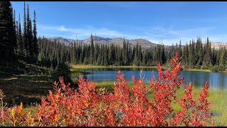
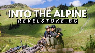
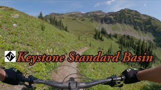
Originally a hiking/horse trail KSB is not snow free until early to mid July most years. A climbing trail, Keystone Climber, bypasses the rocky/rooty sections of the descending trail through the forest and gets you to the open alpine meadows at 1 km then gives way to many kilometers of cruzy alpine MTBliss and steep techy climbs and descents. The turn around point is 11 km in at the Standard Cabin.
Keystone is a remote alpine trail with NO Cell coverage and no water. Come prepared for bike failures, rapid weather changes and bear encounters. Please respect the trail and the alpine environment and don't ride it when wet.
Note: This trail is NOT managed by the Revelstoke Cycling Association.
Turn right onto Keystone FSR at 50 km on Hwy 23 North then follow the signs 17 km to the trailhead.
No bikes past the cabin.
| c1 | c2 | c3 | c4 |
|---|---|---|---|
January | February | March | April |
May | June | July | August |
September | October | November | December |

Service Road Atlas is a free to use, community-driven service for viewing and creating reports on the numerous back-country service roads around B.C. and Alberta.
Save the current map location and zoom level as your default home location whenever this page is loaded.
SaveWe hope you've been enjoying Trailforks!
Create a FREE account to view trail comments and much more.
You must enter a description before submitting.

