more stats
3,973 ft
Distance
-697 ft
Descent
00:07:35
Avg time
-697 ft
Altitude change
1,132 ft
Altitude min
1,830 ft
Altitude max
1,830 ft
Altitude start
1,132 ft
Altitude end
-17.5%
Grade
-71%
Grade max
2.1%
Grade min
46 ft
Distance climb
3,924 ft
Distance down
00:07:35
Avg time

Kill Bill 1 Details

  • Activities
    • Mountain Bike
    • E-Bike
  • Riding Area
    Finale Outdoor Region
    Finale Ligure
  • Ref Number
    #253
  • Difficulty Rating
  • Voted Difficulty
    Red (8 votes)
  • Local Popularity
    90 in Mountain Biking [+]
    • 70 in E-Biking
  • Global Ranking
    #628 in Mountain Biking [+]
    • #2458 in E-Biking
  • Trail Type
    Singletrack
  • Bike Type
    DH, AM
  • Direction
    Downhill Only
    Popular Direction Shown
  • Climb Difficulty
    Green
  • Physical Rating
    Moderate
  • Trail Visibility
    Sometimes hard to follow
  • Season
    All-year round
  • Dogs Allowed
    Yes
  • eBike Allowed
    Yes up to Class 1
  • TTFs on Trail
    Roller Coaster
  • Land Owner
    Finale Outdoor Region

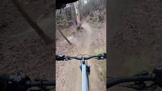
Kill Bill 1 trail goes parallel to its brother Kill Bill 2. The style is very similar: tight corners, step sections, off-camera bits and some rock gardens too. The trail finishes on a gravel road end, after that, you’ll be able to reach both the trails Madonna della Guardia and Cacciatore.

source: ...
Access Info

Madonna della Guardia is reachable from the E80 highway accessing Finale Ligure, then drive north on the SP490 until the brown sign on your right saying "Santuario di Madonna della Guardia".

Disclaimer

Given its nature, the trail can change after weather happenings and season changes. Always pay attention.

Trail Supporters
Local Trail Association

Recent Activity on Trail

Past Week
  • 2 rides
  • 19 miles average
6 Months
  • 197 rides
  • 25 miles avg distance
All
  • 769 rides
  • Last: Jun 18, 2026
c1c2c3c4
January
February
March
April
May
June
July
August
September
October
November
December
Status:
on Jun 7, 2026
Dry
Avg: 4.56 (53 votes)
Your vote: 0

view (4,163)
close
3D
Trail Conditions
  • Unknown
  • Snow Groomed
  • Snow Packed
  • Snow Covered
  • Snow Cover Partial
  • Freeze/thaw Cycle
  • Icy
  • Prevalent Mud
  • Wet
  • Variable
  • Ideal
  • Dry
  • Very Dry
Trail Flow (Ridden Direction)
Trailforks scans users ridelogs to determine the most popular direction each trail is ridden. A good flowing trail network will have most trails flowing in a single direction according to their intension.
The colour categories are based on what percentage of riders are riding a trail in its intended direction.
  • > 96%
  • > 90%
  • > 80%
  • > 70%
  • > 50%
  • < 50%
  • bi-directional trail
  • no data
Trail Last Ridden
Trailforks scans ridelogs to determine the last time a trail was ridden.
  • < 2 days
  • < 1 week
  • < 2 weeks
  • < 1 month
  • < 6 months
  • > 6 months
Trail Ridden Direction
The intended direction a trail should be ridden.
  • Downhill Only
  • Downhill Primary
  • Both Directions
  • Uphill Primary
  • Uphill Only
  • One Direction
Contribute Details
Colors indicate trail is missing specified detail.
  • Description
  • Photos
  • Description & Photos
  • Videos
Trail Popularity ?
Trailforks scans ridelogs to determine which trails are ridden the most in the last 9 months. Trails are compared with nearby trails in the same city region with a possible 25 colour shades. Think of this as a heatmap, more rides = more kinetic energy = warmer colors.
  • most popular
  • popular
  • less popular
  • not popular
ATV/ORV/OHV Filter
Max Vehicle Width
inches
US Cell Coverage
Legend
cell carrier legend

Radar Time
Activity Recordings
Trailforks uses anonymized public activity data. ?
Activity Recordings
Trailforks uses anonymized public activity data. ?
Personal Heatmap
Activity Types
all / none
Options
2
Date range month
Winter Trails
Warning A routing network for winter maps does not exist. Selecting trails using the winter trails layer has been disabled.
Missing Trails
Most Popular
Least Popular
Trails are colored based on popularity. The more popular a trail is, the more red. Less popular trails trend towards green.
Jump Magnitude Heatmap
Heatmap of where riders jump on trails. Zoom in to see individual jumps, click circles to view jump details.
BC Backroad Status

Service Road Atlas is a free to use, community-driven service for viewing and creating reports on the numerous back-country service roads around B.C. and Alberta.

map legend
Slope Aspect
Direction the slope faces
Flat N NE E SE S SW W NW
Trails Deemphasized
Trails are shown in grey.
disable
Only show trails with no bike usage.
Enable
Suggested Layers
Based on selected activity type

    Save the current map location and zoom level as your default home location whenever this page is loaded.

    Save
        Directions to kill-bill-1 trailhead (44.204330, 8.269060)

        Photos

        10 more »
        59 |
        Dec 30, 2024 @ 7:51am
        Dec 30, 2024
        206 |
        Jan 28, 2023 @ 2:24pm
        Jan 28, 2023
        240 |
        Oct 11, 2022 @ 11:58pm
        Oct 11, 2022
        264 |
        Oct 11, 2022 @ 11:58pm
        Oct 11, 2022

        Videos

        6 more »
        youtuber Finale Ligure  Teil 2 - Auf den Spuren der...
        9:52 | 237 | Feb 18, 2025 , Finale Ligure
        Kill Bill and Madonna della Guardia //FINALE...
        0:51 | 302 | Oct 24, 2024 , Finale Ligure
        KillBill 1 [Full run] - Finale Ligure 2024 ...
        3:43 | 484 | Jun 5, 2024 , Finale Ligure
        Finale Ligure MTB ⚫️ | Kill Bill 1 | First...
        0:00 | 307 | Dec 19, 2023 , Finale Ligure

        Trail Lists

        Routes with this trail

        4.3 13 miles 2,234 ft 7 Point to Point
        Route connecting Roller Coaster Kill Bill 1 Madonna Della Guardia Pina Morta Pina Morta Lower Neanderthaler
        27 miles 2,491 ft 7 Loop
        Quick ride, if you don't have much time. Starting from Ceriale, in front of TrekUpBike (bikeshop). You...
        13 miles 2,231 ft 7 Point to Point
        Route connecting Roller Coaster Kill Bill 1 Madonna Della Guardia Pina Morta Pina Morta Lower Neanderthaler

        8 Reviews & Comments


        We hope you've been enjoying Trailforks!

        Create a FREE account to view trail comments and much more.

        Frequently Asked Questions About Kill Bill 1

        Where is Kill Bill 1 located?
        Kill Bill 1 is located in Finale Outdoor Region, Finale Ligure, Italy. It is part of the Finale Outdoor Region trail network. The trailhead is located at coordinates 44.20433, 8.26906.
        How hard is Kill Bill 1?
        Kill Bill 1 is rated as Red difficulty. The physical rating is Moderate. The average grade is 17.5%. The climb difficulty is rated Green.
        What is the elevation gain for Kill Bill 1?
        The trail has 697 ft of elevation descent. The elevation ranges from 1,132 ft to 1,830 ft.
        Is Kill Bill 1 a point to point trail?
        Yes, Kill Bill 1 is a point to point trail. The direction is Downhill Only. The trail type is singletrack.

        Hit the Trail

        Open in App

        Get this trail on your phone instantly.
        open trail in app

        Download Trail

        Save to wishlist, Garmin & download.
        save the trail

        Find Related Routes

        Find routes and users activities that include this trail.
        find routes for this trail

        You must enter a description before submitting.