more stats
1.1 miles
Distance
-659 ft
Descent
00:12:10
Avg time
-661 ft
Altitude change
1,045 ft
Altitude min
1,706 ft
Altitude max
1,706 ft
Altitude start
1,047 ft
Altitude end
-11.5%
Grade
-47.8%
Grade max
3.6%
Grade min
118 ft
Distance climb
1 mile
Distance down
190 ft
Distance flat
00:12:10
Avg time

La Alberca Details

  • Activities
    • Mountain Bike
    • E-Bike
    • Hike
    • Trail Running
  • Riding Area
    Ojén
    Marbella
  • Difficulty Rating
  • Local Popularity
    35 in Mountain Biking [+]
    • 40 in E-Biking
    • 5 in Trail Running
    • 5 in Hiking
  • Global Ranking
    #113854 in Mountain Biking [+]
    • #80757 in E-Biking
    • #140652 in Trail Running
    • #134960 in Hiking
  • Trail Type
    Singletrack
  • Bike Type
    DH, AM
  • Direction
    Downhill Primary
    Popular Direction Shown
  • Climb Difficulty
    Black Diamond
  • Physical Rating
    Hard
  • Dogs Allowed
    Yes
  • eBike Allowed
  • TTFs on Trail
    Rock Garden, Roller Coaster, Skinny

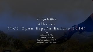
Fun and fast trail, mainly with loose sections, some rocks and kind or roller coaster in the middle section. Ends on an abandoned pool, that's why its call "La Alberca"

Recent Activity on Trail

Past Week
  • 0 rides
  •  
6 Months
  • 0 rides
  •  
All
  • 18 rides
  • Last: Aug 30, 2025
c1c2c3c4
January
February
March
April
May
June
July
August
September
October
November
December
update trails status or condition

La Alberca Trail Reports

statusdatedescription
Dec 2, 2024 @ 9:55am
Dec 2, 2024
Most of the trail is a mess and a bit difficult to navigate without riding first. I'd avoid in its current condition
Jan 18, 2024 @ 3:00pm
Jan 18, 2024
lot of erosion and huge amount of big loose rocks, also on some trails around. Barely rideable.
Sep 19, 2017 @ 4:06pm
Sep 19, 2017
Really dry. Lots of loose sections. Poor grip.
Feb 27, 2017 @ 1:42am
Feb 27, 2017
reporter trail is on optimal conditions after several hours working on it pass week, ready for the Endurama Sun Race
Nov 7, 2016 @ 10:45am
Nov 7, 2016
reporter
more »
Status:
on Dec 2, 2024
Very Dry
Avg: 4.13 (1 votes)
Your vote: 0

view (75)
close
3D
Trail Conditions
  • Unknown
  • Snow Groomed
  • Snow Packed
  • Snow Covered
  • Snow Cover Partial
  • Freeze/thaw Cycle
  • Icy
  • Prevalent Mud
  • Wet
  • Variable
  • Ideal
  • Dry
  • Very Dry
Trail Flow (Ridden Direction)
Trailforks scans users ridelogs to determine the most popular direction each trail is ridden. A good flowing trail network will have most trails flowing in a single direction according to their intension.
The colour categories are based on what percentage of riders are riding a trail in its intended direction.
  • > 96%
  • > 90%
  • > 80%
  • > 70%
  • > 50%
  • < 50%
  • bi-directional trail
  • no data
Trail Last Ridden
Trailforks scans ridelogs to determine the last time a trail was ridden.
  • < 2 days
  • < 1 week
  • < 2 weeks
  • < 1 month
  • < 6 months
  • > 6 months
Trail Ridden Direction
The intended direction a trail should be ridden.
  • Downhill Only
  • Downhill Primary
  • Both Directions
  • Uphill Primary
  • Uphill Only
  • One Direction
Contribute Details
Colors indicate trail is missing specified detail.
  • Description
  • Photos
  • Description & Photos
  • Videos
Trail Popularity ?
Trailforks scans ridelogs to determine which trails are ridden the most in the last 9 months. Trails are compared with nearby trails in the same city region with a possible 25 colour shades. Think of this as a heatmap, more rides = more kinetic energy = warmer colors.
  • most popular
  • popular
  • less popular
  • not popular
ATV/ORV/OHV Filter
Max Vehicle Width
inches
US Cell Coverage
Legend
cell carrier legend

Radar Time
Activity Recordings
Trailforks uses anonymized public activity data. ?
Activity Recordings
Trailforks uses anonymized public activity data. ?
Personal Heatmap
Activity Types
all / none
Options
2
Date range month
Winter Trails
Warning A routing network for winter maps does not exist. Selecting trails using the winter trails layer has been disabled.
Missing Trails
Most Popular
Least Popular
Trails are colored based on popularity. The more popular a trail is, the more red. Less popular trails trend towards green.
Jump Magnitude Heatmap
Heatmap of where riders jump on trails. Zoom in to see individual jumps, click circles to view jump details.
BC Backroad Status

Service Road Atlas is a free to use, community-driven service for viewing and creating reports on the numerous back-country service roads around B.C. and Alberta.

map legend
Slope Aspect
Direction the slope faces
Flat N NE E SE S SW W NW
Trails Deemphasized
Trails are shown in grey.
disable
Only show trails with no bike usage.
Enable
Suggested Layers
Based on selected activity type

    Save the current map location and zoom level as your default home location whenever this page is loaded.

    Save
        Directions to la-alberca trailhead (36.565880, -4.820640)

        Photos

        5 more »
        98 |
        Mar 16, 2017 @ 3:44am
        Mar 16, 2017
        108 |
        Mar 16, 2017 @ 3:44am
        Mar 16, 2017
        93 |
        Mar 16, 2017 @ 3:44am
        Mar 16, 2017
        90 |
        Mar 16, 2017 @ 3:44am
        Mar 16, 2017

        Videos

        2 more »
        Trailforks #72 - Alberca (TC2 Open Andalucía...
        3:19 | 87 | Apr 11, 2024 , Marbella
        La Alberca trail
        6:19 | 414 | Feb 14, 2020 , Marbella

        Routes with this trail

        5.0 16 miles 3,608 ft 14 Loop Race
        5.0 17 miles 4,308 ft 6 Loop Race
        Be prepared for 2 grueling climbs, first one will take you up to the antennas, from 350m to 970m, so 600m...
        4.5 15 miles 3,802 ft 8 Loop Race
        Tackle one of the longest descents in Ojen area, from the infamous Antennas down to the cemetery gates....

        2 Reviews & Comments


        We hope you've been enjoying Trailforks!

        Create a FREE account to view trail comments and much more.

        Nearby Trails

        Frequently Asked Questions About La Alberca

        Where is La Alberca located?
        La Alberca is located in Ojén, Marbella, Spain. It is part of the Ojén trail network. The trailhead is located at coordinates 36.56588, -4.82064.
        How hard is La Alberca?
        La Alberca is rated as Red difficulty. The physical rating is Hard. The average grade is 11.5%. The climb difficulty is rated Black Diamond.
        What is the elevation gain for La Alberca?
        The trail has 659 ft of elevation descent. The elevation ranges from 1,045 ft to 1,706 ft.
        Is La Alberca a point to point trail?
        La Alberca is not a point to point trail. The direction is Downhill Primary. The trail type is singletrack.

        Hit the Trail

        Open in App

        Get this trail on your phone instantly.
        open trail in app

        Download Trail

        Save to wishlist, Garmin & download.
        save the trail

        Find Related Routes

        Find routes and users activities that include this trail.
        find routes for this trail

        You must enter a description before submitting.