more stats
2,474 ft
Distance
-232 ft
Descent
00:04:54
Avg time
-233 ft
Altitude change
7,141 ft
Altitude min
7,374 ft
Altitude max
7,374 ft
Altitude start
7,142 ft
Altitude end
-9.4%
Grade
-29.2%
Grade max
-0.4%
Grade min
2,379 ft
Distance down
95 ft
Distance flat
00:04:54
Avg time

La Jube Details

  • Activities
    • Mountain Bike
    • E-Bike
  • Riding Area
  • Difficulty Rating
  • Local Popularity
    60 in Mountain Biking [+]
    • 60 in E-Biking
  • Global Ranking
    #86414 in Mountain Biking [+]
    • #62644 in E-Biking
  • Trail Type
    Singletrack
  • Bike Type
    AM, XC
  • Direction
    Downhill Primary
  • Climb Difficulty
    Blue
  • Physical Rating
    Moderate
  • Trail Visibility
    Always easy to follow
  • Season
    All year
  • Dogs Allowed
    Yes
  • eBike Allowed
    Yes up to Class 1
  • TTFs on Trail
    Drop, Jump, Rock Garden
  • Ride in Rain
    Yes
  • Year Opened
    2012

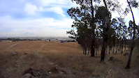
Para los que quieren iniciar en el Enduro y DH.

Access Info

Inicia del arrancador USA Bikes hasta llegar a la zona de campamento con malla.

Trail Supporters

  • Usa Bikes

    since 2005
    Builder
  • Tsáab Kaan Outdoors
    since 2005
    Maintainer
Local Trail Association

Recent Activity on Trail

Past Week
  • 0 rides
  •  
6 Months
  • 0 rides
  •  
All
  • 61 rides
  • Last: Jun 14, 2026
c1c2c3c4
January
February
March
April
May
June
July
August
September
October
November
December
update trails status or condition

La Jube Trail Reports

statusdatedescription
Jun 30, 2024 @ 12:02pm
Jun 30, 2024
reporter Favor de no cortar arboles si no tienen la técnica para este trail, líneas rectas la ciclopista.
Jun 30, 2024 @ 12:01pm
Jun 30, 2024
reporter Reparada por sus creadores y reparadores USA Bikes
Jun 30, 2024 @ 12:01pm
Jun 30, 2024
reporter
Apr 8, 2024 @ 10:13am
Apr 8, 2024
Mar 22, 2024 @ 12:41am
Mar 22, 2024
more »
Status:
on Jun 30, 2024
Ideal
Avg: 4.13 (1 votes)
Your vote: 0

view (973)
close
3D
Trail Conditions
  • Unknown
  • Snow Groomed
  • Snow Packed
  • Snow Covered
  • Snow Cover Partial
  • Freeze/thaw Cycle
  • Icy
  • Prevalent Mud
  • Wet
  • Variable
  • Ideal
  • Dry
  • Very Dry
Trail Flow (Ridden Direction)
Trailforks scans users ridelogs to determine the most popular direction each trail is ridden. A good flowing trail network will have most trails flowing in a single direction according to their intension.
The colour categories are based on what percentage of riders are riding a trail in its intended direction.
  • > 96%
  • > 90%
  • > 80%
  • > 70%
  • > 50%
  • < 50%
  • bi-directional trail
  • no data
Trail Last Ridden
Trailforks scans ridelogs to determine the last time a trail was ridden.
  • < 2 days
  • < 1 week
  • < 2 weeks
  • < 1 month
  • < 6 months
  • > 6 months
Trail Ridden Direction
The intended direction a trail should be ridden.
  • Downhill Only
  • Downhill Primary
  • Both Directions
  • Uphill Primary
  • Uphill Only
  • One Direction
Contribute Details
Colors indicate trail is missing specified detail.
  • Description
  • Photos
  • Description & Photos
  • Videos
Trail Popularity ?
Trailforks scans ridelogs to determine which trails are ridden the most in the last 9 months. Trails are compared with nearby trails in the same city region with a possible 25 colour shades. Think of this as a heatmap, more rides = more kinetic energy = warmer colors.
  • most popular
  • popular
  • less popular
  • not popular
ATV/ORV/OHV Filter
Max Vehicle Width
inches
US Cell Coverage
Legend
cell carrier legend

Radar Time
Activity Recordings
Trailforks uses anonymized public activity data. ?
Activity Recordings
Trailforks uses anonymized public activity data. ?
Personal Heatmap
Activity Types
all / none
Options
2
Date range month
Winter Trails
Warning A routing network for winter maps does not exist. Selecting trails using the winter trails layer has been disabled.
Missing Trails
Most Popular
Least Popular
Trails are colored based on popularity. The more popular a trail is, the more red. Less popular trails trend towards green.
Jump Magnitude Heatmap
Heatmap of where riders jump on trails. Zoom in to see individual jumps, click circles to view jump details.
BC Backroad Status

Service Road Atlas is a free to use, community-driven service for viewing and creating reports on the numerous back-country service roads around B.C. and Alberta.

map legend
Slope Aspect
Direction the slope faces
Flat N NE E SE S SW W NW
Trails Deemphasized
Trails are shown in grey.
disable
Only show trails with no bike usage.
Enable
Suggested Layers
Based on selected activity type

    Save the current map location and zoom level as your default home location whenever this page is loaded.

    Save
        Directions to la-jube trailhead (19.065960, -98.339440)

        Photos

        4 more »
        124 |
        Mar 22, 2021 @ 2:06pm
        Mar 22, 2021
        120 |
        Mar 22, 2021 @ 2:06pm
        Mar 22, 2021
        127 |
        Jan 12, 2017 @ 9:03pm
        Jan 12, 2017
        156 |
        May 23, 2015 @ 6:43pm
        May 23, 2015

        Videos

        3 more »
        La JUBE by El Pescado
        0:52 | 108 | May 27, 2015 , Cholula
        Reportade en la JUBE
        3:15 | 51 | May 27, 2015 , Cholula
        La JUBE
        2:57 | 69 | May 27, 2015 , Cholula

        1 Review & Comments


        We hope you've been enjoying Trailforks!

        Create a FREE account to view trail comments and much more.

        • By usabikes-mex CEO & contributors
        • #29661 - 1,732 views

        Frequently Asked Questions About La Jube

        Where is La Jube located?
        La Jube is located in Cerro Zapotecas Trail Network, Cholula, México. It is part of the Cerro Zapotecas Trail Network trail network. The trailhead is located at coordinates 19.06596, -98.33944.
        How hard is La Jube?
        La Jube is rated as Blue difficulty. The physical rating is Moderate. The average grade is 9.4%. The climb difficulty is rated Blue.
        What is the elevation gain for La Jube?
        The trail has 232 ft of elevation descent. The elevation ranges from 7,141 ft to 7,374 ft.
        Is La Jube a point to point trail?
        La Jube is not a point to point trail. The direction is Downhill Primary. The trail type is singletrack.

        Hit the Trail

        Open in App

        Get this trail on your phone instantly.
        open trail in app

        Download Trail

        Save to wishlist, Garmin & download.
        save the trail

        Find Related Routes

        Find routes and users activities that include this trail.
        find routes for this trail

        You must enter a description before submitting.