
Open in App
Get this trail on your phone instantly.

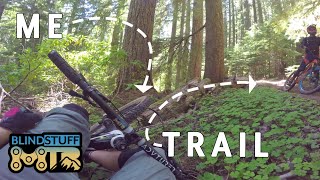
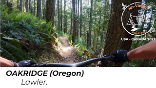
Lawler is a wonderful trail that is a little more technical than most Oakridge trails tend to be. Tends to have some big climbing moments during the duration of the trail. After the first mile or so, there is a junction where one can view a shelter. Turn left to go to the Shelter (.25miles down the trail on your right). If you continue you down this path, which I recommend you do, especially if you climbed all the way up there), you will after about 2miles come to a lookout overviewing the foothills of the Cascades and beginning of the Willamette River. From there, you will retrace your path back to the junction and turn left again (coming from the OAB) and continue on your merry way.
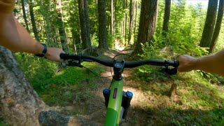
The trail itself dives you through some magnificent forests. Has lots of fun shale sections. A few steep down pitches, and an uphill climb most people hike-a-bike. Some sharp switchbacks to test your jedi skills on too.
There are some fun hits usually hidden away towards the bottom for you AM riders as well.
Note, the trail can be quite brushy and doesn't see a lot of trail work. Is usually clear for logs/snow by March/April thanks to the DOD and GOATS.
| c1 | c2 | c3 | c4 |
|---|---|---|---|
January | February | March | April |
May | June | July | August |
September | October | November | December |

Service Road Atlas is a free to use, community-driven service for viewing and creating reports on the numerous back-country service roads around B.C. and Alberta.
Save the current map location and zoom level as your default home location whenever this page is loaded.
SaveWe hope you've been enjoying Trailforks!
Create a FREE account to view trail comments and much more.
You must enter a description before submitting.

