more stats
1.2 miles
Distance
83 ft
Climb
-660 ft
Descent
00:07:28
Avg time
-577 ft
Altitude change
342 ft
Altitude min
950 ft
Altitude max
950 ft
Altitude start
374 ft
Altitude end
-9%
Grade
-81.8%
Grade max
14.2%
Grade min
1,496 ft
Distance climb
4,587 ft
Distance down
338 ft
Distance flat
00:07:28
Avg time

Leaping Lizard Details

  • Activities
    • Mountain Bike
    • Hike
    • Trail Running
  • Riding Area
  • Difficulty Rating
  • Voted Difficulty
    Black Diamond (3 votes)
  • Local Popularity
    70 in Mountain Biking [+]
    • 40 in Trail Running
    • 5 in Hiking
  • Global Ranking
    #32987 in Mountain Biking [+]
    • #105423 in Trail Running
    • #122126 in Hiking
  • Trail Type
    Singletrack
  • Bike Type
    AM, XC
  • Direction
    Downhill Only
    Popular Direction Shown
  • Physical Rating
    Moderate
  • Trail Visibility
    Always easy to follow
  • Dogs Allowed
    Yes
  • eBike Allowed
    Yes up to Class 1
  • TTFs on Trail
    Bridge, Jump, Rock Garden, Roller Coaster
  • Land Owner

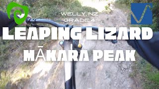
One of the original Makara Peak trails and offers something different in the Wellington area. It's a fast rough and relatively wide plunge down the valley that suits big bikes and rewards staying off the brakes.

It doesn't get a lot of maintenance, so the chutes near the bottom can change after heavy rain. It ends at the most remote part of the park at which point you can exit out via Bail Out to the end of South Karori Road, or climb back into the park via the steep and challenging Possum Bait Line.

Track starts off with a fast roller coaster style downhill along an old farm 4WD track. You will pass a left hand branch that takes you down Nikau. From here the track switches back into single track, which is tight in places and increasingly steep and loose.

Access Info

From the end of Missing Link, head straight up the 4WD track rather than turning right into Aratihi and grind your way up for around 10 minutes. Alternatively, from the peak join Upper Leaping Lizard for a solid non-stop run to the bottom.

Local Trail Association

Recent Activity on Trail

Past Week
  • 1 rides
  • 32.1 km average
6 Months
  • 24 rides
  • 20.5 km avg distance
All
  • 389 rides
  • Last: Jun 11, 2026
c1c2c3c4
January
February
March
April
May
June
July
August
September
October
November
December
update trails status or condition

Leaping Lizard Trail Reports

statusdatedescription
Mar 7, 2026 @ 11:20am (Pacific/Auckland)
Mar 6, 2026
Feb 28, 2026 @ 7:09am (Pacific/Auckland)
Feb 27, 2026
Feb 8, 2026 @ 9:49am (Pacific/Auckland)
Feb 7, 2026
Nov 23, 2025 @ 12:29pm (Pacific/Auckland)
Nov 22, 2025
Loose in places. Lots of loose gravel on the trail.
Aug 16, 2025 @ 7:48pm
Aug 16, 2025
reporter Winter has taken its toll, with ruts getting deeper and surface being quite cut up. Great fun though.
more »
Status:
on Mar 7, 2026
Variable
Avg: 4.31 (16 votes)
Your vote: 0

view (3,443)
close
3D
Trail Conditions
  • Unknown
  • Snow Groomed
  • Snow Packed
  • Snow Covered
  • Snow Cover Partial
  • Freeze/thaw Cycle
  • Icy
  • Prevalent Mud
  • Wet
  • Variable
  • Ideal
  • Dry
  • Very Dry
Trail Flow (Ridden Direction)
Trailforks scans users ridelogs to determine the most popular direction each trail is ridden. A good flowing trail network will have most trails flowing in a single direction according to their intension.
The colour categories are based on what percentage of riders are riding a trail in its intended direction.
  • > 96%
  • > 90%
  • > 80%
  • > 70%
  • > 50%
  • < 50%
  • bi-directional trail
  • no data
Trail Last Ridden
Trailforks scans ridelogs to determine the last time a trail was ridden.
  • < 2 days
  • < 1 week
  • < 2 weeks
  • < 1 month
  • < 6 months
  • > 6 months
Trail Ridden Direction
The intended direction a trail should be ridden.
  • Downhill Only
  • Downhill Primary
  • Both Directions
  • Uphill Primary
  • Uphill Only
  • One Direction
Contribute Details
Colors indicate trail is missing specified detail.
  • Description
  • Photos
  • Description & Photos
  • Videos
Trail Popularity ?
Trailforks scans ridelogs to determine which trails are ridden the most in the last 9 months. Trails are compared with nearby trails in the same city region with a possible 25 colour shades. Think of this as a heatmap, more rides = more kinetic energy = warmer colors.
  • most popular
  • popular
  • less popular
  • not popular
ATV/ORV/OHV Filter
Max Vehicle Width
inches
US Cell Coverage
Legend
cell carrier legend

Radar Time
Activity Recordings
Trailforks uses anonymized public activity data. ?
Activity Recordings
Trailforks uses anonymized public activity data. ?
Personal Heatmap
Activity Types
all / none
Options
2
Date range month
Winter Trails
Warning A routing network for winter maps does not exist. Selecting trails using the winter trails layer has been disabled.
Missing Trails
Most Popular
Least Popular
Trails are colored based on popularity. The more popular a trail is, the more red. Less popular trails trend towards green.
Jump Magnitude Heatmap
Heatmap of where riders jump on trails. Zoom in to see individual jumps, click circles to view jump details.
BC Backroad Status

Service Road Atlas is a free to use, community-driven service for viewing and creating reports on the numerous back-country service roads around B.C. and Alberta.

map legend
Slope Aspect
Direction the slope faces
Flat N NE E SE S SW W NW
Trails Deemphasized
Trails are shown in grey.
disable
Only show trails with no bike usage.
Enable
Suggested Layers
Based on selected activity type

    Save the current map location and zoom level as your default home location whenever this page is loaded.

    Save
        Directions to leaping-lizard-18775 trailhead (-41.296660, 174.702390)

        Photos

        4 more »
        120 |
        Feb 1, 2019 @ 9:47pm
        Feb 1, 2019
        110 |
        Aug 6, 2018 @ 11:32am
        Aug 6, 2018
        137 |
        Aug 6, 2018 @ 11:32am
        Aug 6, 2018
        166 |
        Aug 6, 2018 @ 11:32am
        Aug 6, 2018

        Videos

        6 more »
        Leaping Lizard | Mākara Peak | Wellington, NZ...
        8:05 | 565 | Nov 22, 2021 , Wellington
        Leaping Lizard (Main) & Bailout Trails,...
        6:51 | 728 | Jun 28, 2019 , Wellington
        Leaping Lizard Trail, Wellington, NZ (static cam)
        0:29 | 644 | Aug 26, 2018 , Wellington
        New Upper Leaping Lizard Trail, Makara Peak,...
        2:18 | 783 | Jul 26, 2018 , Wellington

        Routes with this trail

        5.0 6 miles 1,489 ft 16 Loop
        An Advanced grade loop taking you out to the wilds of Makara Peak. Harder than an Intermediate grade due...
        3.0 4 miles 729 ft 4 Loop
        A great loop for riders looking for some variety or to extend their normal ride. This largely intermediate...
        4 miles 1,569 ft 9 Point to Point
        Alternative grade 4 (advanced) route to the summit from the end of . Taking in , the top of and and it...

        4 Reviews & Comments


        We hope you've been enjoying Trailforks!

        Create a FREE account to view trail comments and much more.

        • By mccmartiniTF Pro MCG & contributors
        • #18775 - 10,875 views

        Frequently Asked Questions About Leaping Lizard

        Where is Leaping Lizard located?
        Leaping Lizard is located in Mākara Peak Mountain Bike Park, Wellington, New Zealand. It is part of the Mākara Peak Mountain Bike Park trail network. The trailhead is located at coordinates -41.29666, 174.70239.
        How hard is Leaping Lizard?
        Leaping Lizard is rated as Advanced difficulty. The physical rating is Moderate. The average grade is 9%.
        What is the elevation gain for Leaping Lizard?
        Leaping Lizard has 83 ft of elevation gain. The trail has 660 ft of elevation descent. The elevation ranges from 342 ft to 950 ft.
        Is Leaping Lizard a point to point trail?
        Yes, Leaping Lizard is a point to point trail. The direction is Downhill Only. The trail type is singletrack.

        Hit the Trail

        Open in App

        Get this trail on your phone instantly.
        open trail in app

        Download Trail

        Save to wishlist, Garmin & download.
        save the trail

        Find Related Routes

        Find routes and users activities that include this trail.
        find routes for this trail

        You must enter a description before submitting.