more stats
2,093 ft
Distance
15 ft
Climb
-315 ft
Descent
00:08:41
Avg time
-299 ft
Altitude change
1,984 ft
Altitude min
2,283 ft
Altitude max
2,283 ft
Altitude start
1,985 ft
Altitude end
-14.3%
Grade
-45.1%
Grade max
15.9%
Grade min
203 ft
Distance climb
1,644 ft
Distance down
243 ft
Distance flat
00:08:41
Avg time

Lens Distortion Details

  • Activities
    • Mountain Bike
    • Hike
    • Trail Running
  • Riding Area
    Burke Mountain
    Coquitlam, British Columbia
  • Difficulty Rating
  • Voted Difficulty
    Black Diamond (1 vote)
  • Local Popularity
    65 in Mountain Biking [+]
    • 5 in Trail Running
    • 5 in Hiking
  • Global Ranking
    #38653 in Mountain Biking [+]
    • #128967 in Trail Running
    • #121976 in Hiking
  • Hiking SAC Scale
    T1 Hiking
  • Trail Type
    Singletrack
  • Bike Type
    AM
  • Physical Rating
    Moderate
  • Trail Visibility
    Always easy to follow
  • TTFs on Trail
    Berm, Bridge, Drop, Jump, Ladder Bridge, Log Ride

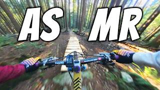
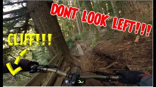
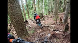
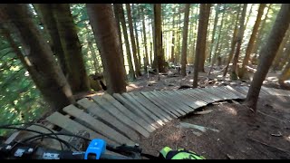
Distortion is a flowy trail with several wood features, of which a few are more difficult options. The trail starts just up the road from the viewpoint.

Please allow trail to drain after a rain before riding.

Remember to slow down at the playground.

Disclaimer

This trail is unsanctioned. Ride at your own risk. NO WET RIDES

Trail Supporters
  • Sponsor
Traditionally Indigenous Territory

Recent Activity on Trail

Past Week
  • 3 rides
  • 19.0 km average
6 Months
  • 77 rides
  • 15.1 km avg distance
All
  • 617 rides
  • Last: Jun 16, 2026
c1c2c3c4
January
February
March
April
May
June
July
August
September
October
November
December
Status:
on May 23, 2026
Ideal
Avg: 4.44 (12 votes)
Your vote: 0

view (119)
close
3D
Trail Conditions
  • Unknown
  • Snow Groomed
  • Snow Packed
  • Snow Covered
  • Snow Cover Partial
  • Freeze/thaw Cycle
  • Icy
  • Prevalent Mud
  • Wet
  • Variable
  • Ideal
  • Dry
  • Very Dry
Trail Flow (Ridden Direction)
Trailforks scans users ridelogs to determine the most popular direction each trail is ridden. A good flowing trail network will have most trails flowing in a single direction according to their intension.
The colour categories are based on what percentage of riders are riding a trail in its intended direction.
  • > 96%
  • > 90%
  • > 80%
  • > 70%
  • > 50%
  • < 50%
  • bi-directional trail
  • no data
Trail Last Ridden
Trailforks scans ridelogs to determine the last time a trail was ridden.
  • < 2 days
  • < 1 week
  • < 2 weeks
  • < 1 month
  • < 6 months
  • > 6 months
Trail Ridden Direction
The intended direction a trail should be ridden.
  • Downhill Only
  • Downhill Primary
  • Both Directions
  • Uphill Primary
  • Uphill Only
  • One Direction
Contribute Details
Colors indicate trail is missing specified detail.
  • Description
  • Photos
  • Description & Photos
  • Videos
Trail Popularity ?
Trailforks scans ridelogs to determine which trails are ridden the most in the last 9 months. Trails are compared with nearby trails in the same city region with a possible 25 colour shades. Think of this as a heatmap, more rides = more kinetic energy = warmer colors.
  • most popular
  • popular
  • less popular
  • not popular
ATV/ORV/OHV Filter
Max Vehicle Width
inches
US Cell Coverage
Legend
cell carrier legend

Radar Time
Activity Recordings
Trailforks uses anonymized public activity data. ?
Activity Recordings
Trailforks uses anonymized public activity data. ?
Personal Heatmap
Activity Types
all / none
Options
2
Date range month
Winter Trails
Warning A routing network for winter maps does not exist. Selecting trails using the winter trails layer has been disabled.
Missing Trails
Most Popular
Least Popular
Trails are colored based on popularity. The more popular a trail is, the more red. Less popular trails trend towards green.
Jump Magnitude Heatmap
Heatmap of where riders jump on trails. Zoom in to see individual jumps, click circles to view jump details.
BC Backroad Status

Service Road Atlas is a free to use, community-driven service for viewing and creating reports on the numerous back-country service roads around B.C. and Alberta.

map legend
Slope Aspect
Direction the slope faces
Flat N NE E SE S SW W NW
Trails Deemphasized
Trails are shown in grey.
disable
Only show trails with no bike usage.
Enable
Suggested Layers
Based on selected activity type

    Save the current map location and zoom level as your default home location whenever this page is loaded.

    Save
        Directions to lens-distortion trailhead (49.324270, -122.735130)

        Photos

        3 more »
        94 |
        Aug 10, 2024 @ 7:42am
        Aug 10, 2024
        84 |
        Aug 10, 2024 @ 7:39am
        Aug 10, 2024
        170 |
        Apr 27, 2024 @ 1:47pm
        Apr 27, 2024
        41 |
        Jan 15, 2026 @ 5:02pm
        Jan 15, 2026

        Videos

        7 more »
        youtuber Winter Riding Doesn't get any Better than
        11:59 | 245 | Dec 8, 2024 , Coquitlam
        LENS DISTORTION | MOUNT BURKE | INTENSE TAZER...
        4:53 | 44 | Feb 15, 2026 , Coquitlam
        Lens Distortion June 24 2024
        2:55 | 264 | Jun 27, 2024 , Coquitlam
        Lens Distortion June 12 2024
        3:12 | 102 | Jun 16, 2024 , Coquitlam

        Routes with this trail

        23 miles 5,105 ft 14
        A top secrete mission relies on this route to power it's first leg of the day. Shore time...

        Trail Products

        7 Reviews & Comments


        We hope you've been enjoying Trailforks!

        Create a FREE account to view trail comments and much more.

        • By lennnnyTF Pro Burke & contributors
        • #442901 - 2,220 views

        Frequently Asked Questions About Lens Distortion

        Where is Lens Distortion located?
        Lens Distortion is located in Burke Mountain, Coquitlam, British Columbia, Canada. It is part of the Burke Mountain trail network. The trailhead is located at coordinates 49.32427, -122.73513.
        How hard is Lens Distortion?
        Lens Distortion is rated as Black Diamond difficulty. The physical rating is Moderate. The average grade is 14.3%.
        What is the elevation gain for Lens Distortion?
        Lens Distortion has 15 ft of elevation gain. The trail has 315 ft of elevation descent. The elevation ranges from 1,984 ft to 2,283 ft.
        How long is Lens Distortion?
        Lens Distortion is 2,093 ft long. The trail type is singletrack.

        Hit the Trail

        Open in App

        Get this trail on your phone instantly.
        open trail in app

        Download Trail

        Save to wishlist, Garmin & download.
        save the trail

        Find Related Routes

        Find routes and users activities that include this trail.
        find routes for this trail

        You must enter a description before submitting.