more stats
1.2 miles
Distance
-536 ft
Descent
00:05:07
Avg time
-536 ft
Altitude change
5,677 ft
Altitude min
6,214 ft
Altitude max
6,214 ft
Altitude start
5,679 ft
Altitude end
-8.3%
Grade
-56.3%
Grade max
-1.1%
Grade min
1 mile
Distance down
00:05:07
Avg time

Levitate Details

  • Activities
    • Mountain Bike
    • E-Bike
  • Riding Area
    Corner Canyon
    Draper, Utah
  • Difficulty Rating
  • Voted Difficulty
    Black Diamond (12 votes)
  • Local Popularity
    75 in Mountain Biking [+]
    • 90 in E-Biking
  • Global Ranking
    #560 in Mountain Biking [+]
    • #1330 in E-Biking
  • Trail Type
    Singletrack
  • Direction
    Downhill Only
    Popular Direction Shown
  • Trail Visibility
    Always easy to follow
  • Season
    May - Nov
  • Dogs Allowed
    Yes
  • eBike Allowed
    Yes up to Class 1
  • TTFs on Trail
    Drop, Jump, Gap Jump
  • Year Opened
    2017
  • Land Owner

TRAIL UPDATE: Jumps now mandatory.

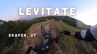
This trail continues to evolve through efforts of local volunteers. For Spring '21, a few tables near the bottom have been refreshed and slightly enlarged, step-down drops refurbished, a major berm rebuilt, and the step-up coming out of the trees at .8 miles has been shaped into the new Apollo Jump. The new jump is now one of the two largest features but very smooth when hit at trail speed. Overall, the trail is quite fast, flowy, with some decent sized jumps and continues to be more deserving of its black diamond rating.

Small but mandatory gap jumps have been added to the trail. There are no ride-arounds for these features. Jumping is now considered mandatory for this trail. Filter features will continue to be added in order to prevent underskilled riders from causing undue damage and injuring themselves on larger features. These filters are designed specifically to reduce maintenance as well as injuries.

Disclaimer

Jumping is now mandatory.

Trail Supporters
Local Trail Association
Traditionally Indigenous Territory

Recent Activity on Trail

Past Week
  • 16 rides
  • 11 miles average
6 Months
  • 169 rides
  • 12 miles avg distance
All
  • 2,436 rides
  • Last: Jun 20, 2026
c1c2c3c4
January
February
March
April
May
June
July
August
September
October
November
December
update trails status or condition

Levitate Trail Reports

statusdatedescription
Jun 16, 2026 @ 6:36am (America/Denver)
Jun 16, 2026
Levitate rebuild is complete and a running great. Enjoy the new jumps!
Jun 12, 2026 @ 8:07am (America/Boise)
Jun 12, 2026
After rebuild the trail is so fun! Well done trail builders. New gaps are perfect!
Jun 5, 2026 @ 8:38pm (America/Denver)
Jun 5, 2026
May 23, 2026 @ 8:13am (America/Boise)
May 23, 2026
New gaps are great. Reworked areas are a little soft but really fun.
May 20, 2026 @ 9:00am (America/Denver)
May 20, 2026
Closed to public until Friday, May 21 for some rebuilding/tuning.
more »
Status:
on Jun 16, 2026
Ideal
Avg: 4.48 (74 votes)
Your vote: 0

view (30,663)
close
3D
Trail Conditions
  • Unknown
  • Snow Groomed
  • Snow Packed
  • Snow Covered
  • Snow Cover Partial
  • Freeze/thaw Cycle
  • Icy
  • Prevalent Mud
  • Wet
  • Variable
  • Ideal
  • Dry
  • Very Dry
Trail Flow (Ridden Direction)
Trailforks scans users ridelogs to determine the most popular direction each trail is ridden. A good flowing trail network will have most trails flowing in a single direction according to their intension.
The colour categories are based on what percentage of riders are riding a trail in its intended direction.
  • > 96%
  • > 90%
  • > 80%
  • > 70%
  • > 50%
  • < 50%
  • bi-directional trail
  • no data
Trail Last Ridden
Trailforks scans ridelogs to determine the last time a trail was ridden.
  • < 2 days
  • < 1 week
  • < 2 weeks
  • < 1 month
  • < 6 months
  • > 6 months
Trail Ridden Direction
The intended direction a trail should be ridden.
  • Downhill Only
  • Downhill Primary
  • Both Directions
  • Uphill Primary
  • Uphill Only
  • One Direction
Contribute Details
Colors indicate trail is missing specified detail.
  • Description
  • Photos
  • Description & Photos
  • Videos
Trail Popularity ?
Trailforks scans ridelogs to determine which trails are ridden the most in the last 9 months. Trails are compared with nearby trails in the same city region with a possible 25 colour shades. Think of this as a heatmap, more rides = more kinetic energy = warmer colors.
  • most popular
  • popular
  • less popular
  • not popular
ATV/ORV/OHV Filter
Max Vehicle Width
inches
US Cell Coverage
Legend
cell carrier legend

Radar Time
Activity Recordings
Trailforks uses anonymized public activity data. ?
Activity Recordings
Trailforks uses anonymized public activity data. ?
Personal Heatmap
Activity Types
all / none
Options
2
Date range month
Winter Trails
Warning A routing network for winter maps does not exist. Selecting trails using the winter trails layer has been disabled.
Missing Trails
Most Popular
Least Popular
Trails are colored based on popularity. The more popular a trail is, the more red. Less popular trails trend towards green.
Jump Magnitude Heatmap
Heatmap of where riders jump on trails. Zoom in to see individual jumps, click circles to view jump details.
BC Backroad Status

Service Road Atlas is a free to use, community-driven service for viewing and creating reports on the numerous back-country service roads around B.C. and Alberta.

map legend
Slope Aspect
Direction the slope faces
Flat N NE E SE S SW W NW
Trails Deemphasized
Trails are shown in grey.
disable
Only show trails with no bike usage.
Enable
Suggested Layers
Based on selected activity type

    Save the current map location and zoom level as your default home location whenever this page is loaded.

    Save
        Directions to levitate-92231 trailhead (40.472490, -111.837640)

        Photos

        59 more »
        943 |
        Jul 26, 2017 @ 6:29am
        Jul 26, 2017
        1,265 |
        Jun 13, 2017 @ 8:39pm
        Jun 13, 2017
        223 |
        Jun 8, 2024 @ 3:44pm
        Jun 8, 2024
        222 |
        Jun 2, 2024 @ 12:17pm
        Jun 2, 2024

        Videos

        26 more »
        youtuber 5 Best NEW Trails in Utah for MTB!
        10:06 | 1412 | Jul 5, 2021 , Draper
        youtuber Levitate Trail | Corner Canyon - Draper, UT |...
        4:27 | 5259 | Jul 8, 2017 , Draper
        Epic Sunset Ride in Salt Lake City | MTB Road...
        24:49 | 45 | Mar 28, 2026 , Draper
        Levitate - Draper, UT
        3:48 | 263 | Jul 3, 2025 , Draper

        Routes with this trail

        4.0 28 miles 5,122 ft 22 Loop
        This is the ultimate downhill day at Corner Canyon. This route never uses the same piece of singletrack...
        4.0 18 miles 3,314 ft 19
        Earn your turns! This route gives you the 4 best down hill segments in corner canyon. They will be hit in...
        4.0 13 miles 2,112 ft 21
        Start by the curch, climb Anne's West to Levitate, Climb to Rush, leave.

        35 Reviews & Comments


        We hope you've been enjoying Trailforks!

        Create a FREE account to view trail comments and much more.

        • By toddTF Pro Trailforks & contributors
        • #92231 - 37,484 views

        Frequently Asked Questions About Levitate

        Where is Levitate located?
        Levitate is located in Corner Canyon, Draper, Utah, United States. It is part of the Corner Canyon trail network. The trailhead is located at coordinates 40.47249, -111.83764.
        How hard is Levitate?
        Levitate is rated as Black Diamond difficulty. The average grade is 8.3%.
        What is the elevation gain for Levitate?
        The trail has 536 ft of elevation descent. The elevation ranges from 5,677 ft to 6,214 ft.
        Is Levitate a point to point trail?
        Yes, Levitate is a point to point trail. The direction is Downhill Only. The trail type is singletrack.

        Hit the Trail

        Open in App

        Get this trail on your phone instantly.
        open trail in app

        Download Trail

        Save to wishlist, Garmin & download.
        save the trail

        Find Related Routes

        Find routes and users activities that include this trail.
        find routes for this trail

        You must enter a description before submitting.