This trail is archived
This trail is permanently closed/decommissioned
more stats
1,368 ft
Distance
-95 ft
Descent
00:03:07
Avg time
-96 ft
Altitude change
239 ft
Altitude min
335 ft
Altitude max
335 ft
Altitude start
240 ft
Altitude end
-7.1%
Grade
-26.8%
Grade max
1,237 ft
Distance down
131 ft
Distance flat
00:03:07
Avg time

Little Berms Details

  • Activities
    • Mountain Bike
    • E-Bike
    • Adaptive Bike
    • Hike
    • Trail Running
  • Riding Area
    Los Peñasquitos Canyon
    San Diego, California
  • Difficulty Rating
  • Local Popularity
    5 in Mountain Biking [+]
    • 40 in E-Biking
    • 30 in Trail Running
    • 5 in Hiking
  • Trail Type
    Singletrack
  • Bike Type
    AM, XC, Adaptive MTB
  • Direction
    Downhill Primary
  • Climb Difficulty
    Blue
  • Physical Rating
    Moderate
  • Dogs Allowed
    Yes
  • eBike Allowed
    Yes up to Class 1
  • TTFs on Trail
    Berm
  • Land Owner
    City of San Diego

Fun low berms.

Access Info

The trail head is a little tricky to identify at top because there are some forks. Head to the middle and then take the single-track to the left.

This trail is unsanctioned.

Adaptive Bike Info
aMTB Blue Rating: Intermediate features and steeper terrain.

Caution: It is easy to miss this trail and take the wrong one. There are many trails in this area that are impassable for aMTB. This trail is mostly aMTB1, but an off-camber situation has developed at a trail intersection near the bottom. Some adaptive riders will need a spot

Traditionally Indigenous Territory

Recent Activity on Trail

Past Week
  • 0 rides
  •  
6 Months
  • 0 rides
  •  
All
  • 304 rides
  • Last: Jan 12, 2025
c1c2c3c4
January
February
March
April
May
June
July
August
September
October
November
December
update trails status or condition

Little Berms Trail Reports

statusdatedescription
Nov 30, 2024 @ 1:25pm
Nov 30, 2024
Fun little ride. Berms are nice, no ruts. Rollerball is way funner though
May 26, 2024 @ 1:04pm
May 26, 2024
Completely overgrown and most berms are rutted out
Aug 19, 2023 @ 12:08am
Aug 19, 2023
Over grown in some areas
Apr 27, 2023 @ 7:42pm
Apr 27, 2023
Lots of brush, but the trail is plenty clear enough to ride.
Nov 27, 2022 @ 2:36am
Nov 27, 2022
Mostly rocks and loose dirt
more »
Status:
on Nov 30, 2024
Ideal
Avg: 3.7 (11 votes)
Your vote: 0

view (1,982)
close
3D
Trail Conditions
  • Unknown
  • Snow Groomed
  • Snow Packed
  • Snow Covered
  • Snow Cover Partial
  • Freeze/thaw Cycle
  • Icy
  • Prevalent Mud
  • Wet
  • Variable
  • Ideal
  • Dry
  • Very Dry
Trail Flow (Ridden Direction)
Trailforks scans users ridelogs to determine the most popular direction each trail is ridden. A good flowing trail network will have most trails flowing in a single direction according to their intension.
The colour categories are based on what percentage of riders are riding a trail in its intended direction.
  • > 96%
  • > 90%
  • > 80%
  • > 70%
  • > 50%
  • < 50%
  • bi-directional trail
  • no data
Trail Last Ridden
Trailforks scans ridelogs to determine the last time a trail was ridden.
  • < 2 days
  • < 1 week
  • < 2 weeks
  • < 1 month
  • < 6 months
  • > 6 months
Trail Ridden Direction
The intended direction a trail should be ridden.
  • Downhill Only
  • Downhill Primary
  • Both Directions
  • Uphill Primary
  • Uphill Only
  • One Direction
Contribute Details
Colors indicate trail is missing specified detail.
  • Description
  • Photos
  • Description & Photos
  • Videos
Trail Popularity ?
Trailforks scans ridelogs to determine which trails are ridden the most in the last 9 months. Trails are compared with nearby trails in the same city region with a possible 25 colour shades. Think of this as a heatmap, more rides = more kinetic energy = warmer colors.
  • most popular
  • popular
  • less popular
  • not popular
ATV/ORV/OHV Filter
Max Vehicle Width
inches
US Cell Coverage
Legend
cell carrier legend

Radar Time
Activity Recordings
Trailforks uses anonymized public activity data. ?
Activity Recordings
Trailforks uses anonymized public activity data. ?
Personal Heatmap
Activity Types
all / none
Options
2
Date range month
Winter Trails
Warning A routing network for winter maps does not exist. Selecting trails using the winter trails layer has been disabled.
Missing Trails
Most Popular
Least Popular
Trails are colored based on popularity. The more popular a trail is, the more red. Less popular trails trend towards green.
Jump Magnitude Heatmap
Heatmap of where riders jump on trails. Zoom in to see individual jumps, click circles to view jump details.
BC Backroad Status

Service Road Atlas is a free to use, community-driven service for viewing and creating reports on the numerous back-country service roads around B.C. and Alberta.

map legend
Slope Aspect
Direction the slope faces
Flat N NE E SE S SW W NW
Trails Deemphasized
Trails are shown in grey.
disable
Only show trails with no bike usage.
Enable
Suggested Layers
Based on selected activity type

    Save the current map location and zoom level as your default home location whenever this page is loaded.

    Save
        Directions to little-berms trailhead (32.958480, -117.174210)

        Photos

        9 more »
        66 |
        Feb 26, 2022 @ 11:56am
        Feb 26, 2022
        52 |
        Feb 26, 2022 @ 11:56am
        Feb 26, 2022
        57 |
        Feb 26, 2022 @ 11:55am
        Feb 26, 2022
        61 |
        Feb 26, 2022 @ 11:55am
        Feb 26, 2022

        Videos

        7 more »
        DEL MAR PRESERVE//2023//SAN DIEGO, CA//...
        26:43 | 188 | May 17, 2023 , San Diego
        Little Berms - Penasquitos Canyon, San Diego
        0:56 | 162 | Apr 30, 2022 , San Diego
        Tunnel 4, Singletrack Willie, Little Berms,...
        9:10 | 356 | Apr 14, 2021 , San Diego
        Little Berms - UNP MUSIC - Adaptive MTB - PQ...
        0:19 | 225 | Apr 5, 2021 , San Diego

        Routes with this trail

        3.9 8 miles 611 ft 11
        In Albert Einstein's recently-discovered treatise entitled , the first equation we see is called . It is...
        5.0 18 miles 1,648 ft 18 Loop
        One big ass loop with all the good stuff, adding ocean Air and The Shits. Adaptive Info: aMTB riders will...
        5.0 8 miles 844 ft 11 Loop
        Quick loop for a few good trails.

        3 Reviews & Comments


        We hope you've been enjoying Trailforks!

        Create a FREE account to view trail comments and much more.

        • #133567 - 2,938 views

        Hit the Trail

        Open in App

        Get this trail on your phone instantly.
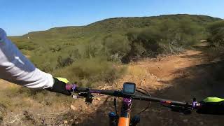
        open trail in app

        Download Trail

        Save to wishlist, Garmin & download.
        save the trail

        Find Related Routes

        Find routes and users activities that include this trail.
        find routes for this trail

        You must enter a description before submitting.