more stats
1.1 miles
Distance
343 ft
Climb
-345 ft
Descent
00:16:05
Avg time
-2 ft
Altitude change
3,058 ft
Altitude min
3,404 ft
Altitude max
3,060 ft
Altitude start
3,058 ft
Altitude end
-46%
Grade max
25.6%
Grade min
3,661 ft
Distance climb
2,051 ft
Distance down
272 ft
Distance flat
00:16:05
Avg time

Lone Pine Details

  • Activities
    • Mountain Bike
    • E-Bike
    • Hike
    • Trail Running
  • Riding Area
    Iron Mountain
    Merritt, British Columbia
  • Difficulty Rating
  • Local Popularity
    100 in Mountain Biking [+]
    • 95 in E-Biking
    • 70 in Trail Running
    • 85 in Hiking
  • Global Ranking
    #47027 in Mountain Biking [+]
    • #8621 in E-Biking
    • #44713 in Trail Running
    • #77546 in Hiking
  • Trail Type
    Singletrack
  • Bike Type
    AM, XC
  • Direction
    Uphill Primary
  • Climb Difficulty
    Blue
  • Physical Rating
    Moderate
  • Dogs Allowed
    Yes
  • eBike Allowed

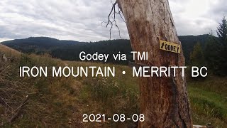
This trail is (essentially) the continuation of the Too Much Info (TMI) trail farther up the hill. It has the same style and character as TMI but is slightly more technically difficult in a short section. There are two notable features on this trail: 1) The Big Easy, a large loop boardwalk over a fallen old growth tree and 2) the large solitary pine at the top of the trail. Similar to TMI, the trail is a fine climb and used to get to access downhill routes.

Local Trail Association

Recent Activity on Trail

Past Week
  • 1 rides
  • 9 miles average
6 Months
  • 23 rides
  • 9 miles avg distance
All
  • 264 rides
  • Last: Jun 18, 2026
c1c2c3c4
January
February
March
April
May
June
July
August
September
October
November
December
Status:
on May 15, 2026
Dry
Avg: 4.24 (6 votes)
Your vote: 0

view (1,245)
close
3D
Trail Conditions
  • Unknown
  • Snow Groomed
  • Snow Packed
  • Snow Covered
  • Snow Cover Partial
  • Freeze/thaw Cycle
  • Icy
  • Prevalent Mud
  • Wet
  • Variable
  • Ideal
  • Dry
  • Very Dry
Trail Flow (Ridden Direction)
Trailforks scans users ridelogs to determine the most popular direction each trail is ridden. A good flowing trail network will have most trails flowing in a single direction according to their intension.
The colour categories are based on what percentage of riders are riding a trail in its intended direction.
  • > 96%
  • > 90%
  • > 80%
  • > 70%
  • > 50%
  • < 50%
  • bi-directional trail
  • no data
Trail Last Ridden
Trailforks scans ridelogs to determine the last time a trail was ridden.
  • < 2 days
  • < 1 week
  • < 2 weeks
  • < 1 month
  • < 6 months
  • > 6 months
Trail Ridden Direction
The intended direction a trail should be ridden.
  • Downhill Only
  • Downhill Primary
  • Both Directions
  • Uphill Primary
  • Uphill Only
  • One Direction
Contribute Details
Colors indicate trail is missing specified detail.
  • Description
  • Photos
  • Description & Photos
  • Videos
Trail Popularity ?
Trailforks scans ridelogs to determine which trails are ridden the most in the last 9 months. Trails are compared with nearby trails in the same city region with a possible 25 colour shades. Think of this as a heatmap, more rides = more kinetic energy = warmer colors.
  • most popular
  • popular
  • less popular
  • not popular
ATV/ORV/OHV Filter
Max Vehicle Width
inches
US Cell Coverage
Legend
cell carrier legend

Radar Time
Activity Recordings
Trailforks uses anonymized public activity data. ?
Activity Recordings
Trailforks uses anonymized public activity data. ?
Personal Heatmap
Activity Types
all / none
Options
2
Date range month
Winter Trails
Warning A routing network for winter maps does not exist. Selecting trails using the winter trails layer has been disabled.
Missing Trails
Most Popular
Least Popular
Trails are colored based on popularity. The more popular a trail is, the more red. Less popular trails trend towards green.
Jump Magnitude Heatmap
Heatmap of where riders jump on trails. Zoom in to see individual jumps, click circles to view jump details.
BC Backroad Status

Service Road Atlas is a free to use, community-driven service for viewing and creating reports on the numerous back-country service roads around B.C. and Alberta.

map legend
Slope Aspect
Direction the slope faces
Flat N NE E SE S SW W NW
Trails Deemphasized
Trails are shown in grey.
disable
Only show trails with no bike usage.
Enable
Suggested Layers
Based on selected activity type

    Save the current map location and zoom level as your default home location whenever this page is loaded.

    Save
        Directions to lone-pine trailhead (50.079190, -120.738040)

        Photos

        16 more »
        59 |
        Oct 15, 2024 @ 9:51am
        Oct 15, 2024
        56 |
        May 16, 2023 @ 2:09pm
        May 16, 2023
        79 |
        Aug 10, 2021 @ 9:01am
        Aug 10, 2021
        52 |
        Jun 13, 2021 @ 7:51am
        Jun 13, 2021

        Videos

        1 more »
        Iron Mountain ❱ Godey via Too Much Info ❱...
        8:37 | 215 | Aug 9, 2021 , Merritt

        Routes with this trail

        13 miles 2,592 ft 8
        Some of Merritt's finest single-track, including Creek, rmation, and .
        26 miles 4,611 ft 54 Loop

        1 Review & Comments


        We hope you've been enjoying Trailforks!

        Create a FREE account to view trail comments and much more.

        • By canadakaTF Pro Trailforks & contributors
        • #1850 - 3,177 views

        Frequently Asked Questions About Lone Pine

        Where is Lone Pine located?
        Lone Pine is located in Iron Mountain, Merritt, British Columbia, Canada. It is part of the Iron Mountain trail network. The trailhead is located at coordinates 50.07919, -120.73804.
        How hard is Lone Pine?
        Lone Pine is rated as Blue difficulty. The physical rating is Moderate. The climb difficulty is rated Blue.
        What is the elevation gain for Lone Pine?
        Lone Pine has 343 ft of elevation gain. The trail has 345 ft of elevation descent. The elevation ranges from 3,058 ft to 3,404 ft.
        Is Lone Pine a point to point trail?
        Lone Pine is not a point to point trail. The direction is Uphill Primary. The trail type is singletrack.

        Hit the Trail

        Open in App

        Get this trail on your phone instantly.
        open trail in app

        Download Trail

        Save to wishlist, Garmin & download.
        save the trail

        Find Related Routes

        Find routes and users activities that include this trail.
        find routes for this trail

        You must enter a description before submitting.