

Open in App
Get this trail on your phone instantly.

Lost Lake starts at its namesake trailhead. After a very quick downhill out of the gate, the route climbs up through big forest. The trail is somewhat wide for singletrack and a bit technical with roots and rocks.
Stay straight when the trail intersects with a doubletrack and then bear left at an intersection with the winter/horse route.
From here the trail narrows and skirts a rocky hillside. The valley to your left drops away as you climb up and through a shallow waterfall. Continue pedaling up through the dark forest around small bands of shale-laden cliffs.
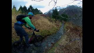
As the valley begins to close, the route transitions to a section of open forest. You'll be traveling right along side and only a few inches above a tiny creek. After a few bends in the trail you'll get through this section and then start hear the waterfalls in another giant valley that you'll ride above.
The route transitions again. You're still in the forest but will have an awareness that you're very high up above another giant valley. As you continue climbing, the big trees give way to big shrubs and big mountains. It's hard to keep your eyes on the trail at this point.
The ascent continues to be steady and a little rocky. Lost Lake is a very popular route so the trail is also a little trenched in places.
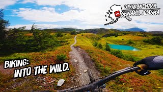
Pedal up a few punchy sections on the way to the upper intersection with the winter route. Stay left to continue towards the lake. The grade begins to less on roll across alpine meadows and dry marshes. The route winds its way across narrow trail through small stands of twisted pine and spruce.
There's one more section of steep climbing before rolling downhill to the lake. It's well worth the effort with the best views available. On three sides you're surrounded by mountains and one side with Resurrection Bay.
After a break at Lost Lake, retrace your steps and enjoy the spectacular experience in reverse back to the trailhead.
Bear and moose are present in the area. The best way to avoid an interaction is to not surprising an animal. Use bells, sing and/or travel in a group.
This ride can be done from either of 2 trailheads: on Lost Lake Trail Road about 5 miles from Seward. As you are driving into Seward, take a right hand turn on Scott Way (this turns into Rough Dr.) at the T intersection take a left hand turn onto Heather Lee Ln, from there take a right hand turn onto Hayden Ln (this turns into Lost Lake Trail Rd) the parking lot is at the end of the road. The second start is at the Primrose Campground, about 17 miles from Seward. As you are driving toward Seward (111 miles from Anchorage) take a right hand turn onto Primrose Spur Rd and the parking lot is at the end.
| c1 | c2 | c3 | c4 |
|---|---|---|---|
January | February | March | April |
May | June | July | August |
September | October | November | December |


Service Road Atlas is a free to use, community-driven service for viewing and creating reports on the numerous back-country service roads around B.C. and Alberta.
Save the current map location and zoom level as your default home location whenever this page is loaded.
SaveWe hope you've been enjoying Trailforks!
Create a FREE account to view trail comments and much more.
 TRAILFORKS STA & contributors
You must enter a description before submitting.

