


Open in App
Get this trail on your phone instantly.

Overview
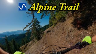
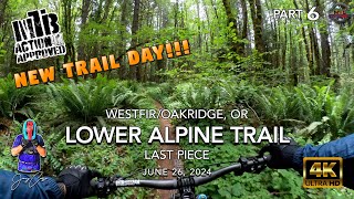
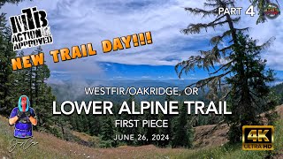
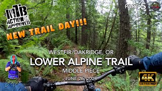
The original backcountry ride that put Oakridge on the map, this has the same start as the ATCA but you stick just to the Alpine Trail all the way down. A great combination of deep forests, narrow singletrack, and scary-fast segments that will have your palms hurting from handing out so many high fives to your riding buddies.
Route Details
After the shuttle vehicle drops you on National Forest Road NF-1912, take the short connector from the road, and then a right onto the legendary Alpine Trail. The trail starts with a climb, which feels steeper than it is because you’re not yet warmed up. Soon enough it levels off and begins to playfully roll through the landscape, past towering conifers and through beargrass meadows. A ripping, prolonged descent ends where the trail again crosses National Forest Road NF-1912 twice in a short distance.
You’ll continue descending singletrack past the turnoff to the Tire Mountain Trail (a ride for another day). Even though there are a couple small uphills it would be exaggerating to call them “climbs”, and the trail seems like it rolls downhill endlessly, through rocky, exposed hillsides with scrubby oaks to more pine-needle loam than you thought could possibly exist in nine miles of trail.
As you continue to drop you’ll catch glimpses of the valley floor but the fun isn’t over yet. The final segment doesn’t disappoint, offering up everything from twists and turns to no-brakes-if-you-dare straightaways. One last hard left near the bottom and you’re almost there, glad to give your forearms a rest but at the same time disappointed to know that endless descents aren’t really endless. Console yourself by riding through the historic covered bridge and visiting the Westfir Lodge and Mountain Market for refreshments and beta on the nearest swimming hole.
Riding Season
Late spring through late fall.
| c1 | c2 | c3 | c4 |
|---|---|---|---|
January | February | March | April |
May | June | July | August |
September | October | November | December |

Service Road Atlas is a free to use, community-driven service for viewing and creating reports on the numerous back-country service roads around B.C. and Alberta.
Save the current map location and zoom level as your default home location whenever this page is loaded.
SaveWe hope you've been enjoying Trailforks!
Create a FREE account to view trail comments and much more.
You must enter a description before submitting.

