more stats
8.2 miles
Distance
34 ft
Climb
-4,473 ft
Descent
01:14:20
Avg time
-4,438 ft
Altitude change
3,577 ft
Altitude min
8,016 ft
Altitude max
8,016 ft
Altitude start
3,576 ft
Altitude end
-10.2%
Grade
-64.8%
Grade max
14.7%
Grade min
581 ft
Distance climb
8 miles
Distance down
659 ft
Distance flat
01:14:20
Avg time

Lower Sisson Callahan Details

  • Activities
    • Mountain Bike
    • Hike
    • Trail Running
  • Riding Area
    The Eddys
    Mount Shasta, California
  • Difficulty Rating
  • Local Popularity
    60 in Mountain Biking [+]
    • 75 in Trail Running
    • 5 in Hiking
  • Global Ranking
    #83566 in Mountain Biking [+]
    • #36401 in Trail Running
    • #121411 in Hiking
  • Hiking SAC Scale
    T2 Mountain Hiking
  • Trail Type
    Singletrack
  • Bike Type
    DH, AM
  • Direction
    Downhill Primary
    Popular Direction Shown
  • Climb Difficulty
    Double Black Diamond
  • Physical Rating
    Hard
  • Trail Visibility
    Always easy to follow
  • Season
    Jun-Sep
  • Alpine Trail
    Yes
  • Dogs Allowed
    Yes
  • eBike Allowed
  • TTFs on Trail
    Berm, Rock Garden
  • Land Owner
    Shasta-Trinity National Forest

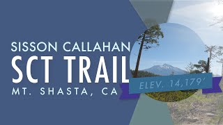
8 miles of rocky descent. This trail can be ridden from the top if you start at the Upper Sisson Callahan, however many riders shuttle to the halfway point using 41N53 road. This trail has some flowy sections, but the majority is one big rock garden. Your hands will be hurting.

Top Half: The top starts out flowy with several unexpected switchbacks before it mellows out and follows the river. There are a few straight smooth sections in the middle and then the trail gets rockier as you get closer to the second half.

Lower Half: Many people shuttle this and some ride the road to the second half. This half starts out flowy with some rock gardens. About halfway down it gets really close to the river with some exposure. The rest of the trail is rocky all the way to the bottom.
-----
The trail ends in the middle of nowhere. If you want to ride to the North Shore side of the Lake, stop near the bottom at the little turn marked with rocks. Then, climb through the river to the road on the other side. Follow this road and you will at the North Shore. If you want to ride to the WA Barr Road, keep on, passed the rock turn, and cross the river on your left. This is kind of a free for all and there isn't a spot that's better for crossing. So pick a spot before the trail ends and cross the river. Once you have crossed, ride through the trees until you reach a road(s) and follow that road to WA Barr Road.

Access Info

If you want to ride the whole thing, you can ride the Upper Sisson Callahan. Shasta Gravity offers shuttles to the Upper Sisson Callahan. Once you have made it to the top of Upper Sisson Callahan, you take the trail down the other side of the hill. It should be obvious and there should be a sign that says Lake Siskiyou. (You could also shuttle to the lower half and hike up to the top of the upper half).

If you want to ride the lower half, drive/ride West A Barr Road past Lake Siskiyou until you reach a small, narrow bridge over the creek. Then, take a right, right after the bridge and stay right at the fork onto 41N53 road. Follow the main road until you reach the second ford across the creek. The trailhead (going down) is on the right a few hundred feet before the creek crossing. The bottom of the upper half is on the left, right before the creek crossing. Note: 41N53 is a bumpy and rocky road.

Disclaimer

Don't Skid!

Trail Supporters
Local Trail Association
Traditionally Indigenous Territory

Recent Activity on Trail

Past Week
  • 3 rides
  • 28 miles average
6 Months
  • 5 rides
  • 23 miles avg distance
All
  • 71 rides
  • Last: Jun 20, 2026
c1c2c3c4
January
February
March
April
May
June
July
August
September
October
November
December
update trails status or condition

Lower Sisson... Trail Reports

statusdatedescription
May 24, 2026 @ 7:19pm (America/Los_Angeles)
May 24, 2026
Don't know what that previous comment was talking about with the trail sabotage. Was running fine and clear today 5/24/26.
May 22, 2026 @ 5:52am (America/Los_Angeles)
May 22, 2026
Severe trail sabotage from below the switchbacks down to the road crossing. Shasta Gravity Adventures will be up soon to clear the logs, trees,...
Sep 7, 2025 @ 12:56pm
Sep 7, 2025
Only ride this if you love rocks and are comfortable carrying speed through long rock gardens. We loved it, but many will hate it. Definitely a...
Oct 30, 2024 @ 7:10am
Oct 30, 2024
A few downed trees but still ripping.
Sep 2, 2024 @ 9:32am
Sep 2, 2024
A couple trees to climb over on the lower half along the river
more »
Status:
on May 24, 2026
Dry
Avg: 3.99 (4 votes)
Your vote: 0

view (361)
close
3D
Trail Conditions
  • Unknown
  • Snow Groomed
  • Snow Packed
  • Snow Covered
  • Snow Cover Partial
  • Freeze/thaw Cycle
  • Icy
  • Prevalent Mud
  • Wet
  • Variable
  • Ideal
  • Dry
  • Very Dry
Trail Flow (Ridden Direction)
Trailforks scans users ridelogs to determine the most popular direction each trail is ridden. A good flowing trail network will have most trails flowing in a single direction according to their intension.
The colour categories are based on what percentage of riders are riding a trail in its intended direction.
  • > 96%
  • > 90%
  • > 80%
  • > 70%
  • > 50%
  • < 50%
  • bi-directional trail
  • no data
Trail Last Ridden
Trailforks scans ridelogs to determine the last time a trail was ridden.
  • < 2 days
  • < 1 week
  • < 2 weeks
  • < 1 month
  • < 6 months
  • > 6 months
Trail Ridden Direction
The intended direction a trail should be ridden.
  • Downhill Only
  • Downhill Primary
  • Both Directions
  • Uphill Primary
  • Uphill Only
  • One Direction
Contribute Details
Colors indicate trail is missing specified detail.
  • Description
  • Photos
  • Description & Photos
  • Videos
Trail Popularity ?
Trailforks scans ridelogs to determine which trails are ridden the most in the last 9 months. Trails are compared with nearby trails in the same city region with a possible 25 colour shades. Think of this as a heatmap, more rides = more kinetic energy = warmer colors.
  • most popular
  • popular
  • less popular
  • not popular
ATV/ORV/OHV Filter
Max Vehicle Width
inches
US Cell Coverage
Legend
cell carrier legend

Radar Time
Activity Recordings
Trailforks uses anonymized public activity data. ?
Activity Recordings
Trailforks uses anonymized public activity data. ?
Personal Heatmap
Activity Types
all / none
Options
2
Date range month
Winter Trails
Warning A routing network for winter maps does not exist. Selecting trails using the winter trails layer has been disabled.
Missing Trails
Most Popular
Least Popular
Trails are colored based on popularity. The more popular a trail is, the more red. Less popular trails trend towards green.
Jump Magnitude Heatmap
Heatmap of where riders jump on trails. Zoom in to see individual jumps, click circles to view jump details.
BC Backroad Status

Service Road Atlas is a free to use, community-driven service for viewing and creating reports on the numerous back-country service roads around B.C. and Alberta.

map legend
Slope Aspect
Direction the slope faces
Flat N NE E SE S SW W NW
Trails Deemphasized
Trails are shown in grey.
disable
Only show trails with no bike usage.
Enable
Suggested Layers
Based on selected activity type

    Save the current map location and zoom level as your default home location whenever this page is loaded.

    Save
        Directions to lower-sisson-callahan trailhead (41.315500, -122.489410)

        Photos

        13 more »
        22 |
        May 14, 2026 @ 3:36pm
        May 14, 2026
        19 |
        May 14, 2026 @ 3:28pm
        May 14, 2026
        26 |
        May 14, 2026 @ 2:59pm
        May 14, 2026
        115 |
        Jun 5, 2024 @ 6:40am
        Jun 5, 2024

        Videos

        1 more »
        Riding the Lower Sisson Callahan Trail (SCT)
        14:29 | 695 | Jun 24, 2021 , Mount Shasta

        Routes with this trail

        11 miles 1,608 ft 2 Point to Point
        9 miles 2,661 ft 1 Out & Back

        9 Reviews & Comments


        We hope you've been enjoying Trailforks!

        Create a FREE account to view trail comments and much more.

        • By nubbsTF Pro & contributors
        • #64163 - 9,637 views

        Frequently Asked Questions About Lower Sisson Callahan

        Where is Lower Sisson Callahan located?
        Lower Sisson Callahan is located in The Eddys, Mount Shasta, California, United States. It is part of the The Eddys trail network. The trailhead is located at coordinates 41.3155, -122.48941.
        How hard is Lower Sisson Callahan?
        Lower Sisson Callahan is rated as Black Diamond difficulty. The physical rating is Hard. The average grade is 10.2%. The climb difficulty is rated Double Black Diamond.
        What is the elevation gain for Lower Sisson Callahan?
        Lower Sisson Callahan has 34 ft of elevation gain. The trail has 4,473 ft of elevation descent. The elevation ranges from 3,577 ft to 8,016 ft.
        Is Lower Sisson Callahan a point to point trail?
        Lower Sisson Callahan is not a point to point trail. The direction is Downhill Primary. The trail type is singletrack.

        Hit the Trail

        Open in App

        Get this trail on your phone instantly.
        open trail in app

        Download Trail

        Save to wishlist, Garmin & download.
        save the trail

        Find Related Routes

        Find routes and users activities that include this trail.
        find routes for this trail

        You must enter a description before submitting.