more stats
1.9 miles
Distance
195 ft
Climb
-278 ft
Descent
00:14:45
Avg time
-83 ft
Altitude change
718 ft
Altitude min
816 ft
Altitude max
816 ft
Altitude start
733 ft
Altitude end
-0.848%
Grade
-17.539%
Grade max
18.562%
Grade min
3,592 ft
Distance climb
4,830 ft
Distance down
1,384 ft
Distance flat
00:14:45
Avg time

Lynx Details

  • Activities
    • Mountain Bike
    • E-Bike
    • Hike
    • Trail Running
  • Riding Area
    Sentiers Mont-Tremblant (réseau municipal)
    Ville de Mont-Tremblant, Quebec
  • Difficulty Rating
  • Voted Difficulty
    Blue (1 vote)
  • Local Popularity
    75 in Mountain Biking [+]
    • 85 in E-Biking
    • 90 in Trail Running
    • 5 in Hiking
  • Global Ranking
    #52406 in Mountain Biking [+]
    • #9062 in E-Biking
    • #28057 in Trail Running
    • #99326 in Hiking
  • Trail Type
    Singletrack
  • Bike Type
    XC
  • Direction
    Both Directions
  • eBike Allowed
  • TTFs on Trail
    Bridge, Jump, Rock Garden
  • Land Owner
    Ville de Mont-Tremblant

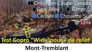
Following the Diable river and the multifunctionnal trail, the trail has a few short but technical climbs to test your skills. Many good spots to take a break with tables and places to lie by the river. Be careful when you cross the multifunctional trail.

Longeant la rivière La Diable et la piste multifonctionnelle, le sentier comporte de courtes montées techniques qui vous donneront de beaux défis. Ce sentier est un bon endroit pour faire une pause avec quelques tables à pique-nique et des ouvertures sur la rivière pour se rafraichir ou simplement se reposer. Soyez prudents lors des croisements avec la piste multifonctionnelle.

Local Trail Association

Recent Activity on Trail

Past Week
  • 4 rides
  • 14 miles average
6 Months
  • 10 rides
  • 14 miles avg distance
All
  • 516 rides
  • Last: Jun 16, 2026
c1c2c3c4
January
February
March
April
May
June
July
August
September
October
November
December
update trails status or condition

Lynx Trail Reports

Status:
on Sep 26, 2025
Ideal
Avg: 3.52 (11 votes)
Your vote: 0

view (2,000)
close
3D
Trail Conditions
  • Unknown
  • Snow Groomed
  • Snow Packed
  • Snow Covered
  • Snow Cover Partial
  • Freeze/thaw Cycle
  • Icy
  • Prevalent Mud
  • Wet
  • Variable
  • Ideal
  • Dry
  • Very Dry
Trail Flow (Ridden Direction)
Trailforks scans users ridelogs to determine the most popular direction each trail is ridden. A good flowing trail network will have most trails flowing in a single direction according to their intension.
The colour categories are based on what percentage of riders are riding a trail in its intended direction.
  • > 96%
  • > 90%
  • > 80%
  • > 70%
  • > 50%
  • < 50%
  • bi-directional trail
  • no data
Trail Last Ridden
Trailforks scans ridelogs to determine the last time a trail was ridden.
  • < 2 days
  • < 1 week
  • < 2 weeks
  • < 1 month
  • < 6 months
  • > 6 months
Trail Ridden Direction
The intended direction a trail should be ridden.
  • Downhill Only
  • Downhill Primary
  • Both Directions
  • Uphill Primary
  • Uphill Only
  • One Direction
Contribute Details
Colors indicate trail is missing specified detail.
  • Description
  • Photos
  • Description & Photos
  • Videos
Trail Popularity ?
Trailforks scans ridelogs to determine which trails are ridden the most in the last 9 months. Trails are compared with nearby trails in the same city region with a possible 25 colour shades. Think of this as a heatmap, more rides = more kinetic energy = warmer colors.
  • most popular
  • popular
  • less popular
  • not popular
ATV/ORV/OHV Filter
Max Vehicle Width
inches
US Cell Coverage
Legend
cell carrier legend

Radar Time
Activity Recordings
Trailforks uses anonymized public activity data. ?
Activity Recordings
Trailforks uses anonymized public activity data. ?
Personal Heatmap
Activity Types
all / none
Options
2
Date range month
Winter Trails
Warning A routing network for winter maps does not exist. Selecting trails using the winter trails layer has been disabled.
Missing Trails
Most Popular
Least Popular
Trails are colored based on popularity. The more popular a trail is, the more red. Less popular trails trend towards green.
Jump Magnitude Heatmap
Heatmap of where riders jump on trails. Zoom in to see individual jumps, click circles to view jump details.
BC Backroad Status

Service Road Atlas is a free to use, community-driven service for viewing and creating reports on the numerous back-country service roads around B.C. and Alberta.

map legend
Slope Aspect
Direction the slope faces
Flat N NE E SE S SW W NW
Trails Deemphasized
Trails are shown in grey.
disable
Only show trails with no bike usage.
Enable
Suggested Layers
Based on selected activity type

    Save the current map location and zoom level as your default home location whenever this page is loaded.

    Save
        Directions to lynx-8366 trailhead (46.195390, -74.569700)

        Photos

        36 more »
        181 |
        May 28, 2019 @ 4:55pm
        May 28, 2019
        251 |
        Nov 18, 2012 @ 1:00pm
        Nov 18, 2012
        26 |
        Jul 27, 2025 @ 10:03am
        Jul 27, 2025
        100 |
        Aug 28, 2020 @ 4:33am
        Aug 28, 2020

        Videos

        3 more »
        MTB - Mont-Tremblant - Fuel EXe 9.8XT -...
        34:37 | 140 | Nov 8, 2022 , Ville de Mont-Tremblant
        MONT TREMBLANT//QUEBEC//PART 3
        25:46 | 160 | Sep 19, 2021 , Ville de Mont-Tremblant
        Mont Tremblant - Lynx - July 2020 (4K60)
        7:05 | 504 | Jul 27, 2020 , Ville de Mont-Tremblant

        Trail Lists

        Routes with this trail

        8 miles 1,106 ft 5
        Chill route around Tremblant village.

        1 Review & Comments


        We hope you've been enjoying Trailforks!

        Create a FREE account to view trail comments and much more.

        Frequently Asked Questions About Lynx

        Where is Lynx located?
        Lynx is located in Sentiers Mont-Tremblant (réseau municipal), Ville de Mont-Tremblant, Quebec, Canada. It is part of the Sentiers Mont-Tremblant (réseau municipal) trail network. The trailhead is located at coordinates 46.19539, -74.5697.
        How hard is Lynx?
        Lynx is rated as Blue difficulty. The average grade is 0.848%.
        What is the elevation gain for Lynx?
        Lynx has 195 ft of elevation gain. The trail has 278 ft of elevation descent. The elevation ranges from 718 ft to 816 ft.
        Is Lynx a point to point trail?
        Lynx is not a point to point trail. The direction is Both Directions. The trail type is singletrack.

        Hit the Trail

        Open in App

        Get this trail on your phone instantly.
        open trail in app

        Download Trail

        Save to wishlist, Garmin & download.
        save the trail

        Find Related Routes

        Find routes and users activities that include this trail.
        find routes for this trail

        You must enter a description before submitting.