more stats
3,629 ft
Distance
3 ft
Climb
-409 ft
Descent
00:06:47
Avg time
-406 ft
Altitude change
490 ft
Altitude min
897 ft
Altitude max
897 ft
Altitude start
489 ft
Altitude end
-11.2%
Grade
-52.6%
Grade max
2.5%
Grade min
157 ft
Distance climb
3,396 ft
Distance down
75 ft
Distance flat
00:06:47
Avg time

Macho Mango Details

  • Activities
    • Mountain Bike
    • Hike
    • Trail Running
  • Riding Area
    Hope
    , British Columbia
  • Difficulty Rating
  • Local Popularity
    95 in Mountain Biking [+]
    • 5 in Trail Running
    • 50 in Hiking
  • Global Ranking
    #54940 in Mountain Biking [+]
    • #283960 in Trail Running
    • #111110 in Hiking
  • Trail Type
    Singletrack
  • Bike Type
    DH, AM
  • Direction
    Downhill Primary
    Popular Direction Shown
  • Physical Rating
    Moderate
  • Trail Visibility
    Always easy to follow
  • TTFs on Trail
    Berm, Bridge, Drop, Jump, Gap Jump, Rock Garden, Roller Coaster
  • Year Opened
    2019

Comes off of Gorilla and starts a new section that was built by the locals. Macho Mango is a bit of a little peddle to start and then it opens up into fun downhill part that lands you back on the double track to connect onto the lower half of the older trail Gorilla.

Access Info

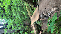
Starts part way down Gorilla

Local Trail Association

Recent Activity on Trail

Past Week
  • 1 rides
  • 8 miles average
6 Months
  • 9 rides
  • 6 miles avg distance
All
  • 29 rides
  • Last: Jun 20, 2026
c1c2c3c4
January
February
March
April
May
June
July
August
September
October
November
December
update trails status or condition

Macho Mango Trail Reports

statusdatedescription
Jun 20, 2026 @ 3:49pm (America/Vancouver)
Jun 20, 2026
There’s a downed log and it can’t be removed and you can’t go around it.
Jun 17, 2026 @ 9:05pm (America/Vancouver)
Jun 17, 2026
Running good
Aug 12, 2025 @ 11:57am
Aug 12, 2025
In very good state. Fun and flowy
Mar 16, 2024 @ 1:49pm
Mar 16, 2024
Great shape, nothing down, running great.
Sep 30, 2023 @ 6:55pm
Sep 30, 2023
an amazing trail. worth the climbby a long shot.
more »
Status:
on Jun 20, 2026
Ideal
Avg: 4.24 (2 votes)
Your vote: 0

view (84)
close
3D
Trail Conditions
  • Unknown
  • Snow Groomed
  • Snow Packed
  • Snow Covered
  • Snow Cover Partial
  • Freeze/thaw Cycle
  • Icy
  • Prevalent Mud
  • Wet
  • Variable
  • Ideal
  • Dry
  • Very Dry
Trail Flow (Ridden Direction)
Trailforks scans users ridelogs to determine the most popular direction each trail is ridden. A good flowing trail network will have most trails flowing in a single direction according to their intension.
The colour categories are based on what percentage of riders are riding a trail in its intended direction.
  • > 96%
  • > 90%
  • > 80%
  • > 70%
  • > 50%
  • < 50%
  • bi-directional trail
  • no data
Trail Last Ridden
Trailforks scans ridelogs to determine the last time a trail was ridden.
  • < 2 days
  • < 1 week
  • < 2 weeks
  • < 1 month
  • < 6 months
  • > 6 months
Trail Ridden Direction
The intended direction a trail should be ridden.
  • Downhill Only
  • Downhill Primary
  • Both Directions
  • Uphill Primary
  • Uphill Only
  • One Direction
Contribute Details
Colors indicate trail is missing specified detail.
  • Description
  • Photos
  • Description & Photos
  • Videos
Trail Popularity ?
Trailforks scans ridelogs to determine which trails are ridden the most in the last 9 months. Trails are compared with nearby trails in the same city region with a possible 25 colour shades. Think of this as a heatmap, more rides = more kinetic energy = warmer colors.
  • most popular
  • popular
  • less popular
  • not popular
ATV/ORV/OHV Filter
Max Vehicle Width
inches
US Cell Coverage
Legend
cell carrier legend

Radar Time
Activity Recordings
Trailforks uses anonymized public activity data. ?
Activity Recordings
Trailforks uses anonymized public activity data. ?
Personal Heatmap
Activity Types
all / none
Options
2
Date range month
Winter Trails
Warning A routing network for winter maps does not exist. Selecting trails using the winter trails layer has been disabled.
Missing Trails
Most Popular
Least Popular
Trails are colored based on popularity. The more popular a trail is, the more red. Less popular trails trend towards green.
Jump Magnitude Heatmap
Heatmap of where riders jump on trails. Zoom in to see individual jumps, click circles to view jump details.
BC Backroad Status

Service Road Atlas is a free to use, community-driven service for viewing and creating reports on the numerous back-country service roads around B.C. and Alberta.

map legend
Slope Aspect
Direction the slope faces
Flat N NE E SE S SW W NW
Trails Deemphasized
Trails are shown in grey.
disable
Only show trails with no bike usage.
Enable
Suggested Layers
Based on selected activity type

    Save the current map location and zoom level as your default home location whenever this page is loaded.

    Save
        Directions to macho-mango-188263 trailhead (49.386980, -121.368240)

        Photos

        6 more »
        63 |
        Oct 1, 2023 @ 12:34pm
        Oct 1, 2023
        64 |
        Oct 1, 2023 @ 12:34pm
        Oct 1, 2023
        56 |
        Sep 30, 2023 @ 7:02pm
        Sep 30, 2023
        123 |
        Jul 8, 2019 @ 8:31am
        Jul 8, 2019

        Videos

        2 more »
        Macho Mango Bridge
        0:07 | | Jun 4, 2019 , Hope
        Macho Mango Berm
        0:15 | | Jun 4, 2019 , Hope

        Trail Products

        3 Reviews & Comments


        We hope you've been enjoying Trailforks!

        Create a FREE account to view trail comments and much more.

        • By vedan304 & contributors
        • #188263 - 1,471 views

        Frequently Asked Questions About Macho Mango

        Where is Macho Mango located?
        Macho Mango is located in Hope, British Columbia, Canada. It is part of the Hope trail network. The trailhead is located at coordinates 49.38698, -121.36824.
        How hard is Macho Mango?
        Macho Mango is rated as Black Diamond difficulty. The physical rating is Moderate. The average grade is 11.2%.
        What is the elevation gain for Macho Mango?
        Macho Mango has 3 ft of elevation gain. The trail has 409 ft of elevation descent. The elevation ranges from 490 ft to 897 ft.
        Is Macho Mango a point to point trail?
        Macho Mango is not a point to point trail. The direction is Downhill Primary. The trail type is singletrack.

        Hit the Trail

        Open in App

        Get this trail on your phone instantly.
        open trail in app

        Download Trail

        Save to wishlist, Garmin & download.
        save the trail

        Find Related Routes

        Find routes and users activities that include this trail.
        find routes for this trail

        You must enter a description before submitting.