more stats
1.7 miles
Distance
138 ft
Climb
-1,128 ft
Descent
00:12:05
Avg time
-988 ft
Altitude change
2,670 ft
Altitude min
3,664 ft
Altitude max
3,664 ft
Altitude start
2,677 ft
Altitude end
-10.8%
Grade
-82.4%
Grade max
14.7%
Grade min
2,152 ft
Distance climb
1 mile
Distance down
705 ft
Distance flat
00:12:05
Avg time

Mago Details

  • Activities
    • Mountain Bike
    • E-Bike
  • Riding Area
  • Difficulty Rating
  • Voted Difficulty
    Blue (2 votes)
  • Local Popularity
    100 in Mountain Biking [+]
    • 100 in E-Biking
  • Global Ranking
    #1605 in Mountain Biking [+]
    • #3160 in E-Biking
  • Trail Type
    Singletrack
  • Bike Type
    DH, AM
  • Direction
    Downhill Only
    Popular Direction Shown
  • Dogs Allowed
    Yes
  • eBike Allowed

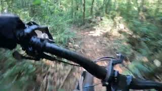
Saindo da taturana a trilha começa em uma área mais larga e alterna entre single e double track, com algumas subidas/retomadas após esses trechos, depois mergulha serra abaixo paralela a taturana e depois ao Ugly, trilha muito bem feita com grandes inclinações em alguns momentos.

Access Info

Siga a Taturana e preste atenção na primeira entrada maior a direita após o segundo trecho plano da trilha, a taturana está em constante mudança, portanto sugiro usar o GPX.

Recent Activity on Trail

Past Week
  • 0 rides
  •  
6 Months
  • 13 rides
  • 10 miles avg distance
All
  • 52 rides
  • Last: Jun 21, 2026
c1c2c3c4
January
February
March
April
May
June
July
August
September
October
November
December
update trails status or condition

Mago Trail Reports

statusdatedescription
Jun 12, 2026 @ 10:40am (America/Sao_Paulo)
Jun 12, 2026
Trilha passando por manutenção. Salto adicionado ao final depois do ultimo toboga Vegetação removida Trechos de trilha ajustados
May 23, 2025 @ 7:52am
May 23, 2025
Sep 28, 2024 @ 7:51am
Sep 28, 2024
Aug 4, 2024 @ 12:51am
Aug 4, 2024
Apr 6, 2024 @ 1:11am
Apr 6, 2024
more »
Status:
on Jun 12, 2026
Ideal
Avg: 4.24 (4 votes)
Your vote: 0

view (1,819)
close
3D
Trail Conditions
  • Unknown
  • Snow Groomed
  • Snow Packed
  • Snow Covered
  • Snow Cover Partial
  • Freeze/thaw Cycle
  • Icy
  • Prevalent Mud
  • Wet
  • Variable
  • Ideal
  • Dry
  • Very Dry
Trail Flow (Ridden Direction)
Trailforks scans users ridelogs to determine the most popular direction each trail is ridden. A good flowing trail network will have most trails flowing in a single direction according to their intension.
The colour categories are based on what percentage of riders are riding a trail in its intended direction.
  • > 96%
  • > 90%
  • > 80%
  • > 70%
  • > 50%
  • < 50%
  • bi-directional trail
  • no data
Trail Last Ridden
Trailforks scans ridelogs to determine the last time a trail was ridden.
  • < 2 days
  • < 1 week
  • < 2 weeks
  • < 1 month
  • < 6 months
  • > 6 months
Trail Ridden Direction
The intended direction a trail should be ridden.
  • Downhill Only
  • Downhill Primary
  • Both Directions
  • Uphill Primary
  • Uphill Only
  • One Direction
Contribute Details
Colors indicate trail is missing specified detail.
  • Description
  • Photos
  • Description & Photos
  • Videos
Trail Popularity ?
Trailforks scans ridelogs to determine which trails are ridden the most in the last 9 months. Trails are compared with nearby trails in the same city region with a possible 25 colour shades. Think of this as a heatmap, more rides = more kinetic energy = warmer colors.
  • most popular
  • popular
  • less popular
  • not popular
ATV/ORV/OHV Filter
Max Vehicle Width
inches
US Cell Coverage
Legend
cell carrier legend

Radar Time
Activity Recordings
Trailforks uses anonymized public activity data. ?
Activity Recordings
Trailforks uses anonymized public activity data. ?
Personal Heatmap
Activity Types
all / none
Options
2
Date range month
Winter Trails
Warning A routing network for winter maps does not exist. Selecting trails using the winter trails layer has been disabled.
Missing Trails
Most Popular
Least Popular
Trails are colored based on popularity. The more popular a trail is, the more red. Less popular trails trend towards green.
Jump Magnitude Heatmap
Heatmap of where riders jump on trails. Zoom in to see individual jumps, click circles to view jump details.
BC Backroad Status

Service Road Atlas is a free to use, community-driven service for viewing and creating reports on the numerous back-country service roads around B.C. and Alberta.

map legend
Slope Aspect
Direction the slope faces
Flat N NE E SE S SW W NW
Trails Deemphasized
Trails are shown in grey.
disable
Only show trails with no bike usage.
Enable
Suggested Layers
Based on selected activity type

    Save the current map location and zoom level as your default home location whenever this page is loaded.

    Save
        Directions to mago trailhead (-23.279330, -46.954550)

        Photos

        5 more »
        7 |
        Jun 12, 2026 @ 6:38am
        Jun 12, 2026
        5 |
        Jun 12, 2026 @ 6:38am
        Jun 12, 2026
        7 |
        Jun 12, 2026 @ 6:38am
        Jun 12, 2026
        6 |
        Jun 12, 2026 @ 6:38am
        Jun 12, 2026

        Videos

        1 more »
        Mago Março 22
        11:26 | 5 | Jun 12, 2026 , My City

        2 Reviews & Comments


        We hope you've been enjoying Trailforks!

        Create a FREE account to view trail comments and much more.

        Nearby Trails

        • By verdeciclistaTF Pro & contributors
        • #392338 - 1,024 views

        Frequently Asked Questions About Mago

        Where is Mago located?
        Mago is located in Serra do Japi, Brazil. It is part of the Serra do Japi trail network. The trailhead is located at coordinates -23.27933, -46.95455.
        How hard is Mago?
        Mago is rated as Black Diamond difficulty. The average grade is 10.8%.
        What is the elevation gain for Mago?
        Mago has 42 m of elevation gain. The trail has 344 m of elevation descent. The elevation ranges from 814 m to 1,117 m.
        Is Mago a point to point trail?
        Yes, Mago is a point to point trail. The direction is Downhill Only. The trail type is singletrack.

        Hit the Trail

        Open in App

        Get this trail on your phone instantly.
        open trail in app

        Download Trail

        Save to wishlist, Garmin & download.
        save the trail

        Find Related Routes

        Find routes and users activities that include this trail.
        find routes for this trail

        You must enter a description before submitting.