more stats
2,438 ft
Distance
-946 ft
Descent
00:09:07
Avg time
-946 ft
Altitude change
265 ft
Altitude min
1,211 ft
Altitude max
1,211 ft
Altitude start
266 ft
Altitude end
-38.8%
Grade
-93.9%
Grade max
-13.6%
Grade min
2,438 ft
Distance down
00:09:07
Avg time

Maitai Face (full) Details

  • Activities
    • Mountain Bike
    • E-Bike
    • Winter Fat Bike
  • Riding Area
  • Difficulty Rating
  • Voted Difficulty
    Double Black Diamond (1 vote)
  • Local Popularity
    45 in Mountain Biking
  • Global Ranking
    #101260 in Mountain Biking
  • Trail Type
    Singletrack
  • Bike Type
    DH, AM, XC, DJ, RD, Fat
  • Physical Rating
    Hard
  • Season
    All year (but hard in the wet)
  • Dogs Allowed
    Yes
  • eBike Allowed
    Yes up to Class 1
  • TTFs on Trail
    Jump

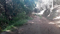
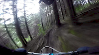
Maitai Face (full) is a steep, well made downhill track that is also trail bike friendly. It's super steep in places (over 50%). Built in pine forest it's off camber, rooty, has steep corners and is challenging. In the dry it has loads of grip - in the wet not so much. It finishes on the Maitai Valley Road opposite the golf club. The climb is not technical but hard work, worth it though. New trail grade in 2021

Access Info

This trail is maintained by the Nelson Mountain Bike Club. Please consider supporting the club.

Recent Activity on Trail

Past Week
  • 0 rides
  •  
6 Months
  • 6 rides
  • 26.2 km avg distance
All
  • 28 rides
  • Last: May 29, 2026
c1c2c3c4
January
February
March
April
May
June
July
August
September
October
November
December
update trails status or condition

Maitai Face (full) Trail Reports

Status:
on Jun 13, 2026
Avg: 4.29 (11 votes)
Your vote: 0

view (456)
close
3D
Trail Conditions
  • Unknown
  • Snow Groomed
  • Snow Packed
  • Snow Covered
  • Snow Cover Partial
  • Freeze/thaw Cycle
  • Icy
  • Prevalent Mud
  • Wet
  • Variable
  • Ideal
  • Dry
  • Very Dry
Trail Flow (Ridden Direction)
Trailforks scans users ridelogs to determine the most popular direction each trail is ridden. A good flowing trail network will have most trails flowing in a single direction according to their intension.
The colour categories are based on what percentage of riders are riding a trail in its intended direction.
  • > 96%
  • > 90%
  • > 80%
  • > 70%
  • > 50%
  • < 50%
  • bi-directional trail
  • no data
Trail Last Ridden
Trailforks scans ridelogs to determine the last time a trail was ridden.
  • < 2 days
  • < 1 week
  • < 2 weeks
  • < 1 month
  • < 6 months
  • > 6 months
Trail Ridden Direction
The intended direction a trail should be ridden.
  • Downhill Only
  • Downhill Primary
  • Both Directions
  • Uphill Primary
  • Uphill Only
  • One Direction
Contribute Details
Colors indicate trail is missing specified detail.
  • Description
  • Photos
  • Description & Photos
  • Videos
Trail Popularity ?
Trailforks scans ridelogs to determine which trails are ridden the most in the last 9 months. Trails are compared with nearby trails in the same city region with a possible 25 colour shades. Think of this as a heatmap, more rides = more kinetic energy = warmer colors.
  • most popular
  • popular
  • less popular
  • not popular
ATV/ORV/OHV Filter
Max Vehicle Width
inches
US Cell Coverage
Legend
cell carrier legend

Radar Time
Activity Recordings
Trailforks uses anonymized public activity data. ?
Activity Recordings
Trailforks uses anonymized public activity data. ?
Personal Heatmap
Activity Types
all / none
Options
2
Date range month
Winter Trails
Warning A routing network for winter maps does not exist. Selecting trails using the winter trails layer has been disabled.
Missing Trails
Most Popular
Least Popular
Trails are colored based on popularity. The more popular a trail is, the more red. Less popular trails trend towards green.
Jump Magnitude Heatmap
Heatmap of where riders jump on trails. Zoom in to see individual jumps, click circles to view jump details.
BC Backroad Status

Service Road Atlas is a free to use, community-driven service for viewing and creating reports on the numerous back-country service roads around B.C. and Alberta.

map legend
Slope Aspect
Direction the slope faces
Flat N NE E SE S SW W NW
Trails Deemphasized
Trails are shown in grey.
disable
Only show trails with no bike usage.
Enable
Suggested Layers
Based on selected activity type

    Save the current map location and zoom level as your default home location whenever this page is loaded.

    Save
        Directions to maitai-face-full trailhead (-41.286030, 173.336790)

        Photos

        10 more »
        108 |
        Jan 28, 2017 @ 1:43am
        Jan 28, 2017
        144 |
        Jan 28, 2017 @ 1:47am
        Jan 28, 2017
        149 |
        Jan 28, 2017 @ 1:52am
        Jan 28, 2017
        144 |
        Jan 28, 2017 @ 1:59am
        Jan 28, 2017

        Videos

        4 more »
        youtuber Deep in New Zealand Steeps
        10:22 | 915 | Jan 16, 2019 , Nelson
        youtuber Steeper Than Steep | Maitai Face with Whiskey Mike
        5:11 | 953 | Apr 20, 2018 , Nelson
        messing around on some step trails in nelson nz
        2:53 | 215 | Dec 18, 2017 , Nelson
        Winter DH series round 2
        5:53 | 255 | Jul 17, 2016 , Nelson

        Routes with this trail

        37 miles 10,048 ft 17 Race
        The epic 2024 Mammoth Course
        37 miles 10,232 ft 16 Race
        The epic 2024 Mammoth Course

        Reviews / Comments

        No reviews yet, be the first to write a review or ask a question.
        Use trail reports to comment on trail conditions.


        We hope you've been enjoying Trailforks!

        Create a FREE account to view trail comments and much more.

        • By NMTBCTF Pro NMTBC & contributors
        • #37291 - 6,777 views

        Frequently Asked Questions About Maitai Face (full)

        Where is Maitai Face (full) located?
        Maitai Face (full) is located in Waitarake/Sharlands, Nelson, New Zealand. It is part of the Waitarake/Sharlands trail network. The trailhead is located at coordinates -41.28603, 173.33679.
        How hard is Maitai Face (full)?
        Maitai Face (full) is rated as Double Black Diamond difficulty. The physical rating is Hard. The average grade is 38.8%.
        What is the elevation gain for Maitai Face (full)?
        The trail has 288 m of elevation descent. The elevation ranges from 81 m to 369 m.
        How long is Maitai Face (full)?
        Maitai Face (full) is 743.0 m long. The trail type is singletrack.

        Hit the Trail

        Open in App

        Get this trail on your phone instantly.
        open trail in app

        Download Trail

        Save to wishlist, Garmin & download.
        save the trail

        Find Related Routes

        Find routes and users activities that include this trail.
        find routes for this trail

        You must enter a description before submitting.