more stats
1.4 miles
Distance
63 ft
Climb
-116 ft
Descent
00:07:22
Avg time
-53 ft
Altitude change
2,733 ft
Altitude min
2,798 ft
Altitude max
2,788 ft
Altitude start
2,734 ft
Altitude end
-12.133%
Grade max
39.703%
Grade min
1,951 ft
Distance climb
4,060 ft
Distance down
1,395 ft
Distance flat
00:07:22
Avg time

Maverick Trail Details

  • Activities
    • Mountain Bike
    • Horse
    • Hike
    • Trail Running
  • Riding Area
    Brown's Ranch
    Scottsdale, Arizona
  • Difficulty Rating
  • Voted Difficulty
    Green (3 votes)
  • Local Popularity
    75 in Mountain Biking [+]
    • 55 in Trail Running
    • 30 in Hiking
    • 5 in Horseback
  • Global Ranking
    #4408 in Mountain Biking [+]
    • #90861 in Trail Running
    • #117222 in Hiking
  • Trail Type
    Singletrack
  • Bike Type
    AM, XC
  • Direction
    Both Directions
  • Climb Difficulty
    Blue
  • Physical Rating
    Moderate
  • Dogs Allowed
    Yes
  • eBike Allowed
  • Land Owner

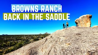
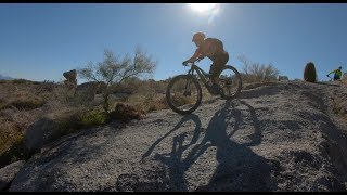
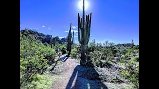
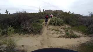
Fast and fairly smooth singletrack featuring lots of turns and numerous whoop-de-doos. No sustained climbs or descents. A few rocky and sandy sections, but completely rideable.

Access Info

Well-signed entrance off Brown's Ranch Road or Watershed Trail. Connector trail access from Cholla Mtn Loop Trail.

Recent Activity on Trail

Past Week
  • 1 rides
  • 20 miles average
6 Months
  • 119 rides
  • 19 miles avg distance
All
  • 942 rides
  • Last: Jun 14, 2026
c1c2c3c4
January
February
March
April
May
June
July
August
September
October
November
December
Status:
on Mar 30, 2026
Ideal
Avg: 4 (14 votes)
Your vote: 0

view (3,910)
close
3D
Trail Conditions
  • Unknown
  • Snow Groomed
  • Snow Packed
  • Snow Covered
  • Snow Cover Partial
  • Freeze/thaw Cycle
  • Icy
  • Prevalent Mud
  • Wet
  • Variable
  • Ideal
  • Dry
  • Very Dry
Trail Flow (Ridden Direction)
Trailforks scans users ridelogs to determine the most popular direction each trail is ridden. A good flowing trail network will have most trails flowing in a single direction according to their intension.
The colour categories are based on what percentage of riders are riding a trail in its intended direction.
  • > 96%
  • > 90%
  • > 80%
  • > 70%
  • > 50%
  • < 50%
  • bi-directional trail
  • no data
Trail Last Ridden
Trailforks scans ridelogs to determine the last time a trail was ridden.
  • < 2 days
  • < 1 week
  • < 2 weeks
  • < 1 month
  • < 6 months
  • > 6 months
Trail Ridden Direction
The intended direction a trail should be ridden.
  • Downhill Only
  • Downhill Primary
  • Both Directions
  • Uphill Primary
  • Uphill Only
  • One Direction
Contribute Details
Colors indicate trail is missing specified detail.
  • Description
  • Photos
  • Description & Photos
  • Videos
Trail Popularity ?
Trailforks scans ridelogs to determine which trails are ridden the most in the last 9 months. Trails are compared with nearby trails in the same city region with a possible 25 colour shades. Think of this as a heatmap, more rides = more kinetic energy = warmer colors.
  • most popular
  • popular
  • less popular
  • not popular
ATV/ORV/OHV Filter
Max Vehicle Width
inches
US Cell Coverage
Legend
cell carrier legend

Radar Time
Activity Recordings
Trailforks uses anonymized public activity data. ?
Activity Recordings
Trailforks uses anonymized public activity data. ?
Personal Heatmap
Activity Types
all / none
Options
2
Date range month
Winter Trails
Warning A routing network for winter maps does not exist. Selecting trails using the winter trails layer has been disabled.
Missing Trails
Most Popular
Least Popular
Trails are colored based on popularity. The more popular a trail is, the more red. Less popular trails trend towards green.
Jump Magnitude Heatmap
Heatmap of where riders jump on trails. Zoom in to see individual jumps, click circles to view jump details.
BC Backroad Status

Service Road Atlas is a free to use, community-driven service for viewing and creating reports on the numerous back-country service roads around B.C. and Alberta.

map legend
Slope Aspect
Direction the slope faces
Flat N NE E SE S SW W NW
Trails Deemphasized
Trails are shown in grey.
disable
Only show trails with no bike usage.
Enable
Suggested Layers
Based on selected activity type

    Save the current map location and zoom level as your default home location whenever this page is loaded.

    Save
        Directions to maverick-trail trailhead (33.772800, -111.825480)

        Photos

        1 more »
        57 |
        Sep 26, 2017 @ 10:24pm
        Sep 26, 2017

        Videos

        4 more »
        Brown's Ranch | Post crash, the knee still...
        5:45 | 270 | Feb 2, 2020 , Scottsdale
        Brown's Ranch - 03/17/2019
        5:23 | 229 | Dec 9, 2019 , Scottsdale
        The Best Loop For Begginers
        9:41 | 284 | Mar 11, 2019 , Scottsdale
        Maverick Trail Browns Ranch
        9:21 | 445 | Feb 10, 2019 , Scottsdale

        Routes with this trail

        3.6 14 miles 865 ft 39 Loop
        Brown’s Ranch Trails will give you a bugs-in-teeth grin as you carve turns on groomed desert...
        21 miles 1,099 ft 15
        Starts from Brown's Ranch TH. Includes some of the best trails in the system. Designed to run CCW for the...
        3.4 28 miles 1,731 ft 18
        This route follows some our favorite technical routes at Brown's Ranch that are not to be missed! Budget...

        3 Reviews & Comments


        We hope you've been enjoying Trailforks!

        Create a FREE account to view trail comments and much more.

        • By schillingsworthTF Pro TRAILFORKS HTA & contributors
        • #18046 - 2,711 views

        Frequently Asked Questions About Maverick Trail

        Where is Maverick Trail located?
        Maverick Trail is located in Brown's Ranch, Scottsdale, Arizona, United States. It is part of the Brown's Ranch trail network. The trailhead is located at coordinates 33.7728, -111.82548.
        How hard is Maverick Trail?
        Maverick Trail is rated as Blue difficulty. The physical rating is Moderate. The climb difficulty is rated Blue.
        What is the elevation gain for Maverick Trail?
        Maverick Trail has 19 m of elevation gain. The trail has 35 m of elevation descent. The elevation ranges from 833 m to 853 m.
        Is Maverick Trail a point to point trail?
        Maverick Trail is not a point to point trail. The direction is Both Directions. The trail type is singletrack.

        Hit the Trail

        Open in App

        Get this trail on your phone instantly.
        open trail in app

        Download Trail

        Save to wishlist, Garmin & download.
        save the trail

        Find Related Routes

        Find routes and users activities that include this trail.
        find routes for this trail

        You must enter a description before submitting.