more stats
1,339 ft
Distance
-239 ft
Descent
00:05:35
Avg time
-237 ft
Altitude change
993 ft
Altitude min
1,231 ft
Altitude max
1,231 ft
Altitude start
994 ft
Altitude end
-17.7%
Grade
-35.5%
Grade max
4.1%
Grade min
33 ft
Distance climb
1,073 ft
Distance down
233 ft
Distance flat
00:05:35
Avg time

Trail Details

  • Activities
    • Mountain Bike
  • Riding Area
    Tiger Mountain State Forest
    Issaquah, Washington
  • Difficulty Rating
  • Voted Difficulty
    Black Diamond (4 votes)
  • Local Popularity
    55 in Mountain Biking
  • Global Ranking
    #56287 in Mountain Biking
  • Trail Type
    Singletrack
  • Bike Type
    DH
  • Climb Difficulty
    Double Black Diamond
  • Physical Rating
    Extreme
  • Dogs Allowed
    Yes
  • eBike Allowed
  • TTFs on Trail
    Berm, Drop, Jump
  • Land Owner
    Washington State DNR

MOUNTAIN BIKING ONLY
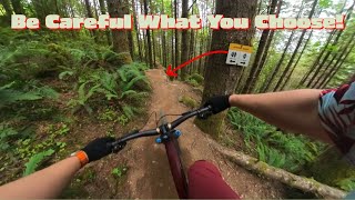
Built in partnership with Evergreen Mountain Bike Alliance, Megafauna trail extends from the bottom of The Legend trail descent with a new expert-only downhill riding experience. Like Legend but as steep as Upper Predator. The double black rating is no joke.

A big thank you to the dedicated volunteers who joined Evergreen Mountain Bike Alliance this spring to share their time and talents for building these trails. Along with your efforts, the Easy, Tiger extension and Megafauna trails were made possible through a Washington Wildlife and Recreation Program state lands development grant, awarded to DNR by the Washington State Recreation and Conservation Office.

Please become a member of Evergreen Mountain Bike Alliance & support Washington State DNR as they improve and expand mountain bike trails here in Washington State

Access Info

Ride down the Legend, cross the road and look for the trail sign.

Disclaimer

Mountain Biking Only. Hiking / equestrian use NOT permitted!

Local Trail Association
Traditionally Indigenous Territory

Recent Activity on Trail

Past Week
  • 2 rides
  • 27 miles average
6 Months
  • 18 rides
  • 17 miles avg distance
All
  • 297 rides
  • Last: Jun 18, 2026
c1c2c3c4
January
February
March
April
May
June
July
August
September
October
November
December
update trails status or condition

Megafauna... Trail Reports

statusdatedescription
Mar 23, 2026 @ 2:04pm (America/Los_Angeles)
Mar 23, 2026
all clear. Great dirt today
Apr 18, 2025 @ 1:56pm
Apr 18, 2025
Mostly good. Some loose tree branches and debris.
Apr 17, 2025 @ 11:03am
Apr 17, 2025
Seemed dry enough and running well. I dismounted once because I didn't trust myself to be safe, but the trail seemed to be in good condition.
Aug 3, 2024 @ 2:16am
Aug 3, 2024
May 11, 2024 @ 2:34am
May 11, 2024
more »
Status:
on Mar 23, 2026
Ideal
Avg: 4.43 (31 votes)
Your vote: 0

view (2,403)
close
3D
Trail Conditions
  • Unknown
  • Snow Groomed
  • Snow Packed
  • Snow Covered
  • Snow Cover Partial
  • Freeze/thaw Cycle
  • Icy
  • Prevalent Mud
  • Wet
  • Variable
  • Ideal
  • Dry
  • Very Dry
Trail Flow (Ridden Direction)
Trailforks scans users ridelogs to determine the most popular direction each trail is ridden. A good flowing trail network will have most trails flowing in a single direction according to their intension.
The colour categories are based on what percentage of riders are riding a trail in its intended direction.
  • > 96%
  • > 90%
  • > 80%
  • > 70%
  • > 50%
  • < 50%
  • bi-directional trail
  • no data
Trail Last Ridden
Trailforks scans ridelogs to determine the last time a trail was ridden.
  • < 2 days
  • < 1 week
  • < 2 weeks
  • < 1 month
  • < 6 months
  • > 6 months
Trail Ridden Direction
The intended direction a trail should be ridden.
  • Downhill Only
  • Downhill Primary
  • Both Directions
  • Uphill Primary
  • Uphill Only
  • One Direction
Contribute Details
Colors indicate trail is missing specified detail.
  • Description
  • Photos
  • Description & Photos
  • Videos
Trail Popularity ?
Trailforks scans ridelogs to determine which trails are ridden the most in the last 9 months. Trails are compared with nearby trails in the same city region with a possible 25 colour shades. Think of this as a heatmap, more rides = more kinetic energy = warmer colors.
  • most popular
  • popular
  • less popular
  • not popular
ATV/ORV/OHV Filter
Max Vehicle Width
inches
US Cell Coverage
Legend
cell carrier legend

Radar Time
Activity Recordings
Trailforks uses anonymized public activity data. ?
Activity Recordings
Trailforks uses anonymized public activity data. ?
Personal Heatmap
Activity Types
all / none
Options
2
Date range month
Winter Trails
Warning A routing network for winter maps does not exist. Selecting trails using the winter trails layer has been disabled.
Missing Trails
Most Popular
Least Popular
Trails are colored based on popularity. The more popular a trail is, the more red. Less popular trails trend towards green.
Jump Magnitude Heatmap
Heatmap of where riders jump on trails. Zoom in to see individual jumps, click circles to view jump details.
BC Backroad Status

Service Road Atlas is a free to use, community-driven service for viewing and creating reports on the numerous back-country service roads around B.C. and Alberta.

map legend
Slope Aspect
Direction the slope faces
Flat N NE E SE S SW W NW
Trails Deemphasized
Trails are shown in grey.
disable
Only show trails with no bike usage.
Enable
Suggested Layers
Based on selected activity type

    Save the current map location and zoom level as your default home location whenever this page is loaded.

    Save
        Directions to megafauna-mountain-biking-only trailhead (47.479490, -121.901150)

        Photos

        12 more »
        1,096 |
        Apr 22, 2019 @ 11:19am
        Apr 22, 2019
        1,380 |
        Oct 28, 2017 @ 11:07am
        Oct 28, 2017
        1,496 |
        Oct 20, 2017 @ 8:19am
        Oct 20, 2017
        109 |
        Mar 14, 2024 @ 9:11pm
        Mar 14, 2024

        Videos

        11 more »
        Some of the best parts of Mega Fauna
        0:31 | 187 | Jan 4, 2025 , Issaquah
        youtuber Kyle Strait inspired me to do this || Megafauna
        9:27 | 504 | Dec 4, 2023 , Issaquah
        You Pay for These Trails on the Way Out
        5:05 | 379 | Jul 15, 2023 , Issaquah
        The Legend, Megafauna - Tiger mountain MTB [4K]
        4:00 | 760 | May 15, 2022 , Issaquah

        Trail Lists

        Routes with this trail

        5.0 48 miles 10,456 ft 33 Loop
        A route that connects all the trails on Tiger (as of May 2026) with great flow, limited repeats, and zero...
        70 miles 12,856 ft 36
        The Real McCoy loop 2024 edition. Now with Tokyo Drift!
        33 miles 6,311 ft 43 Loop
        On Saturday (5/12/2018) I’m planning on riding the following route on Tiger. This is in lieu of not...

        3 Reviews & Comments


        We hope you've been enjoying Trailforks!

        Create a FREE account to view trail comments and much more.

        Frequently Asked Questions About Megafauna (MOUNTAIN BIKING ONLY)

        Where is Megafauna (MOUNTAIN BIKING ONLY) located?
        Megafauna (MOUNTAIN BIKING ONLY) is located in Tiger Mountain State Forest, Issaquah, Washington, United States. It is part of the Tiger Mountain State Forest trail network. The trailhead is located at coordinates 47.47949, -121.90115.
        How hard is Megafauna (MOUNTAIN BIKING ONLY)?
        Megafauna (MOUNTAIN BIKING ONLY) is rated as Double Black Diamond difficulty. The physical rating is Extreme. The average grade is 17.7%. The climb difficulty is rated Double Black Diamond.
        What is the elevation gain for Megafauna (MOUNTAIN BIKING ONLY)?
        The trail has 239 ft of elevation descent. The elevation ranges from 993 ft to 1,231 ft.
        How long is Megafauna (MOUNTAIN BIKING ONLY)?
        Megafauna (MOUNTAIN BIKING ONLY) is 1,339 ft long. The trail type is singletrack.

        Hit the Trail

        Open in App

        Get this trail on your phone instantly.
        open trail in app

        Download Trail

        Save to wishlist, Garmin & download.
        save the trail

        Find Related Routes

        Find routes and users activities that include this trail.
        find routes for this trail

        You must enter a description before submitting.