more stats
5,253 ft
Distance
-601 ft
Descent
00:08:15
Avg time
-599 ft
Altitude change
4,806 ft
Altitude min
5,408 ft
Altitude max
5,408 ft
Altitude start
4,810 ft
Altitude end
-11.4%
Grade
-43.6%
Grade max
6.5%
Grade min
167 ft
Distance climb
4,967 ft
Distance down
118 ft
Distance flat
00:08:15
Avg time

Merry Widow Details

  • Activities
    • Mountain Bike
  • Riding Area
    Copper City
    Three Forks, Montana
  • Difficulty Rating
  • Voted Difficulty
    Black Diamond (2 votes)
  • Local Popularity
    85 in Mountain Biking
  • Global Ranking
    #65671 in Mountain Biking
  • Trail Type
    Singletrack
  • Bike Type
    DH, AM
  • Direction
    Downhill Only
    Popular Direction Shown
  • Trail Visibility
    Always easy to follow
  • Dogs Allowed
    Yes
  • eBike Allowed
  • TTFs on Trail
    Berm, Drop, Rock Garden, Wallride
  • Year Opened
    2019
  • Land Owner
    BLM

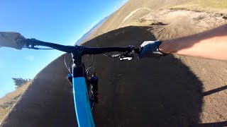
Steep, downhill directional trail. Has some tough rocky features, but easier switchbacks compared to Never Sweat. Crossing the gully and to the bottom is smoother. Fun, steep sides to the gully.

Access Info

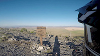
Ride up High Ore and take your second left on the ridge line.

Trail Supporters
Local Trail Association

Recent Activity on Trail

Past Week
  • 0 rides
  •  
6 Months
  • 21 rides
  • 14 miles avg distance
All
  • 229 rides
  • Last: Jun 13, 2026
c1c2c3c4
January
February
March
April
May
June
July
August
September
October
November
December
update trails status or condition

Merry Widow Trail Reports

statusdatedescription
Jun 14, 2026 @ 7:19am (America/Denver)
Jun 14, 2026
Recent machine work on lower half of trail. Expect some new speed and flow/features. Preride-reride-freeride. Let us know what you think! Join...
May 29, 2026 @ 10:50am (America/Denver)
May 29, 2026
Machine work ongoing ride aware and when you see machine you’ll know it’s fresh/soft. Join SWMMBA for a volunteer day!
Apr 19, 2026 @ 3:24pm (America/Denver)
Apr 19, 2026
Rideable, few short chunks of mud. Should dry out by tomorrow
Mar 27, 2026 @ 2:33pm (America/Denver)
Mar 27, 2026
Mar 1, 2026 @ 1:28pm (America/Denver)
Mar 1, 2026
more »
Status:
on Jun 14, 2026
Ideal
Avg: 4.21 (8 votes)
Your vote: 0

view (1,225)
close
3D
Trail Conditions
  • Unknown
  • Snow Groomed
  • Snow Packed
  • Snow Covered
  • Snow Cover Partial
  • Freeze/thaw Cycle
  • Icy
  • Prevalent Mud
  • Wet
  • Variable
  • Ideal
  • Dry
  • Very Dry
Trail Flow (Ridden Direction)
Trailforks scans users ridelogs to determine the most popular direction each trail is ridden. A good flowing trail network will have most trails flowing in a single direction according to their intension.
The colour categories are based on what percentage of riders are riding a trail in its intended direction.
  • > 96%
  • > 90%
  • > 80%
  • > 70%
  • > 50%
  • < 50%
  • bi-directional trail
  • no data
Trail Last Ridden
Trailforks scans ridelogs to determine the last time a trail was ridden.
  • < 2 days
  • < 1 week
  • < 2 weeks
  • < 1 month
  • < 6 months
  • > 6 months
Trail Ridden Direction
The intended direction a trail should be ridden.
  • Downhill Only
  • Downhill Primary
  • Both Directions
  • Uphill Primary
  • Uphill Only
  • One Direction
Contribute Details
Colors indicate trail is missing specified detail.
  • Description
  • Photos
  • Description & Photos
  • Videos
Trail Popularity ?
Trailforks scans ridelogs to determine which trails are ridden the most in the last 9 months. Trails are compared with nearby trails in the same city region with a possible 25 colour shades. Think of this as a heatmap, more rides = more kinetic energy = warmer colors.
  • most popular
  • popular
  • less popular
  • not popular
ATV/ORV/OHV Filter
Max Vehicle Width
inches
US Cell Coverage
Legend
cell carrier legend

Radar Time
Activity Recordings
Trailforks uses anonymized public activity data. ?
Activity Recordings
Trailforks uses anonymized public activity data. ?
Personal Heatmap
Activity Types
all / none
Options
2
Date range month
Winter Trails
Warning A routing network for winter maps does not exist. Selecting trails using the winter trails layer has been disabled.
Missing Trails
Most Popular
Least Popular
Trails are colored based on popularity. The more popular a trail is, the more red. Less popular trails trend towards green.
Jump Magnitude Heatmap
Heatmap of where riders jump on trails. Zoom in to see individual jumps, click circles to view jump details.
BC Backroad Status

Service Road Atlas is a free to use, community-driven service for viewing and creating reports on the numerous back-country service roads around B.C. and Alberta.

map legend
Slope Aspect
Direction the slope faces
Flat N NE E SE S SW W NW
Trails Deemphasized
Trails are shown in grey.
disable
Only show trails with no bike usage.
Enable
Suggested Layers
Based on selected activity type

    Save the current map location and zoom level as your default home location whenever this page is loaded.

    Save
        Directions to merry-widow trailhead (45.989550, -111.528550)

        Photos

        12 more »
        7 |
        Jun 14, 2026 @ 6:17am
        Jun 14, 2026
        8 |
        Jun 14, 2026 @ 6:17am
        Jun 14, 2026
        8 |
        Jun 14, 2026 @ 6:17am
        Jun 14, 2026
        473 |
        May 18, 2020 @ 8:02pm
        May 18, 2020

        Videos

        3 more »
        Riding the Merry Widow Trail at Copper City
        4:31 | 108 | Jan 11, 2026 , Three Forks
        Copper City Trails - Merrywidow - Bozeman...
        4:45 | 2056 | Jun 6, 2019 , Three Forks
        Marry widow copper city
        8:49 | 758 | Aug 8, 2019 , Three Forks

        Routes with this trail

        21 miles 3,526 ft 12
        21 mile route at Copper City to cover most of the trail system
        3.0 9 miles 1,784 ft 5 Loop
        lets gooooooooooooooo boys.
        2.0 19 miles 3,079 ft 29
        This is a big day! Enjoy the full boundary of Copper City. Lots of up, lots of down, and a hike-a-bike in...

        3 Reviews & Comments


        We hope you've been enjoying Trailforks!

        Create a FREE account to view trail comments and much more.

        • By livefreerdieTF Pro SWMMBA & contributors
        • #183084 - 4,418 views

        Frequently Asked Questions About Merry Widow

        Where is Merry Widow located?
        Merry Widow is located in Copper City, Three Forks, Montana, United States. It is part of the Copper City trail network. The trailhead is located at coordinates 45.98955, -111.52855.
        How hard is Merry Widow?
        Merry Widow is rated as Black Diamond difficulty. The average grade is 11.4%.
        What is the elevation gain for Merry Widow?
        The trail has 601 ft of elevation descent. The elevation ranges from 4,806 ft to 5,408 ft.
        Is Merry Widow a point to point trail?
        Yes, Merry Widow is a point to point trail. The direction is Downhill Only. The trail type is singletrack.

        Hit the Trail

        Open in App

        Get this trail on your phone instantly.
        open trail in app

        Download Trail

        Save to wishlist, Garmin & download.
        save the trail

        Find Related Routes

        Find routes and users activities that include this trail.
        find routes for this trail

        You must enter a description before submitting.