more stats
1.5 miles
Distance
15 ft
Climb
-943 ft
Descent
2 miles
High Point
-932 ft
Altitude change
7,413 ft
Altitude min
8,345 ft
Altitude start
7,411 ft
Altitude end
-11.6%
Grade
-30.5%
Grade max
11.2%
Grade min
453 ft
Distance climb
1 mile
Distance down
200 ft
Distance flat

Meteoride Details

  • Activities
    • Mountain Bike
  • Riding Area
    MEDL (Mount Elden Dry Lakes)
    Flagstaff, Arizona
  • Difficulty Rating
  • Voted Difficulty
    Black Diamond (3 votes)
  • Local Popularity
    100 in Mountain Biking
  • Trail Type
    Singletrack
  • Direction
    Downhill Only
    Popular Direction Shown
  • Trail Visibility
    Always easy to follow
  • eBike Allowed
  • TTFs on Trail
    Drop, Jump, Rock Face, Rock Garden
  • Year Opened
    2024
  • Land Owner
    Coconino National Forest

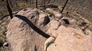
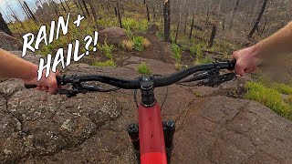
Downhill-only mountain bike-specific trail. Includes technical features like rock rolls, drops, & optional jumps. Some features have B-line options. Trail completed 04/19/2024

Access Info

Starts from Lower Brookbank Trail. Junction is signposted.

Local Trail Association

Recent Activity on Trail

Past Week
  • 9 rides
  • 23 miles average
6 Months
  • 89 rides
  • 15 miles avg distance
All
  • 290 rides
  • Last: Jun 19, 2026
c1c2c3c4
January
February
March
April
May
June
July
August
September
October
November
December
update trails status or condition

Meteoride Trail Reports

Status:
on Mar 22, 2026
Ideal
Avg: 4.75 (24 votes)
Your vote: 0

view (1,728)
close
3D
Trail Conditions
  • Unknown
  • Snow Groomed
  • Snow Packed
  • Snow Covered
  • Snow Cover Partial
  • Freeze/thaw Cycle
  • Icy
  • Prevalent Mud
  • Wet
  • Variable
  • Ideal
  • Dry
  • Very Dry
Trail Flow (Ridden Direction)
Trailforks scans users ridelogs to determine the most popular direction each trail is ridden. A good flowing trail network will have most trails flowing in a single direction according to their intension.
The colour categories are based on what percentage of riders are riding a trail in its intended direction.
  • > 96%
  • > 90%
  • > 80%
  • > 70%
  • > 50%
  • < 50%
  • bi-directional trail
  • no data
Trail Last Ridden
Trailforks scans ridelogs to determine the last time a trail was ridden.
  • < 2 days
  • < 1 week
  • < 2 weeks
  • < 1 month
  • < 6 months
  • > 6 months
Trail Ridden Direction
The intended direction a trail should be ridden.
  • Downhill Only
  • Downhill Primary
  • Both Directions
  • Uphill Primary
  • Uphill Only
  • One Direction
Contribute Details
Colors indicate trail is missing specified detail.
  • Description
  • Photos
  • Description & Photos
  • Videos
Trail Popularity ?
Trailforks scans ridelogs to determine which trails are ridden the most in the last 9 months. Trails are compared with nearby trails in the same city region with a possible 25 colour shades. Think of this as a heatmap, more rides = more kinetic energy = warmer colors.
  • most popular
  • popular
  • less popular
  • not popular
ATV/ORV/OHV Filter
Max Vehicle Width
inches
US Cell Coverage
Legend
cell carrier legend

Radar Time
Activity Recordings
Trailforks uses anonymized public activity data. ?
Activity Recordings
Trailforks uses anonymized public activity data. ?
Personal Heatmap
Activity Types
all / none
Options
2
Date range month
Winter Trails
Warning A routing network for winter maps does not exist. Selecting trails using the winter trails layer has been disabled.
Missing Trails
Most Popular
Least Popular
Trails are colored based on popularity. The more popular a trail is, the more red. Less popular trails trend towards green.
Jump Magnitude Heatmap
Heatmap of where riders jump on trails. Zoom in to see individual jumps, click circles to view jump details.
BC Backroad Status

Service Road Atlas is a free to use, community-driven service for viewing and creating reports on the numerous back-country service roads around B.C. and Alberta.

map legend
Slope Aspect
Direction the slope faces
Flat N NE E SE S SW W NW
Trails Deemphasized
Trails are shown in grey.
disable
Only show trails with no bike usage.
Enable
Suggested Layers
Based on selected activity type

    Save the current map location and zoom level as your default home location whenever this page is loaded.

    Save
        Directions to meteoride trailhead (35.257420, -111.637700)

        Photos

        12 more »
        275 |
        Apr 24, 2025 @ 9:05pm
        Apr 24, 2025
        245 |
        Oct 9, 2024 @ 5:47pm
        Oct 9, 2024
        220 |
        Oct 9, 2024 @ 5:47pm
        Oct 9, 2024
        216 |
        Oct 9, 2024 @ 5:48pm
        Oct 9, 2024

        Videos

        6 more »
        Meteoride Lived Up to the Hype! Fast Full Run!...
        8:22 | 8 | Jun 14, 2026 , Flagstaff
        Flagstaff Enduro: STAGE 2
        7:13 | 111 | Nov 1, 2025 , Flagstaff
        Meteoride - Oct 2025 - Mt Elden - Flagstaff AZ
        10:50 | 101 | Oct 28, 2025 , Flagstaff
        Ripping downhill in a DOWNPOUR?!
        8:42 | 69 | Aug 22, 2025 , Flagstaff

        Routes with this trail

        3.8 11 miles 1,952 ft 4 Loop
        11 mile loop featuring both of Flagstaff's newest downhill only trails! is a DH only jumpline/flow trail,...
        28 miles 4,115 ft 10
        https://rockyroad5050.wordpress.com/5-aspen-asphyxiation/
        18 miles 2,734 ft 11
        18 mile route that hits Meteoride and Big Bang.

        15 Reviews & Comments


        We hope you've been enjoying Trailforks!

        Create a FREE account to view trail comments and much more.

        • By anotherbikerguyTF Pro & contributors
        • #748565 - 4,779 views

        Frequently Asked Questions About Meteoride

        Where is Meteoride located?
        Meteoride is located in MEDL (Mount Elden Dry Lakes), Flagstaff, Arizona, United States. It is part of the MEDL (Mount Elden Dry Lakes) trail network. The trailhead is located at coordinates 35.25742, -111.6377.
        How hard is Meteoride?
        Meteoride is rated as Black Diamond difficulty. The average grade is 11.6%.
        What is the elevation gain for Meteoride?
        Meteoride has 15 ft of elevation gain. The trail has 943 ft of elevation descent. The elevation ranges from 7,413 ft to 8,345 ft.
        Is Meteoride a point to point trail?
        Yes, Meteoride is a point to point trail. The direction is Downhill Only. The trail type is singletrack.

        Hit the Trail

        Open in App

        Get this trail on your phone instantly.
        open trail in app

        Download Trail

        Save to wishlist, Garmin & download.
        save the trail

        Find Related Routes

        Find routes and users activities that include this trail.
        find routes for this trail

        You must enter a description before submitting.