more stats
4,302 ft
Distance
470 ft
Climb
-9 ft
Descent
00:10:59
Avg time
461 ft
Altitude change
1,383 ft
Altitude min
1,843 ft
Altitude max
1,383 ft
Altitude start
1,843 ft
Altitude end
10.704%
Grade
-4.779%
Grade max
32.429%
Grade min
4,010 ft
Distance climb
254 ft
Distance down
39 ft
Distance flat
00:10:59
Avg time

Methuselah Details

  • Activities
    • Mountain Bike
    • Horse
    • Hike
    • Trail Running
  • Riding Area
    El Corte de Madera Creek Preserve
    Redwood City, California
  • Difficulty Rating
  • Voted Difficulty
    Green (1 vote)
  • Local Popularity
    65 in Mountain Biking [+]
    • 35 in Trail Running
    • 40 in Hiking
    • 5 in Horseback
  • Global Ranking
    #81628 in Mountain Biking [+]
    • #111192 in Trail Running
    • #1252 in Hiking
    • #1512 in Horseback
  • Trail Type
    Singletrack
  • Direction
    Both Directions
  • Climb Difficulty
    Blue
  • Physical Rating
    Moderate
  • Dogs Allowed
    Yes
  • eBike Allowed
  • Ride in Rain
    Yes
  • Land Owner

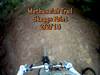
Very nice single track into one of the nicest parts of the park. Trail restoration work done in 2015. This trail has some jumps that can be easily rolled. The lower portion of the trail is a bit steep and exposed.

Local Trail Association
Traditionally Indigenous Territory

Recent Activity on Trail

Past Week
  • 1 rides
  • 12 miles average
6 Months
  • 39 rides
  • 16 miles avg distance
All
  • 595 rides
  • Last: Jun 15, 2026
c1c2c3c4
January
February
March
April
May
June
July
August
September
October
November
December
update trails status or condition

Methuselah Trail Reports

Status:
on Mar 22, 2025
Ideal
Avg: 4.1 (15 votes)
Your vote: 0

view (3,286)
close
3D
Trail Conditions
  • Unknown
  • Snow Groomed
  • Snow Packed
  • Snow Covered
  • Snow Cover Partial
  • Freeze/thaw Cycle
  • Icy
  • Prevalent Mud
  • Wet
  • Variable
  • Ideal
  • Dry
  • Very Dry
Trail Flow (Ridden Direction)
Trailforks scans users ridelogs to determine the most popular direction each trail is ridden. A good flowing trail network will have most trails flowing in a single direction according to their intension.
The colour categories are based on what percentage of riders are riding a trail in its intended direction.
  • > 96%
  • > 90%
  • > 80%
  • > 70%
  • > 50%
  • < 50%
  • bi-directional trail
  • no data
Trail Last Ridden
Trailforks scans ridelogs to determine the last time a trail was ridden.
  • < 2 days
  • < 1 week
  • < 2 weeks
  • < 1 month
  • < 6 months
  • > 6 months
Trail Ridden Direction
The intended direction a trail should be ridden.
  • Downhill Only
  • Downhill Primary
  • Both Directions
  • Uphill Primary
  • Uphill Only
  • One Direction
Contribute Details
Colors indicate trail is missing specified detail.
  • Description
  • Photos
  • Description & Photos
  • Videos
Trail Popularity ?
Trailforks scans ridelogs to determine which trails are ridden the most in the last 9 months. Trails are compared with nearby trails in the same city region with a possible 25 colour shades. Think of this as a heatmap, more rides = more kinetic energy = warmer colors.
  • most popular
  • popular
  • less popular
  • not popular
ATV/ORV/OHV Filter
Max Vehicle Width
inches
US Cell Coverage
Legend
cell carrier legend

Radar Time
Activity Recordings
Trailforks uses anonymized public activity data. ?
Activity Recordings
Trailforks uses anonymized public activity data. ?
Personal Heatmap
Activity Types
all / none
Options
2
Date range month
Winter Trails
Warning A routing network for winter maps does not exist. Selecting trails using the winter trails layer has been disabled.
Missing Trails
Most Popular
Least Popular
Trails are colored based on popularity. The more popular a trail is, the more red. Less popular trails trend towards green.
Jump Magnitude Heatmap
Heatmap of where riders jump on trails. Zoom in to see individual jumps, click circles to view jump details.
BC Backroad Status

Service Road Atlas is a free to use, community-driven service for viewing and creating reports on the numerous back-country service roads around B.C. and Alberta.

map legend
Slope Aspect
Direction the slope faces
Flat N NE E SE S SW W NW
Trails Deemphasized
Trails are shown in grey.
disable
Only show trails with no bike usage.
Enable
Suggested Layers
Based on selected activity type

    Save the current map location and zoom level as your default home location whenever this page is loaded.

    Save
        Directions to methuselah trailhead (37.400050, -122.331240)

        Photos

        2 more »
        185 |
        Jul 7, 2020 @ 7:26pm
        Jul 7, 2020
        251 |
        Jul 4, 2020 @ 6:18pm
        Jul 4, 2020

        Videos

        2 more »
        Corte de Madera - Methuselah DH jumps
        2:55 | 188 | Oct 30, 2023 , Redwood City
        Methuselah Trail, Skeggs Point, 2/2/13
        3:40 | 288 | Feb 2, 2013 , Redwood City

        Routes with this trail

        4.5 19 miles 4,269 ft 10 Loop
        Big loop from Star Hill parking, hitting , , , , and
        3.5 15 miles 3,209 ft 25 Loop
        Counter clockwise loop hitting most of the fun trails in Skeggs. New Oljon, Blue Blossom, Manzanita, Giant...
        4.0 14 miles 2,475 ft 20 Loop
        This is the typical WCMB ride with a little extra credit thrown in for scouting purposes

        4 Reviews & Comments


        We hope you've been enjoying Trailforks!

        Create a FREE account to view trail comments and much more.

        Frequently Asked Questions About Methuselah

        Where is Methuselah located?
        Methuselah is located in El Corte de Madera Creek Preserve, Redwood City, California, United States. It is part of the El Corte de Madera Creek Preserve trail network. The trailhead is located at coordinates 37.40005, -122.33124.
        How hard is Methuselah?
        Methuselah is rated as Blue difficulty. The physical rating is Moderate. The average grade is 10.704%. The climb difficulty is rated Blue.
        What is the elevation gain for Methuselah?
        Methuselah has 143 m of elevation gain. The trail has 3 m of elevation descent. The elevation ranges from 421 m to 562 m.
        Is Methuselah a point to point trail?
        Methuselah is not a point to point trail. The direction is Both Directions. The trail type is singletrack.

        Hit the Trail

        Open in App

        Get this trail on your phone instantly.
        open trail in app

        Download Trail

        Save to wishlist, Garmin & download.
        save the trail

        Find Related Routes

        Find routes and users activities that include this trail.
        find routes for this trail

        You must enter a description before submitting.