more stats
1,696 ft
Distance
-350 ft
Descent
00:04:37
Avg time
-350 ft
Altitude change
1,020 ft
Altitude min
1,371 ft
Altitude max
1,371 ft
Altitude start
1,020 ft
Altitude end
-20.6%
Grade
-48.5%
Grade max
-3.7%
Grade min
1,696 ft
Distance down
00:04:37
Avg time

Mexican Ninja Details

  • Activities
    • Mountain Bike
    • E-Bike
    • Hike
    • Trail Running
  • Riding Area
    Vedder Mountain
    Chilliwack, British Columbia
  • Difficulty Rating
  • Local Popularity
    100 in Mountain Biking [+]
    • 100 in E-Biking
    • 70 in Trail Running
    • 75 in Hiking
  • Global Ranking
    #39789 in Mountain Biking [+]
    • #7205 in E-Biking
    • #84158 in Trail Running
    • #83976 in Hiking
  • Trail Type
    Singletrack
  • Bike Type
    DH, AM
  • Direction
    Downhill Primary
    Popular Direction Shown
  • Season
    Year round
  • Dogs Allowed
    Yes
  • eBike Allowed
    Yes up to Class 1
  • Land Owner
    RSTBC

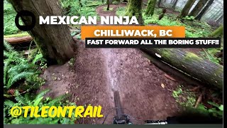
Fast and flowy trail with a few jumps , a big drop and a fast steep section. Trail flows alongside a giant rock outcropping that can be climbed in a short hike for amazing views of Cultus Lake. Large old growth cedars surround you as you descend this old classic.
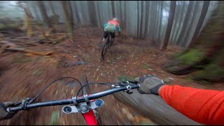
There are two options as you approach the bottom the left takes you through some technical turns ending in a small rock slab into a jump, and the right is the old classic starting in a gap and ending in a fast section ending in a rocky chute. They join up again as you cross the end of New Mexico and ends at Black Hawk Down.

Access Info

Ride down Mongolloyd or climb jeep road across from the start of Dillema.

Trail Supporters
  • past supporters

Local Trail Association
Traditionally Indigenous Territory

Recent Activity on Trail

Past Week
  • 6 rides
  • 8 miles average
6 Months
  • 80 rides
  • 7 miles avg distance
All
  • 741 rides
  • Last: Jun 17, 2026
c1c2c3c4
January
February
March
April
May
June
July
August
September
October
November
December
update trails status or condition

Mexican Ninja Trail Reports

Status:
on May 29, 2026
Ideal
Avg: 3.94 (13 votes)
Your vote: 0

view (5,054)
close
3D
Trail Conditions
  • Unknown
  • Snow Groomed
  • Snow Packed
  • Snow Covered
  • Snow Cover Partial
  • Freeze/thaw Cycle
  • Icy
  • Prevalent Mud
  • Wet
  • Variable
  • Ideal
  • Dry
  • Very Dry
Trail Flow (Ridden Direction)
Trailforks scans users ridelogs to determine the most popular direction each trail is ridden. A good flowing trail network will have most trails flowing in a single direction according to their intension.
The colour categories are based on what percentage of riders are riding a trail in its intended direction.
  • > 96%
  • > 90%
  • > 80%
  • > 70%
  • > 50%
  • < 50%
  • bi-directional trail
  • no data
Trail Last Ridden
Trailforks scans ridelogs to determine the last time a trail was ridden.
  • < 2 days
  • < 1 week
  • < 2 weeks
  • < 1 month
  • < 6 months
  • > 6 months
Trail Ridden Direction
The intended direction a trail should be ridden.
  • Downhill Only
  • Downhill Primary
  • Both Directions
  • Uphill Primary
  • Uphill Only
  • One Direction
Contribute Details
Colors indicate trail is missing specified detail.
  • Description
  • Photos
  • Description & Photos
  • Videos
Trail Popularity ?
Trailforks scans ridelogs to determine which trails are ridden the most in the last 9 months. Trails are compared with nearby trails in the same city region with a possible 25 colour shades. Think of this as a heatmap, more rides = more kinetic energy = warmer colors.
  • most popular
  • popular
  • less popular
  • not popular
ATV/ORV/OHV Filter
Max Vehicle Width
inches
US Cell Coverage
Legend
cell carrier legend

Radar Time
Activity Recordings
Trailforks uses anonymized public activity data. ?
Activity Recordings
Trailforks uses anonymized public activity data. ?
Personal Heatmap
Activity Types
all / none
Options
2
Date range month
Winter Trails
Warning A routing network for winter maps does not exist. Selecting trails using the winter trails layer has been disabled.
Missing Trails
Most Popular
Least Popular
Trails are colored based on popularity. The more popular a trail is, the more red. Less popular trails trend towards green.
Jump Magnitude Heatmap
Heatmap of where riders jump on trails. Zoom in to see individual jumps, click circles to view jump details.
BC Backroad Status

Service Road Atlas is a free to use, community-driven service for viewing and creating reports on the numerous back-country service roads around B.C. and Alberta.

map legend
Slope Aspect
Direction the slope faces
Flat N NE E SE S SW W NW
Trails Deemphasized
Trails are shown in grey.
disable
Only show trails with no bike usage.
Enable
Suggested Layers
Based on selected activity type

    Save the current map location and zoom level as your default home location whenever this page is loaded.

    Save
        Directions to mexican-ninja trailhead (49.074100, -122.000320)

        Photos

        91 more »
        286 |
        May 1, 2011 @ 6:59pm
        May 1, 2011
        224 |
        May 5, 2009 @ 4:54pm
        May 5, 2009
        21 |
        Sep 1, 2025 @ 12:00pm
        Sep 1, 2025
        25 |
        Sep 1, 2025 @ 12:00pm
        Sep 1, 2025

        Videos

        9 more »
        Mexican Ninja  - Chilliwack, BC - MTB Trail...
        0:00 | 103 | Dec 29, 2024 , Chilliwack
        youtuber DO NOT BUY THESE!
        7:50 | 98 | Mar 6, 2024 , Chilliwack
        youtuber Shredding with Rafi the trail dog and the Boys!
        7:49 | 201 | Nov 19, 2023 , Chilliwack
        Ruby's Knoll - Vedder Mountain - Chilliwack, B.C
        0:43 | 265 | Oct 8, 2023 , Chilliwack

        Routes with this trail

        11 miles 3,504 ft 14
        Fraser Valley Vedder Shuttle Epic Relive Your Rides For other ride suggestions for this and other areas....
        22 miles 6,046 ft 59 Loop
        Tentative route for the Vedder Mountain Classic 2020 marathon route
        4 miles 162 ft 22 Shuttled
        Making a plan for a few shuttle runs this weekend at Vedder.

        1 Review & Comments


        We hope you've been enjoying Trailforks!

        Create a FREE account to view trail comments and much more.

        • By BCpovTF Pro & contributors
        • #946 - 5,778 views

        Frequently Asked Questions About Mexican Ninja

        Where is Mexican Ninja located?
        Mexican Ninja is located in Vedder Mountain, Chilliwack, British Columbia, Canada. It is part of the Vedder Mountain trail network. The trailhead is located at coordinates 49.0741, -122.00032.
        How hard is Mexican Ninja?
        Mexican Ninja is rated as Black Diamond difficulty. The average grade is 20.6%.
        What is the elevation gain for Mexican Ninja?
        The trail has 350 ft of elevation descent. The elevation ranges from 1,020 ft to 1,371 ft.
        Is Mexican Ninja a point to point trail?
        Mexican Ninja is not a point to point trail. The direction is Downhill Primary. The trail type is singletrack.

        Hit the Trail

        Open in App

        Get this trail on your phone instantly.
        open trail in app

        Download Trail

        Save to wishlist, Garmin & download.
        save the trail

        Find Related Routes

        Find routes and users activities that include this trail.
        find routes for this trail

        You must enter a description before submitting.