more stats
3,658 ft
Distance
-506 ft
Descent
00:05:10
Avg time
-506 ft
Altitude change
174 ft
Altitude min
682 ft
Altitude max
680 ft
Altitude start
174 ft
Altitude end
-13.8%
Grade
-50.8%
Grade max
2.7%
Grade min
75 ft
Distance climb
3,550 ft
Distance down
30 ft
Distance flat
00:05:10
Avg time

Mini Mega Air Details

  • Activities
    • Mountain Bike
    • E-Bike
  • Riding Area
  • Difficulty Rating
  • Voted Difficulty
    Black Diamond (1 vote)
  • Local Popularity
    90 in Mountain Biking [+]
    • 80 in E-Biking
  • Global Ranking
    #26604 in Mountain Biking [+]
    • #33218 in E-Biking
  • Trail Type
    Singletrack
  • Bike Type
    DH, AM
  • Direction
    Downhill Only
  • Dogs Allowed
    Yes
  • eBike Allowed
    Yes up to Class 1
  • TTFs on Trail
    Berm, Drop, Jump, Gap Jump, Other

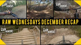
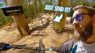
The Mini Free Ride Line is a series of gap and hip jumps, flowing berms, step downs and tabletop jumps. On any weekend you are likely to encounter riders whipping their bikes and showing their style, inc back flips and 360's. This track is probably the most popular of the tracks at Boomers

Local Trail Association
Traditionally Indigenous Territory

Recent Activity on Trail

Past Week
  • 0 rides
  •  
6 Months
  • 8 rides
  • 12 miles avg distance
All
  • 157 rides
  • Last: Jun 13, 2026
c1c2c3c4
January
February
March
April
May
June
July
August
September
October
November
December
update trails status or condition

Mini Mega Air Trail Reports

statusdatedescription
Jul 8, 2022 @ 6:22am
Jul 8, 2022
Running fairly well after top three needs some work with the loose rock and eroded berm but is running very well down and over robos riser
Feb 7, 2021 @ 4:47pm
Feb 7, 2021
Awesome track to ride... super smooth... super flowy... they have recently filled in the first 3 big gap jumps and turned them into table tops to...
Aug 3, 2019 @ 4:45pm
Aug 3, 2019
more » 1 social media mentions
Status:
on Jul 8, 2022
Dry
Avg: 4.59 (9 votes)
Your vote: 0

view (5,156)
close
3D
Trail Conditions
  • Unknown
  • Snow Groomed
  • Snow Packed
  • Snow Covered
  • Snow Cover Partial
  • Freeze/thaw Cycle
  • Icy
  • Prevalent Mud
  • Wet
  • Variable
  • Ideal
  • Dry
  • Very Dry
Trail Flow (Ridden Direction)
Trailforks scans users ridelogs to determine the most popular direction each trail is ridden. A good flowing trail network will have most trails flowing in a single direction according to their intension.
The colour categories are based on what percentage of riders are riding a trail in its intended direction.
  • > 96%
  • > 90%
  • > 80%
  • > 70%
  • > 50%
  • < 50%
  • bi-directional trail
  • no data
Trail Last Ridden
Trailforks scans ridelogs to determine the last time a trail was ridden.
  • < 2 days
  • < 1 week
  • < 2 weeks
  • < 1 month
  • < 6 months
  • > 6 months
Trail Ridden Direction
The intended direction a trail should be ridden.
  • Downhill Only
  • Downhill Primary
  • Both Directions
  • Uphill Primary
  • Uphill Only
  • One Direction
Contribute Details
Colors indicate trail is missing specified detail.
  • Description
  • Photos
  • Description & Photos
  • Videos
Trail Popularity ?
Trailforks scans ridelogs to determine which trails are ridden the most in the last 9 months. Trails are compared with nearby trails in the same city region with a possible 25 colour shades. Think of this as a heatmap, more rides = more kinetic energy = warmer colors.
  • most popular
  • popular
  • less popular
  • not popular
ATV/ORV/OHV Filter
Max Vehicle Width
inches
US Cell Coverage
Legend
cell carrier legend

Radar Time
Activity Recordings
Trailforks uses anonymized public activity data. ?
Activity Recordings
Trailforks uses anonymized public activity data. ?
Personal Heatmap
Activity Types
all / none
Options
2
Date range month
Winter Trails
Warning A routing network for winter maps does not exist. Selecting trails using the winter trails layer has been disabled.
Missing Trails
Most Popular
Least Popular
Trails are colored based on popularity. The more popular a trail is, the more red. Less popular trails trend towards green.
Jump Magnitude Heatmap
Heatmap of where riders jump on trails. Zoom in to see individual jumps, click circles to view jump details.
BC Backroad Status

Service Road Atlas is a free to use, community-driven service for viewing and creating reports on the numerous back-country service roads around B.C. and Alberta.

map legend
Slope Aspect
Direction the slope faces
Flat N NE E SE S SW W NW
Trails Deemphasized
Trails are shown in grey.
disable
Only show trails with no bike usage.
Enable
Suggested Layers
Based on selected activity type

    Save the current map location and zoom level as your default home location whenever this page is loaded.

    Save
        Directions to mini-mega-air trailhead (-28.106310, 153.310470)

        Photos

        12 more »
        14 |
        May 20, 2026 @ 1:13am
        May 20, 2026
        117 |
        Feb 19, 2024 @ 3:54am
        Feb 19, 2024
        124 |
        Feb 19, 2024 @ 3:54am
        Feb 19, 2024
        111 |
        Feb 19, 2024 @ 3:54am
        Feb 19, 2024

        Videos

        7 more »
        youtuber Raw Wednesdays | December Recap
        16:18 | 312 | Dec 29, 2021 , Gold Coast
        youtuber I Tried To Restrain Myself But…
        11:59 | 321 | Jan 21, 2023 , Gold Coast
        youtuber Questioning if Mountain Biking Is for Me.
        12:29 | 265 | Dec 21, 2022 , Gold Coast
        youtuber I've been Putting This Off for MONTHS -...
        19:49 | 356 | Dec 10, 2022 , Gold Coast

        1 Review & Comments


        We hope you've been enjoying Trailforks!

        Create a FREE account to view trail comments and much more.

        • By bobdownpowerTF Pro ORA & contributors
        • #62432 - 4,664 views

        Frequently Asked Questions About Mini Mega Air

        Where is Mini Mega Air located?
        Mini Mega Air is located in Boomerang Farm Bike Park, Gold Coast, Australia. It is part of the Boomerang Farm Bike Park trail network. The trailhead is located at coordinates -28.10631, 153.31047.
        How hard is Mini Mega Air?
        Mini Mega Air is rated as Black Diamond difficulty. The average grade is 13.8%.
        What is the elevation gain for Mini Mega Air?
        The trail has 506 ft of elevation descent. The elevation ranges from 174 ft to 682 ft.
        Is Mini Mega Air a point to point trail?
        Yes, Mini Mega Air is a point to point trail. The direction is Downhill Only. The trail type is singletrack.

        Hit the Trail

        Open in App

        Get this trail on your phone instantly.
        open trail in app

        Download Trail

        Save to wishlist, Garmin & download.
        save the trail

        Find Related Routes

        Find routes and users activities that include this trail.
        find routes for this trail

        You must enter a description before submitting.