more stats
4,970 ft
Distance
13 ft
Climb
-506 ft
Descent
00:05:37
Avg time
-494 ft
Altitude change
2,968 ft
Altitude min
3,461 ft
Altitude max
3,461 ft
Altitude start
2,969 ft
Altitude end
-9.9%
Grade
-39.3%
Grade max
14.9%
Grade min
364 ft
Distance climb
4,350 ft
Distance down
256 ft
Distance flat
00:05:37
Avg time

Missing Link - Lower Details

  • Activities
    • Mountain Bike
  • Riding Area
    Fernhill Trails
    Queenstown
  • Difficulty Rating
  • Local Popularity
    80 in Mountain Biking
  • Global Ranking
    #43390 in Mountain Biking
  • Trail Type
    Singletrack
  • Bike Type
    AM, XC
  • Climb Difficulty
    Blue
  • Physical Rating
    Easy
  • Trail Visibility
    Always easy to follow
  • Alpine Trail
    Yes
  • Dogs Allowed
    Yes
  • TTFs on Trail
    Berm, Jump, Rock Garden

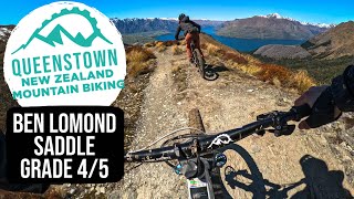
The lower half of Missing Link.
Access is by pushing up the walking track. Biking on the walking track should be kept to a minimum to reduce conflict with walkers.
Starts at low saddle, switchbacks in the tussock. A few gnarly bits in the forest.
Finishes at Beeched As. Turn left to return to the bike park, turn right to head to Fernhill.

Local Trail Association
Traditionally Indigenous Territory

Recent Activity on Trail

Past Week
  • 0 rides
  •  
6 Months
  • 45 rides
  • 23.2 km avg distance
All
  • 141 rides
  • Last: May 30, 2026
c1c2c3c4
January
February
March
April
May
June
July
August
September
October
November
December
update trails status or condition

Missing Link - Lower Trail Reports

statusdatedescription
May 31, 2026 @ 5:36pm (Pacific/Auckland)
May 30, 2026
Closed for Winter! Please keep off the trail to prevent damage. Will let you know when it's back open in Spring!
Jan 16, 2026 @ 3:33pm (Pacific/Auckland)
Jan 15, 2026
Maintenance carried out. Corners restacked and improved, lines of sight cleared. Get it whilst it’s hot
Dec 8, 2025 @ 1:34pm (Pacific/Auckland)
Dec 7, 2025
Riding ok. Some ruts into corners and overhanging veg needs cut back/removed to aid flow. Berms could be built up more to aid flow too. Quite a...
Nov 3, 2025 @ 7:17am (Pacific/Auckland)
Nov 2, 2025
Major erosion (major ruts or slumping, large boulders and roots exposed due to erosion)
Jun 11, 2025 @ 12:27pm
Jun 11, 2025
Please avoid in freeze thaw conditions
more »
Status:
on May 31, 2026
Freeze/thaw Cycle
Avg: 4.3 (8 votes)
Your vote: 0

view (1,589)
close
3D
Trail Conditions
  • Unknown
  • Snow Groomed
  • Snow Packed
  • Snow Covered
  • Snow Cover Partial
  • Freeze/thaw Cycle
  • Icy
  • Prevalent Mud
  • Wet
  • Variable
  • Ideal
  • Dry
  • Very Dry
Trail Flow (Ridden Direction)
Trailforks scans users ridelogs to determine the most popular direction each trail is ridden. A good flowing trail network will have most trails flowing in a single direction according to their intension.
The colour categories are based on what percentage of riders are riding a trail in its intended direction.
  • > 96%
  • > 90%
  • > 80%
  • > 70%
  • > 50%
  • < 50%
  • bi-directional trail
  • no data
Trail Last Ridden
Trailforks scans ridelogs to determine the last time a trail was ridden.
  • < 2 days
  • < 1 week
  • < 2 weeks
  • < 1 month
  • < 6 months
  • > 6 months
Trail Ridden Direction
The intended direction a trail should be ridden.
  • Downhill Only
  • Downhill Primary
  • Both Directions
  • Uphill Primary
  • Uphill Only
  • One Direction
Contribute Details
Colors indicate trail is missing specified detail.
  • Description
  • Photos
  • Description & Photos
  • Videos
Trail Popularity ?
Trailforks scans ridelogs to determine which trails are ridden the most in the last 9 months. Trails are compared with nearby trails in the same city region with a possible 25 colour shades. Think of this as a heatmap, more rides = more kinetic energy = warmer colors.
  • most popular
  • popular
  • less popular
  • not popular
ATV/ORV/OHV Filter
Max Vehicle Width
inches
US Cell Coverage
Legend
cell carrier legend

Radar Time
Activity Recordings
Trailforks uses anonymized public activity data. ?
Activity Recordings
Trailforks uses anonymized public activity data. ?
Personal Heatmap
Activity Types
all / none
Options
2
Date range month
Winter Trails
Warning A routing network for winter maps does not exist. Selecting trails using the winter trails layer has been disabled.
Missing Trails
Most Popular
Least Popular
Trails are colored based on popularity. The more popular a trail is, the more red. Less popular trails trend towards green.
Jump Magnitude Heatmap
Heatmap of where riders jump on trails. Zoom in to see individual jumps, click circles to view jump details.
BC Backroad Status

Service Road Atlas is a free to use, community-driven service for viewing and creating reports on the numerous back-country service roads around B.C. and Alberta.

map legend
Slope Aspect
Direction the slope faces
Flat N NE E SE S SW W NW
Trails Deemphasized
Trails are shown in grey.
disable
Only show trails with no bike usage.
Enable
Suggested Layers
Based on selected activity type

    Save the current map location and zoom level as your default home location whenever this page is loaded.

    Save
        Directions to missing-link-lower-82567 trailhead (-45.012810, 168.635700)

        Photos

        6 more »
        30 |
        Feb 28, 2023 @ 4:09pm
        Feb 28, 2023
        34 |
        Jan 1, 2022 @ 7:15pm
        Jan 1, 2022
        41 |
        Jan 1, 2022 @ 7:14pm
        Jan 1, 2022
        33 |
        Dec 20, 2020 @ 10:32am
        Dec 20, 2020

        Videos

        5 more »
        youtuber Ben Lomond Saddle to Queenstown | Full Trail
        21:31 | 97 | Nov 10, 2025 , Queenstown
        Missing Link MTB - Ben Lomond Saddle Ridgeline...
        9:17 | 27 | May 11, 2025 , Queenstown
        Fernhill Queenstown: Lower Missing Link
        5:35 | 384 | Jul 8, 2019 , Queenstown
        Hidden downhill ridgeline from Ben Lomond...
        20:23 | 508 | May 17, 2018 , Queenstown

        Routes with this trail

        185 miles 39,064 ft 36
        Starting in Tāhuna , heading on bike path to Frankton ,taking in Remarkables, before returning to bike...
        2.0 17 miles 5,006 ft 9 Loop
        Loop linking some of the best backcountry trails in Fernhill, starting straight from Queenstown
        11 miles 4,093 ft 11 Race
        Course map for the 2023 QT bike fest funduro

        1 Review & Comments


        We hope you've been enjoying Trailforks!

        Create a FREE account to view trail comments and much more.

        • By beninjams & contributors
        • #82567 - 3,758 views

        Frequently Asked Questions About Missing Link - Lower

        Where is Missing Link - Lower located?
        Missing Link - Lower is located in Fernhill Trails, Queenstown, New Zealand. It is part of the Fernhill Trails trail network. The trailhead is located at coordinates -45.01281, 168.6357.
        How hard is Missing Link - Lower?
        Missing Link - Lower is rated as Advanced difficulty. The physical rating is Easy. The average grade is 9.9%. The climb difficulty is rated Blue.
        What is the elevation gain for Missing Link - Lower?
        Missing Link - Lower has 4 m of elevation gain. The trail has 154 m of elevation descent. The elevation ranges from 905 m to 1,055 m.
        How long is Missing Link - Lower?
        Missing Link - Lower is 1.5 km long. The trail type is singletrack.

        Hit the Trail

        Open in App

        Get this trail on your phone instantly.
        open trail in app

        Download Trail

        Save to wishlist, Garmin & download.
        save the trail

        Find Related Routes

        Find routes and users activities that include this trail.
        find routes for this trail

        You must enter a description before submitting.