more stats
4,160 ft
Distance
-609 ft
Descent
00:06:12
Avg time
-609 ft
Altitude change
719 ft
Altitude min
1,329 ft
Altitude max
1,329 ft
Altitude start
719 ft
Altitude end
-14.7%
Grade
-39%
Grade max
4,035 ft
Distance down
121 ft
Distance flat
00:06:12
Avg time

Mistral Details

  • Activities
    • Mountain Bike
    • E-Bike
  • Riding Area
  • Difficulty Rating
  • Voted Difficulty
    Blue (1 vote)
  • Local Popularity
    100 in Mountain Biking [+]
    • 100 in E-Biking
  • Global Ranking
    #899 in Mountain Biking [+]
    • #2415 in E-Biking
  • Trail Type
    Singletrack
  • Bike Type
    AM
  • Direction
    Downhill Only
    Popular Direction Shown
  • eBike Allowed
    Yes up to Class 1
  • TTFs on Trail
    Berm

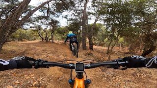
Corriol molt ràpid amb un nivell moderat o la dificultat la poses tu amb la velocitat que agafis. Bona feina la gent de Mataró amb el Mini-BikePark que han fet.

Recent Activity on Trail

Past Week
  • 2 rides
  • 14 miles average
6 Months
  • 69 rides
  • 15 miles avg distance
All
  • 307 rides
  • Last: Jun 22, 2026
c1c2c3c4
January
February
March
April
May
June
July
August
September
October
November
December
Status:
on Apr 10, 2026
Ideal
Avg: 4.45 (4 votes)
Your vote: 0

view (4,160)
close
3D
Trail Conditions
  • Unknown
  • Snow Groomed
  • Snow Packed
  • Snow Covered
  • Snow Cover Partial
  • Freeze/thaw Cycle
  • Icy
  • Prevalent Mud
  • Wet
  • Variable
  • Ideal
  • Dry
  • Very Dry
Trail Flow (Ridden Direction)
Trailforks scans users ridelogs to determine the most popular direction each trail is ridden. A good flowing trail network will have most trails flowing in a single direction according to their intension.
The colour categories are based on what percentage of riders are riding a trail in its intended direction.
  • > 96%
  • > 90%
  • > 80%
  • > 70%
  • > 50%
  • < 50%
  • bi-directional trail
  • no data
Trail Last Ridden
Trailforks scans ridelogs to determine the last time a trail was ridden.
  • < 2 days
  • < 1 week
  • < 2 weeks
  • < 1 month
  • < 6 months
  • > 6 months
Trail Ridden Direction
The intended direction a trail should be ridden.
  • Downhill Only
  • Downhill Primary
  • Both Directions
  • Uphill Primary
  • Uphill Only
  • One Direction
Contribute Details
Colors indicate trail is missing specified detail.
  • Description
  • Photos
  • Description & Photos
  • Videos
Trail Popularity ?
Trailforks scans ridelogs to determine which trails are ridden the most in the last 9 months. Trails are compared with nearby trails in the same city region with a possible 25 colour shades. Think of this as a heatmap, more rides = more kinetic energy = warmer colors.
  • most popular
  • popular
  • less popular
  • not popular
ATV/ORV/OHV Filter
Max Vehicle Width
inches
US Cell Coverage
Legend
cell carrier legend

Radar Time
Activity Recordings
Trailforks uses anonymized public activity data. ?
Activity Recordings
Trailforks uses anonymized public activity data. ?
Personal Heatmap
Activity Types
all / none
Options
2
Date range month
Winter Trails
Warning A routing network for winter maps does not exist. Selecting trails using the winter trails layer has been disabled.
Missing Trails
Most Popular
Least Popular
Trails are colored based on popularity. The more popular a trail is, the more red. Less popular trails trend towards green.
Jump Magnitude Heatmap
Heatmap of where riders jump on trails. Zoom in to see individual jumps, click circles to view jump details.
BC Backroad Status

Service Road Atlas is a free to use, community-driven service for viewing and creating reports on the numerous back-country service roads around B.C. and Alberta.

map legend
Slope Aspect
Direction the slope faces
Flat N NE E SE S SW W NW
Trails Deemphasized
Trails are shown in grey.
disable
Only show trails with no bike usage.
Enable
Suggested Layers
Based on selected activity type

    Save the current map location and zoom level as your default home location whenever this page is loaded.

    Save
        Directions to mistral trailhead (41.577930, 2.454590)

        Photos

        0 more »
        49 |
        Dec 22, 2024 @ 11:37am
        Dec 22, 2024

        Videos

        1 more »
        MISTRAL | Uno de los Trails con Más FLOW de...
        3:40 | 558 | May 3, 2023 , Mataró

        Routes with this trail

        15 miles 3,943 ft 17 Loop
        Ruta endurera espaectacular cerca de Mataró encadenando las mejores trialeras (azules) de la zona.

        Reviews / Comments

        No reviews yet, be the first to write a review or ask a question.
        Use trail reports to comment on trail conditions.


        We hope you've been enjoying Trailforks!

        Create a FREE account to view trail comments and much more.

        • By Dutchmorgan & contributors
        • #403660 - 1,582 views

        Frequently Asked Questions About Mistral

        Where is Mistral located?
        Mistral is located in Mataró, Spain. It is part of the Mataró trail network. The trailhead is located at coordinates 41.57793, 2.45459.
        How hard is Mistral?
        Mistral is rated as Blue difficulty. The average grade is 14.7%.
        What is the elevation gain for Mistral?
        The trail has 186 m of elevation descent. The elevation ranges from 219 m to 405 m.
        Is Mistral a point to point trail?
        Yes, Mistral is a point to point trail. The direction is Downhill Only. The trail type is singletrack.

        Hit the Trail

        Open in App

        Get this trail on your phone instantly.
        open trail in app

        Download Trail

        Save to wishlist, Garmin & download.
        save the trail

        Find Related Routes

        Find routes and users activities that include this trail.
        find routes for this trail

        You must enter a description before submitting.