more stats
1.3 miles
Distance
-950 ft
Descent
00:13:29
Avg time
-950 ft
Altitude change
847 ft
Altitude min
1,798 ft
Altitude max
1,798 ft
Altitude start
846 ft
Altitude end
-13.9%
Grade
-51.6%
Grade max
30 ft
Distance climb
1 mile
Distance down
243 ft
Distance flat
00:13:29
Avg time

Moșu Details

  • Activities
    • Mountain Bike
    • Hike
    • Trail Running
  • Riding Area
    Cioara Mountain
    Reșița
  • AKA
    PS Moşu
  • Difficulty Rating
  • Voted Difficulty
    Blue (2 votes)
  • Local Popularity
    85 in Mountain Biking [+]
    • 75 in Trail Running
    • 5 in Hiking
  • Global Ranking
    #46490 in Mountain Biking [+]
    • #61301 in Trail Running
    • #123284 in Hiking
  • Trail Type
    Singletrack
  • Bike Type
    AM, XC
  • Direction
    Downhill Only
    Popular Direction Shown
  • Physical Rating
    Moderate
  • Season
    Jan - Dec
  • Dogs Allowed
    Yes
  • eBike Allowed
  • TTFs on Trail
    Berm, Jump, Gap Jump, Rock Garden
  • Ride in Rain
    Yes
  • Year Opened
    2017
  • Land Owner
    Romsilva

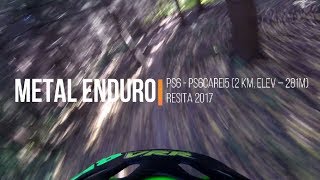
There are three medium sized jumps on this one, a lot of tight corners and even more off-camber. Overall, a technical and fun trail. The rock-garden through the canyon at the end is probably one of the main riding highlights in Reşiţa area (can be quite difficult when it's wet)

Access Info

From Cioara, the trail that goes to the right.

Local Trail Association

Recent Activity on Trail

Past Week
  • 0 rides
  •  
6 Months
  • 0 rides
  •  
All
  • 23 rides
  • Last: May 30, 2026
c1c2c3c4
January
February
March
April
May
June
July
August
September
October
November
December
update trails status or condition

Moșu Trail Reports

statusdatedescription
Dec 28, 2025 @ 12:53pm (Europe/Belgrade)
Dec 28, 2025
a lot of fallen leaves and some fallen tree branches here and there, but still very much fun as always
Oct 19, 2025 @ 10:48am (Europe/Belgrade)
Oct 19, 2025
a lot of fallen leaves, but a lot of fun as always.
Feb 8, 2025 @ 10:34am
Feb 8, 2025
some fallen leaves.
May 6, 2024 @ 3:25am
May 6, 2024
Overgrown vegetation, rideable I would say, seems like the preferred trail for going downhill from the Cioara Hill is Poezie.
Aug 26, 2023 @ 10:00am
Aug 26, 2023
Maybe it’s just me, but I could not find the entrance to this trail. Lots of vegetation and thorns. I took the other trail.
more »
Status:
on Dec 28, 2025
Ideal
Avg: 4.59 (9 votes)
Your vote: 0

view (282)
close
3D
Trail Conditions
  • Unknown
  • Snow Groomed
  • Snow Packed
  • Snow Covered
  • Snow Cover Partial
  • Freeze/thaw Cycle
  • Icy
  • Prevalent Mud
  • Wet
  • Variable
  • Ideal
  • Dry
  • Very Dry
Trail Flow (Ridden Direction)
Trailforks scans users ridelogs to determine the most popular direction each trail is ridden. A good flowing trail network will have most trails flowing in a single direction according to their intension.
The colour categories are based on what percentage of riders are riding a trail in its intended direction.
  • > 96%
  • > 90%
  • > 80%
  • > 70%
  • > 50%
  • < 50%
  • bi-directional trail
  • no data
Trail Last Ridden
Trailforks scans ridelogs to determine the last time a trail was ridden.
  • < 2 days
  • < 1 week
  • < 2 weeks
  • < 1 month
  • < 6 months
  • > 6 months
Trail Ridden Direction
The intended direction a trail should be ridden.
  • Downhill Only
  • Downhill Primary
  • Both Directions
  • Uphill Primary
  • Uphill Only
  • One Direction
Contribute Details
Colors indicate trail is missing specified detail.
  • Description
  • Photos
  • Description & Photos
  • Videos
Trail Popularity ?
Trailforks scans ridelogs to determine which trails are ridden the most in the last 9 months. Trails are compared with nearby trails in the same city region with a possible 25 colour shades. Think of this as a heatmap, more rides = more kinetic energy = warmer colors.
  • most popular
  • popular
  • less popular
  • not popular
ATV/ORV/OHV Filter
Max Vehicle Width
inches
US Cell Coverage
Legend
cell carrier legend

Radar Time
Activity Recordings
Trailforks uses anonymized public activity data. ?
Activity Recordings
Trailforks uses anonymized public activity data. ?
Personal Heatmap
Activity Types
all / none
Options
2
Date range month
Winter Trails
Warning A routing network for winter maps does not exist. Selecting trails using the winter trails layer has been disabled.
Missing Trails
Most Popular
Least Popular
Trails are colored based on popularity. The more popular a trail is, the more red. Less popular trails trend towards green.
Jump Magnitude Heatmap
Heatmap of where riders jump on trails. Zoom in to see individual jumps, click circles to view jump details.
BC Backroad Status

Service Road Atlas is a free to use, community-driven service for viewing and creating reports on the numerous back-country service roads around B.C. and Alberta.

map legend
Slope Aspect
Direction the slope faces
Flat N NE E SE S SW W NW
Trails Deemphasized
Trails are shown in grey.
disable
Only show trails with no bike usage.
Enable
Suggested Layers
Based on selected activity type

    Save the current map location and zoom level as your default home location whenever this page is loaded.

    Save
        Directions to mo-u trailhead (45.275110, 21.872650)

        Photos

        34 more »
        126 |
        Mar 6, 2018 @ 7:01pm
        Mar 6, 2018
        132 |
        Mar 6, 2018 @ 7:00pm
        Mar 6, 2018
        254 |
        Mar 6, 2018 @ 6:59pm
        Mar 6, 2018
        38 |
        Apr 15, 2023 @ 8:36am
        Apr 15, 2023

        Videos

        1 more »
        Ps6carei5
        7:23 | 556 | Mar 7, 2018 , Reșița

        Routes with this trail

        5.0 25 miles 5,131 ft 10 Point to Point Race
        Spread out over two opposing hills above the post-industrial city of Resita, the 2021 edition of Metal...

        Reviews / Comments

        No reviews yet, be the first to write a review or ask a question.
        Use trail reports to comment on trail conditions.


        We hope you've been enjoying Trailforks!

        Create a FREE account to view trail comments and much more.

        • By pufalotTF Pro TRAILFORKS & contributors
        • #94807 - 1,345 views

        Frequently Asked Questions About Moșu

        Where is Moșu located?
        Moșu is located in Cioara Mountain, Reșița, Romania. It is part of the Cioara Mountain trail network. The trailhead is located at coordinates 45.27511, 21.87265.
        How hard is Moșu?
        Moșu is rated as Red difficulty. The physical rating is Moderate. The average grade is 13.9%.
        What is the elevation gain for Moșu?
        The trail has 950 ft of elevation descent. The elevation ranges from 847 ft to 1,798 ft.
        Is Moșu a point to point trail?
        Yes, Moșu is a point to point trail. The direction is Downhill Only. The trail type is singletrack.

        Hit the Trail

        Open in App

        Get this trail on your phone instantly.
        open trail in app

        Download Trail

        Save to wishlist, Garmin & download.
        save the trail

        Find Related Routes

        Find routes and users activities that include this trail.
        find routes for this trail

        You must enter a description before submitting.