This trail is permanently closed/decommissioned
more stats
4,692 ft
Distance
38 ft
Climb
-1,079 ft
Descent
00:14:54
Avg time
-1,041 ft
Altitude change
39 ft
Altitude min
1,080 ft
Altitude max
1,080 ft
Altitude start
39 ft
Altitude end
-22.2%
Grade
-89%
Grade max
28.6%
Grade min
194 ft
Distance climb
4,337 ft
Distance down
161 ft
Distance flat
00:14:54
Avg time

Morepork Details

  • Activities
    • Mountain Bike
    • E-Bike
    • Hike
    • Trail Running
  • Riding Area
  • AKA
    griffins track
  • Difficulty Rating
  • Voted Difficulty
    Double Black Diamond (3 votes)
  • Local Popularity
    45 in Mountain Biking [+]
    • 55 in E-Biking
    • 50 in Trail Running
    • 5 in Hiking
  • Hiking SAC Scale
    T1 Hiking
  • Trail Type
    Singletrack
  • Bike Type
    DH, AM
  • Direction
    Downhill Only
    Popular Direction Shown
  • Physical Rating
    Hard
  • Season
    Summer
  • Dogs Allowed
    Yes
  • eBike Allowed
    Yes up to Class 1
  • TTFs on Trail
    Gap Jump, Rock Face, Rock Garden, Other
  • Year Opened
    2017

Unfortunately, this trail is now closed. The final few hundred meters pass through private property. The land owners have indicated not to want people through their property.

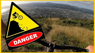
If Trickle Falls is not your cup of tea, then this will be a cup of cold sick. Very steep, rocky, and with more than a few sketchy chutes/drops (grade 5+ to 6). Not for the inexperienced (especially when wet) and should be attempted only on 160mm+ enduro or downhill specific bikes. Originally a walking trail that has had some modifications to make it better to ride.

Access Info

Starts from the steep road up to the Towai Towers. From the ECNZ Road / Mt Towai road intersection, ride up the steep road, and after the second corner (sharp left) you will see a hole in the bush on the left.

(there is an alternative entrance at the ECNZ Road / Mt Towai intersection)

When you are at the bottom of Morepork and come face to face with a fence, go left and left again, walking your bike up the hump to Wainui Road. Be respectful as this last bit is private property,

This trail is unsanctioned.

Recent Activity on Trail

Past Week
  • 0 rides
  •  
6 Months
  • 10 rides
  • 15 miles avg distance
All
  • 73 rides
  • Last: May 30, 2026
c1c2c3c4
January
February
March
April
May
June
July
August
September
October
November
December
update trails status or condition

Morepork Trail Reports

statusdatedescription
Oct 31, 2025 @ 2:57pm (Pacific/Auckland)
Oct 30, 2025
The entire trail need not be closed. You can take the Mawson St exit and remain on public land.
Jan 13, 2024 @ 11:44am
Jan 13, 2024
Jan 9, 2022 @ 2:56pm
Jan 9, 2022
Some clearing work has been done on the bottom section. Nice and clear.
Jan 7, 2022 @ 9:08pm
Jan 7, 2022
In awesome condition.
Jan 5, 2022 @ 11:47am
Jan 5, 2022
Awesome conditions. Dry but not to loose. There is a bit of water in the upper creek bed still. Epic piece of trail
more »
Status:
on Oct 31, 2025
Avg: 4.44 (14 votes)
Your vote: 0

view (495)
close
3D
Trail Conditions
  • Unknown
  • Snow Groomed
  • Snow Packed
  • Snow Covered
  • Snow Cover Partial
  • Freeze/thaw Cycle
  • Icy
  • Prevalent Mud
  • Wet
  • Variable
  • Ideal
  • Dry
  • Very Dry
Trail Flow (Ridden Direction)
Trailforks scans users ridelogs to determine the most popular direction each trail is ridden. A good flowing trail network will have most trails flowing in a single direction according to their intension.
The colour categories are based on what percentage of riders are riding a trail in its intended direction.
  • > 96%
  • > 90%
  • > 80%
  • > 70%
  • > 50%
  • < 50%
  • bi-directional trail
  • no data
Trail Last Ridden
Trailforks scans ridelogs to determine the last time a trail was ridden.
  • < 2 days
  • < 1 week
  • < 2 weeks
  • < 1 month
  • < 6 months
  • > 6 months
Trail Ridden Direction
The intended direction a trail should be ridden.
  • Downhill Only
  • Downhill Primary
  • Both Directions
  • Uphill Primary
  • Uphill Only
  • One Direction
Contribute Details
Colors indicate trail is missing specified detail.
  • Description
  • Photos
  • Description & Photos
  • Videos
Trail Popularity ?
Trailforks scans ridelogs to determine which trails are ridden the most in the last 9 months. Trails are compared with nearby trails in the same city region with a possible 25 colour shades. Think of this as a heatmap, more rides = more kinetic energy = warmer colors.
  • most popular
  • popular
  • less popular
  • not popular
ATV/ORV/OHV Filter
Max Vehicle Width
inches
US Cell Coverage
Legend
cell carrier legend

Radar Time
Activity Recordings
Trailforks uses anonymized public activity data. ?
Activity Recordings
Trailforks uses anonymized public activity data. ?
Personal Heatmap
Activity Types
all / none
Options
2
Date range month
Winter Trails
Warning A routing network for winter maps does not exist. Selecting trails using the winter trails layer has been disabled.
Missing Trails
Most Popular
Least Popular
Trails are colored based on popularity. The more popular a trail is, the more red. Less popular trails trend towards green.
Jump Magnitude Heatmap
Heatmap of where riders jump on trails. Zoom in to see individual jumps, click circles to view jump details.
BC Backroad Status

Service Road Atlas is a free to use, community-driven service for viewing and creating reports on the numerous back-country service roads around B.C. and Alberta.

map legend
Slope Aspect
Direction the slope faces
Flat N NE E SE S SW W NW
Trails Deemphasized
Trails are shown in grey.
disable
Only show trails with no bike usage.
Enable
Suggested Layers
Based on selected activity type

    Save the current map location and zoom level as your default home location whenever this page is loaded.

    Save
        Directions to morepork trailhead (-41.231840, 174.931670)

        Photos

        4 more »
        166 |
        Jun 20, 2021 @ 4:48pm
        Jun 20, 2021
        203 |
        Jan 4, 2021 @ 4:01pm
        Jan 4, 2021
        174 |
        Jan 4, 2021 @ 4:01pm
        Jan 4, 2021
        207 |
        Mar 6, 2020 @ 2:23pm
        Mar 6, 2020

        Videos

        12 more »
        youtuber Have you ever had a trail psych you out? STEEP...
        17:20 | 343 | Jan 4, 2023 , Lower Hutt
        youtuber Morepork @ Wainuiomata Trail Park
        6:49 | 470 | Feb 25, 2022 , Lower Hutt
        youtuber MTB Grade 5. #shorts
        0:11 | 348 | Jan 5, 2022 , Lower Hutt
        youtuber NEXT LEVEL GNAR - Morepork Mountain Bike Trail...
        6:58 | 801 | Mar 4, 2021 , Lower Hutt

        Technical Trail Features (TTF)

        12 Reviews & Comments


        We hope you've been enjoying Trailforks!

        Create a FREE account to view trail comments and much more.

        • #85274 - 9,156 views

        Frequently Asked Questions About Morepork

        Where is Morepork located?
        Morepork is located in Wainuiomata Trail Park (WTP), Lower Hutt, New Zealand. It is part of the Wainuiomata Trail Park (WTP) trail network. The trailhead is located at coordinates -41.23184, 174.93167.
        How hard is Morepork?
        Morepork is rated as Double Black Diamond difficulty. The physical rating is Hard. The average grade is 22.2%.
        What is the elevation gain for Morepork?
        Morepork has 12 m of elevation gain. The trail has 329 m of elevation descent. The elevation ranges from 12 m to 329 m.
        Is Morepork a point to point trail?
        Yes, Morepork is a point to point trail. The direction is Downhill Only. The trail type is singletrack.

        Hit the Trail

        Open in App

        Get this trail on your phone instantly.
        open trail in app

        Download Trail

        Save to wishlist, Garmin & download.
        save the trail

        Find Related Routes

        Find routes and users activities that include this trail.
        find routes for this trail

        You must enter a description before submitting.