more stats
1.3 miles
Distance
754 ft
Climb
00:42:01
Avg time
756 ft
Altitude change
7,498 ft
Altitude min
8,255 ft
Altitude max
7,498 ft
Altitude start
8,255 ft
Altitude end
11.3%
Grade
-0.6%
Grade max
43.2%
Grade min
1 mile
Distance climb
23 ft
Distance down
20 ft
Distance flat
00:42:01
Avg time

Mount Islip Trail Details

  • Activities
    • Hike
    • Mountain Bike
    • Horse
    • Trail Running
  • Riding Area
    Crystal Lake
    Glendora, California
  • Ref Number
    9W05
  • Difficulty Rating
  • Local Popularity
    40 in Mountain Biking [+]
    • 5 in Trail Running
    • 65 in Hiking
    • 5 in Horseback
  • Global Ranking
    #98623 in Mountain Biking [+]
    • #276919 in Trail Running
    • #100057 in Hiking
    • #5923 in Horseback
  • Hiking SAC Scale
    T2 Mountain Hiking
  • Trail Type
    Singletrack
  • Bike Type
    AM, XC
  • Direction
    Both Directions
    Popular Direction Shown
  • Climb Difficulty
    Blue
  • Physical Rating
    Hard
  • Trail Visibility
    Always easy to follow
  • Dogs Allowed
    Yes

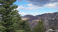
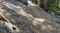
The Mount Islip Trail leads from Little Jimmy CG to the summit of Mount Islip. The grade is moderate with some short steep sections. About 1km above Little Jimmy CG, the trail intersects with the Windy Gap Connector, then continues up the ridge toward the summit. About 0.5km before the summit, the Islip Ridge Trail branches left at a signed junction.

Traditionally Indigenous Territory

Recent Activity on Trail

Past Week
  • 0 rides
  •  
6 Months
  • 1 rides
  • 13 miles avg distance
All
  • 15 rides
  • Last: Jun 1, 2026
c1c2c3c4
January
February
March
April
May
June
July
August
September
October
November
December
update trails status or condition

Mount Islip Trail Trail Reports

statusdatedescription
May 19, 2024 @ 10:12pm
May 19, 2024
Still 50% snow coverage on the slope above Little Jimmy CG, depth about 1m/3ft. Few patches again on the ridge, but mostly clear.
Oct 9, 2022 @ 2:46pm
Oct 9, 2022
Buckthorn and manzanita has been trimmed recently, all clear. Some loose rock and minor ruts from recent rains.
Apr 30, 2022 @ 10:56pm
Apr 30, 2022
Some buckthorn overgrowth, mostly on the south side of the ridge nearing the summit. Otherwise, good conditions.
more »
Status:
on May 19, 2024
Snow Cover Partial
Avg: 3.98 (1 votes)
Your vote: 0

view (14)
close
3D
Trail Conditions
  • Unknown
  • Snow Groomed
  • Snow Packed
  • Snow Covered
  • Snow Cover Partial
  • Freeze/thaw Cycle
  • Icy
  • Prevalent Mud
  • Wet
  • Variable
  • Ideal
  • Dry
  • Very Dry
Trail Flow (Ridden Direction)
Trailforks scans users ridelogs to determine the most popular direction each trail is ridden. A good flowing trail network will have most trails flowing in a single direction according to their intension.
The colour categories are based on what percentage of riders are riding a trail in its intended direction.
  • > 96%
  • > 90%
  • > 80%
  • > 70%
  • > 50%
  • < 50%
  • bi-directional trail
  • no data
Trail Last Ridden
Trailforks scans ridelogs to determine the last time a trail was ridden.
  • < 2 days
  • < 1 week
  • < 2 weeks
  • < 1 month
  • < 6 months
  • > 6 months
Trail Ridden Direction
The intended direction a trail should be ridden.
  • Downhill Only
  • Downhill Primary
  • Both Directions
  • Uphill Primary
  • Uphill Only
  • One Direction
Contribute Details
Colors indicate trail is missing specified detail.
  • Description
  • Photos
  • Description & Photos
  • Videos
Trail Popularity ?
Trailforks scans ridelogs to determine which trails are ridden the most in the last 9 months. Trails are compared with nearby trails in the same city region with a possible 25 colour shades. Think of this as a heatmap, more rides = more kinetic energy = warmer colors.
  • most popular
  • popular
  • less popular
  • not popular
ATV/ORV/OHV Filter
Max Vehicle Width
inches
US Cell Coverage
Legend
cell carrier legend

Radar Time
Activity Recordings
Trailforks uses anonymized public activity data. ?
Activity Recordings
Trailforks uses anonymized public activity data. ?
Personal Heatmap
Activity Types
all / none
Options
2
Date range month
Winter Trails
Warning A routing network for winter maps does not exist. Selecting trails using the winter trails layer has been disabled.
Missing Trails
Most Popular
Least Popular
Trails are colored based on popularity. The more popular a trail is, the more red. Less popular trails trend towards green.
Jump Magnitude Heatmap
Heatmap of where riders jump on trails. Zoom in to see individual jumps, click circles to view jump details.
BC Backroad Status

Service Road Atlas is a free to use, community-driven service for viewing and creating reports on the numerous back-country service roads around B.C. and Alberta.

map legend
Slope Aspect
Direction the slope faces
Flat N NE E SE S SW W NW
Trails Deemphasized
Trails are shown in grey.
disable
Only show trails with no bike usage.
Enable
Suggested Layers
Based on selected activity type

    Save the current map location and zoom level as your default home location whenever this page is loaded.

    Save
        Directions to mount-islip-trail trailhead (34.347380, -117.830560)

        Photos

        5 more »
        44 |
        Nov 1, 2023 @ 9:27pm
        Nov 1, 2023
        68 |
        Oct 15, 2022 @ 11:13pm
        Oct 15, 2022
        49 |
        Oct 9, 2022 @ 2:50pm
        Oct 9, 2022
        59 |
        Oct 9, 2022 @ 2:50pm
        Oct 9, 2022

        Videos

        2 more »
        Pan NE-E-SE from summt
        0:20 | 24 | Oct 9, 2022 , Glendora
        Mellow Climb on Mt Islip
        2:24 | 22 | Jul 7, 2022 , Glendora

        Reviews / Comments

        No reviews yet, be the first to write a review or ask a question.
        Use trail reports to comment on trail conditions.


        We hope you've been enjoying Trailforks!

        Create a FREE account to view trail comments and much more.

        • By toddTF Pro Trailforks & contributors
        • #224079 - 1,688 views

        Frequently Asked Questions About Mount Islip Trail

        Where is Mount Islip Trail located?
        Mount Islip Trail is located in Crystal Lake, Glendora, California, United States. It is part of the Crystal Lake trail network. The trailhead is located at coordinates 34.34738, -117.83056.
        How hard is Mount Islip Trail?
        Mount Islip Trail is rated as Blue difficulty. The physical rating is Hard. The average grade is 11.3%. The climb difficulty is rated Blue.
        What is the elevation gain for Mount Islip Trail?
        Mount Islip Trail has 754 ft of elevation gain. The elevation ranges from 7,498 ft to 8,255 ft.
        Is Mount Islip Trail a point to point trail?
        Mount Islip Trail is not a point to point trail. The direction is Both Directions. The trail type is singletrack.

        Hit the Trail

        Open in App

        Get this trail on your phone instantly.
        open trail in app

        Download Trail

        Save to wishlist, Garmin & download.
        save the trail

        Find Related Routes

        Find routes and users activities that include this trail.
        find routes for this trail

        You must enter a description before submitting.