more stats
1.5 miles
Distance
32 ft
Climb
-523 ft
Descent
00:09:19
Avg time
-490 ft
Altitude change
695 ft
Altitude min
1,214 ft
Altitude max
1,185 ft
Altitude start
696 ft
Altitude end
-6.2%
Grade
-29.4%
Grade max
5.3%
Grade min
1,624 ft
Distance climb
1 mile
Distance down
568 ft
Distance flat
00:09:19
Avg time

Nighthawk Trail Details

  • Activities
    • Mountain Bike
    • E-Bike
    • Gravel Bike
    • Adaptive Bike
    • Hike
    • Trail Running
  • Riding Area
    Black Mountain
    San Diego, California
  • Difficulty Rating
  • Voted Difficulty
    Blue (2 votes)
  • Local Popularity
    40 in Mountain Biking [+]
    • 45 in E-Biking
    • 70 in Trail Running
    • 80 in Hiking
  • Global Ranking
    #125620 in Mountain Biking [+]
    • #85911 in E-Biking
    • #82307 in Trail Running
    • #72345 in Hiking
  • Hiking SAC Scale
    T2 Mountain Hiking
  • Trail Type
    Mixed
  • Bike Type
    DH, AM, XC, Fat, Adaptive MTB, CX, Gravel
  • Direction
    Both Directions[+]
    Popular Direction Shown
    • Both Directions for Gravel Biking
  • Climb Difficulty
    Blue
  • Physical Rating
    Moderate
  • Trail Visibility
    Always easy to follow
  • Family Friendly
    Yes
  • Dogs Allowed
    Yes
  • eBike Allowed
    Yes up to Class 1
  • Ride in Rain
    Yes

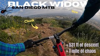
A steep, rocky, and loose climb to the top of black mountain.

Adaptive Bike Info
aMTB Green Rating: Beginner features and moderate terrain.

This trail is entirely aMTB1 except for the last section right before Miner Ridge Loop. Solo adaptive riders should turn around at Nighthawk Connector.

Local Trail Association
Traditionally Indigenous Territory

Recent Activity on Trail

Past Week
  • 1 rides
  • 13 miles average
6 Months
  • 12 rides
  • 10 miles avg distance
All
  • 100 rides
  • Last: Jun 16, 2026
c1c2c3c4
January
February
March
April
May
June
July
August
September
October
November
December
update trails status or condition

Nighthawk Trail Trail Reports

Status:
on Jul 6, 2023
Dry
Avg: 3.33 (9 votes)
Your vote: 0

view (704)
close
3D
Trail Conditions
  • Unknown
  • Snow Groomed
  • Snow Packed
  • Snow Covered
  • Snow Cover Partial
  • Freeze/thaw Cycle
  • Icy
  • Prevalent Mud
  • Wet
  • Variable
  • Ideal
  • Dry
  • Very Dry
Trail Flow (Ridden Direction)
Trailforks scans users ridelogs to determine the most popular direction each trail is ridden. A good flowing trail network will have most trails flowing in a single direction according to their intension.
The colour categories are based on what percentage of riders are riding a trail in its intended direction.
  • > 96%
  • > 90%
  • > 80%
  • > 70%
  • > 50%
  • < 50%
  • bi-directional trail
  • no data
Trail Last Ridden
Trailforks scans ridelogs to determine the last time a trail was ridden.
  • < 2 days
  • < 1 week
  • < 2 weeks
  • < 1 month
  • < 6 months
  • > 6 months
Trail Ridden Direction
The intended direction a trail should be ridden.
  • Downhill Only
  • Downhill Primary
  • Both Directions
  • Uphill Primary
  • Uphill Only
  • One Direction
Contribute Details
Colors indicate trail is missing specified detail.
  • Description
  • Photos
  • Description & Photos
  • Videos
Trail Popularity ?
Trailforks scans ridelogs to determine which trails are ridden the most in the last 9 months. Trails are compared with nearby trails in the same city region with a possible 25 colour shades. Think of this as a heatmap, more rides = more kinetic energy = warmer colors.
  • most popular
  • popular
  • less popular
  • not popular
ATV/ORV/OHV Filter
Max Vehicle Width
inches
US Cell Coverage
Legend
cell carrier legend

Radar Time
Activity Recordings
Trailforks uses anonymized public activity data. ?
Activity Recordings
Trailforks uses anonymized public activity data. ?
Personal Heatmap
Activity Types
all / none
Options
2
Date range month
Winter Trails
Warning A routing network for winter maps does not exist. Selecting trails using the winter trails layer has been disabled.
Missing Trails
Most Popular
Least Popular
Trails are colored based on popularity. The more popular a trail is, the more red. Less popular trails trend towards green.
Jump Magnitude Heatmap
Heatmap of where riders jump on trails. Zoom in to see individual jumps, click circles to view jump details.
BC Backroad Status

Service Road Atlas is a free to use, community-driven service for viewing and creating reports on the numerous back-country service roads around B.C. and Alberta.

map legend
Slope Aspect
Direction the slope faces
Flat N NE E SE S SW W NW
Trails Deemphasized
Trails are shown in grey.
disable
Only show trails with no bike usage.
Enable
Suggested Layers
Based on selected activity type

    Save the current map location and zoom level as your default home location whenever this page is loaded.

    Save
        Directions to nighthawk-trail trailhead (32.982390, -117.112150)

        Photos

        8 more »
        105 |
        Jan 8, 2022 @ 1:56pm
        Jan 8, 2022
        146 |
        Feb 19, 2021 @ 7:23pm
        Feb 19, 2021
        141 |
        Dec 22, 2019 @ 8:09am
        Dec 22, 2019
        166 |
        Dec 22, 2019 @ 8:03am
        Dec 22, 2019

        Videos

        1 more »
        Black Widow trail review, Black Mountain MTB...
        15:33 | 232 | May 17, 2024 , San Diego

        Routes with this trail

        4.5 9 miles 1,400 ft 29 Loop
        A black mountain route that includes fun trails like , downhill and trails. Extend the ride with and east...
        5.0 14 miles 1,996 ft 36 Loop
        MountainBikeBill's favorite long route at at Black Mountain. There is plenty of climbing for the distance...
        11 miles 1,729 ft 9
        Michel's Black Mountain Loop 02032024

        5 Reviews & Comments


        We hope you've been enjoying Trailforks!

        Create a FREE account to view trail comments and much more.

        • By The-dirt-farmerTF Pro & contributors
        • #52419 - 4,268 views

        Frequently Asked Questions About Nighthawk Trail

        Where is Nighthawk Trail located?
        Nighthawk Trail is located in Black Mountain, San Diego, California, United States. It is part of the Black Mountain trail network. The trailhead is located at coordinates 32.98239, -117.11215.
        How hard is Nighthawk Trail?
        Nighthawk Trail is rated as Blue difficulty. The physical rating is Moderate. The average grade is 6.2%. The climb difficulty is rated Blue.
        What is the elevation gain for Nighthawk Trail?
        Nighthawk Trail has 32 ft of elevation gain. The trail has 523 ft of elevation descent. The elevation ranges from 695 ft to 1,214 ft.
        Is Nighthawk Trail a point to point trail?
        Nighthawk Trail is not a point to point trail. The direction is Both Directions. The trail type is mixed.

        Hit the Trail

        Open in App

        Get this trail on your phone instantly.
        open trail in app

        Download Trail

        Save to wishlist, Garmin & download.
        save the trail

        Find Related Routes

        Find routes and users activities that include this trail.
        find routes for this trail

        You must enter a description before submitting.