more stats
2,695 ft
Distance
77 ft
Climb
-78 ft
Descent
00:09:08
Avg time
-1 ft
Altitude change
2,294 ft
Altitude min
2,322 ft
Altitude max
2,299 ft
Altitude start
2,298 ft
Altitude end
-0.037%
Grade
-15.038%
Grade max
16.227%
Grade min
1,000 ft
Distance climb
1,077 ft
Distance down
618 ft
Distance flat
00:09:08
Avg time

No Where Man Details

  • Activities
    • Mountain Bike
    • Winter Fat Bike
    • Hike
    • Trail Running
  • Riding Area
    Mill Woods
    Northwest Edmonton, Alberta
  • Difficulty Rating
  • Local Popularity
    30 in Mountain Biking [+]
    • 5 in Trail Running
    • 5 in Hiking
  • Global Ranking
    #120680 in Mountain Biking [+]
    • #191231 in Trail Running
    • #104400 in Hiking
  • Trail Type
    Singletrack
  • Bike Type
    AM, XC, Fat
  • Direction
    Both Directions
  • Climb Difficulty
    Blue
  • Physical Rating
    Hard
  • Trail Visibility
    Sometimes hard to follow
  • Dogs Allowed
    Yes

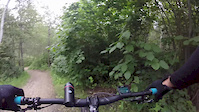
Trail is a technical twisty physically challenging singletrack with very tight corners and difficult climbs with very little run up. Watch for trees, they are everywhere. If you are looking for a flow trail, best to look elsewhere.
South Entrance is just south west of the twin bridge and exits half way up the multi-use entrance that exits to 47 st on the west side of mill creek.

Local Trail Association

Recent Activity on Trail

Past Week
  • 0 rides
  •  
6 Months
  • 2 rides
  • 5 miles avg distance
All
  • 96 rides
  • Last: May 25, 2026
c1c2c3c4
January
February
March
April
May
June
July
August
September
October
November
December
update trails status or condition

No Where Man Trail Reports

statusdatedescription
Oct 9, 2025 @ 10:36am (America/Edmonton)
Oct 9, 2025
Trail is clear, no downed trees. Leaves on the ground are hiding a few of the bigger root sections but very ridable, just a bit dry.
Aug 15, 2022 @ 4:08pm
Aug 15, 2022
a bit dry but great conditions otherwise with no overgrowth creeping onto the trail
Aug 7, 2022 @ 2:03pm
Aug 7, 2022
Less overgrown and great dirt for climbing
Aug 7, 2022 @ 12:01pm
Aug 7, 2022
remaining overgrowth cleared. entire trail is clear to ride
Aug 1, 2022 @ 12:06pm
Aug 1, 2022
overgrowth cleared to the 2nd lower loop from the gravel. mostly good to ride the rest of the way as the growth doesn't look as bad
more »
Status:
on Oct 9, 2025
Dry
Avg: 4.29 (4 votes)
Your vote: 0

view (662)
close
3D
Trail Conditions
  • Unknown
  • Snow Groomed
  • Snow Packed
  • Snow Covered
  • Snow Cover Partial
  • Freeze/thaw Cycle
  • Icy
  • Prevalent Mud
  • Wet
  • Variable
  • Ideal
  • Dry
  • Very Dry
Trail Flow (Ridden Direction)
Trailforks scans users ridelogs to determine the most popular direction each trail is ridden. A good flowing trail network will have most trails flowing in a single direction according to their intension.
The colour categories are based on what percentage of riders are riding a trail in its intended direction.
  • > 96%
  • > 90%
  • > 80%
  • > 70%
  • > 50%
  • < 50%
  • bi-directional trail
  • no data
Trail Last Ridden
Trailforks scans ridelogs to determine the last time a trail was ridden.
  • < 2 days
  • < 1 week
  • < 2 weeks
  • < 1 month
  • < 6 months
  • > 6 months
Trail Ridden Direction
The intended direction a trail should be ridden.
  • Downhill Only
  • Downhill Primary
  • Both Directions
  • Uphill Primary
  • Uphill Only
  • One Direction
Contribute Details
Colors indicate trail is missing specified detail.
  • Description
  • Photos
  • Description & Photos
  • Videos
Trail Popularity ?
Trailforks scans ridelogs to determine which trails are ridden the most in the last 9 months. Trails are compared with nearby trails in the same city region with a possible 25 colour shades. Think of this as a heatmap, more rides = more kinetic energy = warmer colors.
  • most popular
  • popular
  • less popular
  • not popular
ATV/ORV/OHV Filter
Max Vehicle Width
inches
US Cell Coverage
Legend
cell carrier legend

Radar Time
Activity Recordings
Trailforks uses anonymized public activity data. ?
Activity Recordings
Trailforks uses anonymized public activity data. ?
Personal Heatmap
Activity Types
all / none
Options
2
Date range month
Winter Trails
Warning A routing network for winter maps does not exist. Selecting trails using the winter trails layer has been disabled.
Missing Trails
Most Popular
Least Popular
Trails are colored based on popularity. The more popular a trail is, the more red. Less popular trails trend towards green.
Jump Magnitude Heatmap
Heatmap of where riders jump on trails. Zoom in to see individual jumps, click circles to view jump details.
BC Backroad Status

Service Road Atlas is a free to use, community-driven service for viewing and creating reports on the numerous back-country service roads around B.C. and Alberta.

map legend
Slope Aspect
Direction the slope faces
Flat N NE E SE S SW W NW
Trails Deemphasized
Trails are shown in grey.
disable
Only show trails with no bike usage.
Enable
Suggested Layers
Based on selected activity type

    Save the current map location and zoom level as your default home location whenever this page is loaded.

    Save
        Directions to no-where-man trailhead (53.471620, -113.410260)

        Photos

        20 more »
        90 |
        Sep 14, 2020 @ 7:41pm
        Sep 14, 2020
        53 |
        Oct 11, 2019 @ 3:41pm
        Oct 11, 2019
        51 |
        Oct 18, 2020 @ 6:38pm
        Oct 18, 2020
        66 |
        Jul 26, 2020 @ 1:43pm
        Jul 26, 2020

        Videos

        1 more »
        No Where Man
        8:59 | 183 | Aug 10, 2019 , Northwest Edmonton

        Routes with this trail

        7 miles 140 ft 14
        This route connects majority of the blue trails in this area. Starts at 17th St going west with a...

        3 Reviews & Comments


        We hope you've been enjoying Trailforks!

        Create a FREE account to view trail comments and much more.

        • By cooper24TF Pro & contributors
        • #179733 - 1,139 views

        Frequently Asked Questions About No Where Man

        Where is No Where Man located?
        No Where Man is located in Mill Woods, Northwest Edmonton, Alberta, Canada. It is part of the Mill Woods trail network. The trailhead is located at coordinates 53.47162, -113.41026.
        How hard is No Where Man?
        No Where Man is rated as Blue difficulty. The physical rating is Hard. The average grade is 0.037%. The climb difficulty is rated Blue.
        What is the elevation gain for No Where Man?
        No Where Man has 77 ft of elevation gain. The trail has 78 ft of elevation descent. The elevation ranges from 2,294 ft to 2,322 ft.
        Is No Where Man a point to point trail?
        No Where Man is not a point to point trail. The direction is Both Directions. The trail type is singletrack.

        Hit the Trail

        Open in App

        Get this trail on your phone instantly.
        open trail in app

        Download Trail

        Save to wishlist, Garmin & download.
        save the trail

        Find Related Routes

        Find routes and users activities that include this trail.
        find routes for this trail

        You must enter a description before submitting.