more stats
3,073 ft
Distance
132 ft
Climb
-89 ft
Descent
00:04:04
Avg time
43 ft
Altitude change
78 ft
Altitude min
191 ft
Altitude max
126 ft
Altitude start
169 ft
Altitude end
1.404%
Grade
-29.05%
Grade max
58.94%
Grade min
950 ft
Distance climb
1,793 ft
Distance down
330 ft
Distance flat
00:04:04
Avg time

North Bank Details

  • Activities
    • Mountain Bike
    • Hike
    • Trail Running
  • Riding Area
    James River Park System
    Richmond, Virginia
  • Difficulty Rating
  • Voted Difficulty
    Green (1 vote)
  • Local Popularity
    95 in Mountain Biking [+]
    • 95 in Trail Running
    • 90 in Hiking
  • Global Ranking
    #42222 in Mountain Biking [+]
    • #4983 in Trail Running
    • #39021 in Hiking
  • Trail Type
    Singletrack
  • Bike Type
    AM
  • Direction
    Both Directions
  • Climb Difficulty
    Black Diamond
  • Physical Rating
    Hard
  • Season
    Year Round
  • Dogs Allowed
    Yes
  • TTFs on Trail
    Bridge, Jump, Rock Face
  • Land Owner

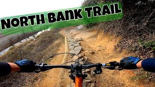
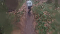
Fast, flowing singletrack with some steep climbs and fast descents. North Bank has good “flow” and is very fast. Be careful of oncoming mountain bikers and pedestrians. Great panoramas of the James River that not many people are able to view are accessible from many areas of North Bank Trail. The trail runs from the Boulevard Bridge to Tredegar Iron Works.

Access Info

This bit of trail connects the Belle Isle and Pump House parking lots for the James River park system.

Heading east from the Pump House parking lot, enter the trail next to kiosk. From there continue under the Boulevard bridge, and to a creek crossing. Cross the creek and continue along a chain link fence until you emerge on a dirt road. Take the dirt road to a wooden ramp (arguably the most difficult climb in the park system).

At the top of the ramp you'll have to take the road for 3 blocks to a right turn at a stop sign (follow signs for "Northbank Trail"). Continue 1 more block to a parking lot entrance and from here take the trail that continues straight making a right bend after the small wooden bridge creek crossing.

From here no more directions should be needed except for a section split for foot versus bike traffic (just follow the signs).

The last section of trail is on a dirt road at the bottom of a grass hill. Look for a right across a foot/access bridge down to the Belle Isle parking lot.

Local Trail Association
Traditionally Indigenous Territory

Recent Activity on Trail

Past Week
  • 4 rides
  • 13 miles average
6 Months
  • 61 rides
  • 11 miles avg distance
All
  • 796 rides
  • Last: Jun 22, 2026
c1c2c3c4
January
February
March
April
May
June
July
August
September
October
November
December
Status:
on Nov 4, 2025
Ideal
Avg: 3.9 (5 votes)
Your vote: 0

view (6,909)
close
3D
Trail Conditions
  • Unknown
  • Snow Groomed
  • Snow Packed
  • Snow Covered
  • Snow Cover Partial
  • Freeze/thaw Cycle
  • Icy
  • Prevalent Mud
  • Wet
  • Variable
  • Ideal
  • Dry
  • Very Dry
Trail Flow (Ridden Direction)
Trailforks scans users ridelogs to determine the most popular direction each trail is ridden. A good flowing trail network will have most trails flowing in a single direction according to their intension.
The colour categories are based on what percentage of riders are riding a trail in its intended direction.
  • > 96%
  • > 90%
  • > 80%
  • > 70%
  • > 50%
  • < 50%
  • bi-directional trail
  • no data
Trail Last Ridden
Trailforks scans ridelogs to determine the last time a trail was ridden.
  • < 2 days
  • < 1 week
  • < 2 weeks
  • < 1 month
  • < 6 months
  • > 6 months
Trail Ridden Direction
The intended direction a trail should be ridden.
  • Downhill Only
  • Downhill Primary
  • Both Directions
  • Uphill Primary
  • Uphill Only
  • One Direction
Contribute Details
Colors indicate trail is missing specified detail.
  • Description
  • Photos
  • Description & Photos
  • Videos
Trail Popularity ?
Trailforks scans ridelogs to determine which trails are ridden the most in the last 9 months. Trails are compared with nearby trails in the same city region with a possible 25 colour shades. Think of this as a heatmap, more rides = more kinetic energy = warmer colors.
  • most popular
  • popular
  • less popular
  • not popular
ATV/ORV/OHV Filter
Max Vehicle Width
inches
US Cell Coverage
Legend
cell carrier legend

Radar Time
Activity Recordings
Trailforks uses anonymized public activity data. ?
Activity Recordings
Trailforks uses anonymized public activity data. ?
Personal Heatmap
Activity Types
all / none
Options
2
Date range month
Winter Trails
Warning A routing network for winter maps does not exist. Selecting trails using the winter trails layer has been disabled.
Missing Trails
Most Popular
Least Popular
Trails are colored based on popularity. The more popular a trail is, the more red. Less popular trails trend towards green.
Jump Magnitude Heatmap
Heatmap of where riders jump on trails. Zoom in to see individual jumps, click circles to view jump details.
BC Backroad Status

Service Road Atlas is a free to use, community-driven service for viewing and creating reports on the numerous back-country service roads around B.C. and Alberta.

map legend
Slope Aspect
Direction the slope faces
Flat N NE E SE S SW W NW
Trails Deemphasized
Trails are shown in grey.
disable
Only show trails with no bike usage.
Enable
Suggested Layers
Based on selected activity type

    Save the current map location and zoom level as your default home location whenever this page is loaded.

    Save
        Directions to north-bank trailhead (37.535219, -77.482989)

        Photos

        No photos have been added for North Bank yet, add a photo.

        Videos

        3 more »
        Richmond Mountain Biking: Buttermilk Loop...
        12:20 | 498 | Feb 1, 2022 , Richmond
        James River Park System: North Bank Trail Tour...
        29:24 | 533 | Jan 2, 2020 , Richmond
        North Bank Crash
        0:13 | 567 | Dec 1, 2015 , Richmond

        Routes with this trail

        28 miles 1,333 ft 22
        2023 Tour de Fall Line - Medium Course - A tour of Richmond's Downtown singletrack
        51 miles 2,418 ft 26 Loop
        2023 Tour de Fall Line - Long Route - A tour of Richmond's Single Track paradise!
        6 miles 419 ft 8 Point to Point
        This is my first route it is a very basic one and can be used for recovery

        1 Review & Comments


        We hope you've been enjoying Trailforks!

        Create a FREE account to view trail comments and much more.

        • By larsthemajTF Pro & contributors
        • #38137 - 3,817 views

        Frequently Asked Questions About North Bank

        Where is North Bank located?
        North Bank is located in James River Park System, Richmond, Virginia, United States. It is part of the James River Park System trail network. The trailhead is located at coordinates 37.53522, -77.48299.
        How hard is North Bank?
        North Bank is rated as Black Diamond difficulty. The physical rating is Hard. The average grade is 1.404%. The climb difficulty is rated Black Diamond.
        What is the elevation gain for North Bank?
        North Bank has 132 ft of elevation gain. The trail has 89 ft of elevation descent. The elevation ranges from 78 ft to 191 ft.
        Is North Bank a point to point trail?
        North Bank is not a point to point trail. The direction is Both Directions. The trail type is singletrack.

        Hit the Trail

        Open in App

        Get this trail on your phone instantly.
        open trail in app

        Download Trail

        Save to wishlist, Garmin & download.
        save the trail

        Find Related Routes

        Find routes and users activities that include this trail.
        find routes for this trail

        You must enter a description before submitting.