more stats
2.0 miles
Distance
216 ft
Climb
-361 ft
Descent
00:28:13
Avg time
-145 ft
Altitude change
5,200 ft
Altitude min
5,352 ft
Altitude max
5,352 ft
Altitude start
5,207 ft
Altitude end
-1.354%
Grade
-63.029%
Grade max
67.493%
Grade min
2,452 ft
Distance climb
1 mile
Distance down
812 ft
Distance flat
00:28:13
Avg time

North Rim Details

  • Activities
    • Mountain Bike
    • E-Bike
    • Hike
    • Trail Running
  • Riding Area
    Gooseberry Mesa
    Hurricane, Utah
  • Difficulty Rating
  • Voted Difficulty
    Blue (1 vote)
  • Local Popularity
    90 in Mountain Biking [+]
    • 90 in E-Biking
    • 65 in Trail Running
    • 70 in Hiking
  • Global Ranking
    #3223 in Mountain Biking [+]
    • #2682 in E-Biking
    • #36322 in Trail Running
    • #23390 in Hiking
  • Hiking SAC Scale
    T2 Mountain Hiking
  • Trail Type
    Singletrack
  • Direction
    Both Directions
  • Climb Difficulty
    Blue
  • Physical Rating
    Moderate
  • Dogs Allowed
    Yes
  • eBike Allowed
    Yes up to Class 1

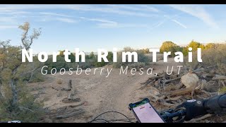
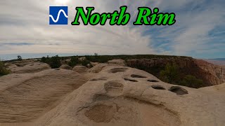
This trail brings you right to the edge of the mesa, and flows over rocks, gravel with some difficult sections, but good practice for the more difficult slick rock sections. Riding this is surreal as the trees on your left move quickly while the endless view on the right is static. A must ride section to complete the Gooseberry experience

Trail Supporters
  • BLM
    BLM
    Land Manager
Traditionally Indigenous Territory

Recent Activity on Trail

Past Week
  • 2 rides
  • 11 miles average
6 Months
  • 145 rides
  • 13 miles avg distance
All
  • 1,170 rides
  • Last: Jun 14, 2026
c1c2c3c4
January
February
March
April
May
June
July
August
September
October
November
December
update trails status or condition

North Rim Trail Reports

Status:
on Apr 25, 2026
Ideal
Avg: 4.38 (79 votes)
Your vote: 0

view (4,852)
close
3D
Trail Conditions
  • Unknown
  • Snow Groomed
  • Snow Packed
  • Snow Covered
  • Snow Cover Partial
  • Freeze/thaw Cycle
  • Icy
  • Prevalent Mud
  • Wet
  • Variable
  • Ideal
  • Dry
  • Very Dry
Trail Flow (Ridden Direction)
Trailforks scans users ridelogs to determine the most popular direction each trail is ridden. A good flowing trail network will have most trails flowing in a single direction according to their intension.
The colour categories are based on what percentage of riders are riding a trail in its intended direction.
  • > 96%
  • > 90%
  • > 80%
  • > 70%
  • > 50%
  • < 50%
  • bi-directional trail
  • no data
Trail Last Ridden
Trailforks scans ridelogs to determine the last time a trail was ridden.
  • < 2 days
  • < 1 week
  • < 2 weeks
  • < 1 month
  • < 6 months
  • > 6 months
Trail Ridden Direction
The intended direction a trail should be ridden.
  • Downhill Only
  • Downhill Primary
  • Both Directions
  • Uphill Primary
  • Uphill Only
  • One Direction
Contribute Details
Colors indicate trail is missing specified detail.
  • Description
  • Photos
  • Description & Photos
  • Videos
Trail Popularity ?
Trailforks scans ridelogs to determine which trails are ridden the most in the last 9 months. Trails are compared with nearby trails in the same city region with a possible 25 colour shades. Think of this as a heatmap, more rides = more kinetic energy = warmer colors.
  • most popular
  • popular
  • less popular
  • not popular
ATV/ORV/OHV Filter
Max Vehicle Width
inches
US Cell Coverage
Legend
cell carrier legend

Radar Time
Activity Recordings
Trailforks uses anonymized public activity data. ?
Activity Recordings
Trailforks uses anonymized public activity data. ?
Personal Heatmap
Activity Types
all / none
Options
2
Date range month
Winter Trails
Warning A routing network for winter maps does not exist. Selecting trails using the winter trails layer has been disabled.
Missing Trails
Most Popular
Least Popular
Trails are colored based on popularity. The more popular a trail is, the more red. Less popular trails trend towards green.
Jump Magnitude Heatmap
Heatmap of where riders jump on trails. Zoom in to see individual jumps, click circles to view jump details.
BC Backroad Status

Service Road Atlas is a free to use, community-driven service for viewing and creating reports on the numerous back-country service roads around B.C. and Alberta.

map legend
Slope Aspect
Direction the slope faces
Flat N NE E SE S SW W NW
Trails Deemphasized
Trails are shown in grey.
disable
Only show trails with no bike usage.
Enable
Suggested Layers
Based on selected activity type

    Save the current map location and zoom level as your default home location whenever this page is loaded.

    Save
        Directions to north-rim trailhead (37.138410, -113.207900)

        Photos

        87 more »
        919 |
        Mar 25, 2018 @ 2:52pm
        Mar 25, 2018
        948 |
        Oct 21, 2015 @ 8:28pm
        Oct 21, 2015
        403 |
        Nov 5, 2017 @ 3:41pm
        Nov 5, 2017
        389 |
        Jun 6, 2017 @ 9:11am
        Jun 6, 2017

        Videos

        18 more »
        youtuber CRAZY WIND at Gooseberry Mesa! | Hurricane, UT
        8:04 | 779 | Feb 13, 2020 , Hurricane
        Gooseberry Mesa Slickrock Playground ...
        25:34 | 84 | Oct 1, 2025 , Hurricane
        North Rim Trail - Gooseberry Mesa
        17:01 | 152 | Dec 31, 2024 , Hurricane
        youtuber North Rim
        13:08 | 151 | Dec 29, 2024 , Hurricane

        Trail Lists

        Routes with this trail

        4.0 11 miles 733 ft 16 Loop
        This is my go-to loop in Gooseberry Mesa. Start off with some rolling slickrock on then warm up to the...
        3.7 13 miles 668 ft 8 Loop
        An intermediate loop around Gooseberry Mesa
        3.7 18 miles 1,141 ft 5 Loop
        Best of Gooseberry Mesa in one ride.

        12 Reviews & Comments


        We hope you've been enjoying Trailforks!

        Create a FREE account to view trail comments and much more.

        • By toddTF Pro Trailforks & contributors
        • #9088 - 9,664 views

        Frequently Asked Questions About North Rim

        Where is North Rim located?
        North Rim is located in Gooseberry Mesa, Hurricane, Utah, United States. It is part of the Gooseberry Mesa trail network. The trailhead is located at coordinates 37.13841, -113.2079.
        How hard is North Rim?
        North Rim is rated as Blue difficulty. The physical rating is Moderate. The average grade is 1.354%. The climb difficulty is rated Blue.
        What is the elevation gain for North Rim?
        North Rim has 216 ft of elevation gain. The trail has 361 ft of elevation descent. The elevation ranges from 5,200 ft to 5,352 ft.
        Is North Rim a point to point trail?
        North Rim is not a point to point trail. The direction is Both Directions. The trail type is singletrack.

        Hit the Trail

        Open in App

        Get this trail on your phone instantly.
        open trail in app

        Download Trail

        Save to wishlist, Garmin & download.
        save the trail

        Find Related Routes

        Find routes and users activities that include this trail.
        find routes for this trail

        You must enter a description before submitting.