more stats
3,323 ft
Distance
34 ft
Climb
-550 ft
Descent
00:05:19
Avg time
-515 ft
Altitude change
716 ft
Altitude min
1,251 ft
Altitude max
1,233 ft
Altitude start
719 ft
Altitude end
-15.5%
Grade
-71%
Grade max
25.5%
Grade min
400 ft
Distance climb
2,257 ft
Distance down
666 ft
Distance flat
00:05:19
Avg time

Ob pruhu Details

  • Activities
    • Mountain Bike
    • E-Bike
    • Hike
    • Trail Running
  • Riding Area
    Soteska
    Novo mesto
  • AKA
    nad bajto
  • Difficulty Rating
  • Voted Difficulty
    Red (1 vote)
  • Local Popularity
    95 in Mountain Biking [+]
    • 100 in E-Biking
    • 5 in Trail Running
    • 5 in Hiking
  • Global Ranking
    #37510 in Mountain Biking [+]
    • #5381 in E-Biking
    • #136158 in Trail Running
    • #130140 in Hiking
  • Trail Exposure
    High Risk
  • Trail Type
    Singletrack
  • Bike Type
    DH, AM
  • Climb Difficulty
    Green
  • Physical Rating
    Moderate
  • Trail Visibility
    Always easy to follow
  • Season
    January - December
  • Dogs Allowed
    Yes
  • eBike Allowed
    Yes up to Class 1
  • TTFs on Trail
    Berm, Drop, Jump, Gap Jump
  • Ride in Rain
    Yes
  • Year Opened
    2010

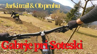
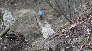
Short but sweet single trail with a few jumps, berms and drops.
Trail goes throught the woods, at the edge of sand quarry (sand pit).

Access Info

Start in at the bridge over river Krka in village Soteska. Uphill starts on asphalt road on the left side of river. Second part of uphill is on gravel road.

Local Trail Association

Recent Activity on Trail

Past Week
  • 0 rides
  •  
6 Months
  • 8 rides
  • 25.1 km avg distance
All
  • 90 rides
  • Last: May 31, 2026
c1c2c3c4
January
February
March
April
May
June
July
August
September
October
November
December
update trails status or condition

Ob pruhu Trail Reports

Status:
on Jun 21, 2026
Ideal
Avg: 4.53 (7 votes)
Your vote: 0

view (436)
close
3D
Trail Conditions
  • Unknown
  • Snow Groomed
  • Snow Packed
  • Snow Covered
  • Snow Cover Partial
  • Freeze/thaw Cycle
  • Icy
  • Prevalent Mud
  • Wet
  • Variable
  • Ideal
  • Dry
  • Very Dry
Trail Flow (Ridden Direction)
Trailforks scans users ridelogs to determine the most popular direction each trail is ridden. A good flowing trail network will have most trails flowing in a single direction according to their intension.
The colour categories are based on what percentage of riders are riding a trail in its intended direction.
  • > 96%
  • > 90%
  • > 80%
  • > 70%
  • > 50%
  • < 50%
  • bi-directional trail
  • no data
Trail Last Ridden
Trailforks scans ridelogs to determine the last time a trail was ridden.
  • < 2 days
  • < 1 week
  • < 2 weeks
  • < 1 month
  • < 6 months
  • > 6 months
Trail Ridden Direction
The intended direction a trail should be ridden.
  • Downhill Only
  • Downhill Primary
  • Both Directions
  • Uphill Primary
  • Uphill Only
  • One Direction
Contribute Details
Colors indicate trail is missing specified detail.
  • Description
  • Photos
  • Description & Photos
  • Videos
Trail Popularity ?
Trailforks scans ridelogs to determine which trails are ridden the most in the last 9 months. Trails are compared with nearby trails in the same city region with a possible 25 colour shades. Think of this as a heatmap, more rides = more kinetic energy = warmer colors.
  • most popular
  • popular
  • less popular
  • not popular
ATV/ORV/OHV Filter
Max Vehicle Width
inches
US Cell Coverage
Legend
cell carrier legend

Radar Time
Activity Recordings
Trailforks uses anonymized public activity data. ?
Activity Recordings
Trailforks uses anonymized public activity data. ?
Personal Heatmap
Activity Types
all / none
Options
2
Date range month
Winter Trails
Warning A routing network for winter maps does not exist. Selecting trails using the winter trails layer has been disabled.
Missing Trails
Most Popular
Least Popular
Trails are colored based on popularity. The more popular a trail is, the more red. Less popular trails trend towards green.
Jump Magnitude Heatmap
Heatmap of where riders jump on trails. Zoom in to see individual jumps, click circles to view jump details.
BC Backroad Status

Service Road Atlas is a free to use, community-driven service for viewing and creating reports on the numerous back-country service roads around B.C. and Alberta.

map legend
Slope Aspect
Direction the slope faces
Flat N NE E SE S SW W NW
Trails Deemphasized
Trails are shown in grey.
disable
Only show trails with no bike usage.
Enable
Suggested Layers
Based on selected activity type

    Save the current map location and zoom level as your default home location whenever this page is loaded.

    Save
        Directions to ob-pruhu trailhead (45.784760, 15.021970)

        Photos

        20 more »
        25 |
        Jun 1, 2026 @ 7:30am
        Jun 1, 2026
        25 |
        Jun 1, 2026 @ 7:28am
        Jun 1, 2026
        31 |
        Jun 1, 2026 @ 7:26am
        Jun 1, 2026
        32 |
        May 19, 2026 @ 12:10pm
        May 19, 2026

        Videos

        2 more »
        Jarki & Ob pruhu MTB Gabrje pri Soteska part 1
        8:50 | 359 | Apr 20, 2022 , Novo mesto
        trejl Ob pruhu (2014)
        3:17 | 522 | Mar 8, 2020 , Novo mesto

        Reviews / Comments

        No reviews yet, be the first to write a review or ask a question.
        Use trail reports to comment on trail conditions.


        We hope you've been enjoying Trailforks!

        Create a FREE account to view trail comments and much more.

        • By majhTF Pro & contributors
        • #74791 - 2,517 views

        Frequently Asked Questions About Ob pruhu

        Where is Ob pruhu located?
        Ob pruhu is located in Soteska, Novo mesto, Slovenia. It is part of the Soteska trail network. The trailhead is located at coordinates 45.78476, 15.02197.
        How hard is Ob pruhu?
        Ob pruhu is rated as Red difficulty. The physical rating is Moderate. The average grade is 15.5%. The climb difficulty is rated Green.
        What is the elevation gain for Ob pruhu?
        Ob pruhu has 34 ft of elevation gain. The trail has 550 ft of elevation descent. The elevation ranges from 716 ft to 1,251 ft.
        How long is Ob pruhu?
        Ob pruhu is 3,323 ft long. The trail type is singletrack.

        Hit the Trail

        Open in App

        Get this trail on your phone instantly.
        open trail in app

        Download Trail

        Save to wishlist, Garmin & download.
        save the trail

        Find Related Routes

        Find routes and users activities that include this trail.
        find routes for this trail

        You must enter a description before submitting.