more stats
5.0 miles
Distance
18 ft
Climb
-1,554 ft
Descent
00:22:54
Avg time
-1,537 ft
Altitude change
9,401 ft
Altitude min
10,937 ft
Altitude max
10,937 ft
Altitude start
9,400 ft
Altitude end
-5.8%
Grade
-52.9%
Grade max
13.9%
Grade min
1,119 ft
Distance climb
5 miles
Distance down
883 ft
Distance flat
00:22:54
Avg time

Off the Top Details

  • Activities
    • Mountain Bike
    • E-Bike
    • Gravel Bike
    • Adaptive Bike
    • Winter Fat Bike
  • Riding Area
    Mammoth Mountain Bike Park
    Mammoth Lakes, California
  • Difficulty Rating
  • Voted Difficulty
    Blue (1 vote)
  • Local Popularity
    100 in Mountain Biking [+]
    • 100 in E-Biking
  • Global Ranking
    #26464 in Mountain Biking [+]
    • #2184 in E-Biking
  • Trail Type
    Doubletrack
  • Bike Type
    AM, XC, Fat, Adaptive MTB, Gravel
  • Direction
    Downhill Only[+]
    Popular Direction Shown
    • Downhill Only for Gravel Biking
  • Climb Difficulty
    Blue
  • Physical Rating
    Moderate
  • Trail Visibility
    Always easy to follow
  • Family Friendly
    Yes
  • eBike Allowed
    Yes up to Class 1

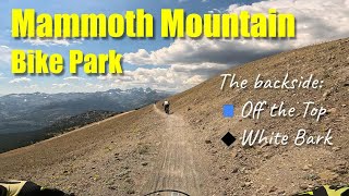
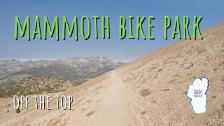
Known as the family adventure trail. Zig zags across the pumice fields at the top. Some of the turns are lined with pavers. There a few rock gardens along this trail, but everything is very mellow and family friendly. At the bottom, turn left on Beach Cruiser to go around Reds Lake or turn right for a shorter route. Link up to Mountain View and Beach cruiser for flowy fun or to White Bark and Richter for more advanced features.

Access Info

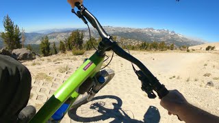
Access from the top of the mountain via the Upper Gondola

Adaptive Bike Info
aMTB Blue Rating: Intermediate features and steeper terrain.

There are few problem spots. Consult POIs.

Trail Supporters

  • USFS
    Land Manager

Bike Park

Recent Activity on Trail

Past Week
  • 0 rides
  •  
6 Months
  • 0 rides
  •  
All
  • 610 rides
  • Last: Aug 9, 2025
c1c2c3c4
January
February
March
April
May
June
July
August
September
October
November
December
update trails status or condition

Off the Top Trail Reports

statusdatedescription
Aug 31, 2025 @ 9:23am
Aug 31, 2025
Nice day at Mammoth Bike park VERY dry. A decent amount of smoke in the sky.
Aug 24, 2025 @ 9:23am
Aug 24, 2025
Aug 15, 2025 @ 11:29am
Aug 15, 2025
Aug 3, 2025 @ 11:20am
Aug 3, 2025
Good condition overall - clear of snow, dry. Couple of small sandy washes
Jun 30, 2025 @ 11:55pm
Jun 30, 2025
Conditions typical of mid-late summer rather than June. There are some patches of snow that can be tricky to navigate if they catch you off...
more »
Status:
on Aug 31, 2025
Ideal
Avg: 4.24 (27 votes)
Your vote: 0

view (4,832)
close
3D
Trail Conditions
  • Unknown
  • Snow Groomed
  • Snow Packed
  • Snow Covered
  • Snow Cover Partial
  • Freeze/thaw Cycle
  • Icy
  • Prevalent Mud
  • Wet
  • Variable
  • Ideal
  • Dry
  • Very Dry
Trail Flow (Ridden Direction)
Trailforks scans users ridelogs to determine the most popular direction each trail is ridden. A good flowing trail network will have most trails flowing in a single direction according to their intension.
The colour categories are based on what percentage of riders are riding a trail in its intended direction.
  • > 96%
  • > 90%
  • > 80%
  • > 70%
  • > 50%
  • < 50%
  • bi-directional trail
  • no data
Trail Last Ridden
Trailforks scans ridelogs to determine the last time a trail was ridden.
  • < 2 days
  • < 1 week
  • < 2 weeks
  • < 1 month
  • < 6 months
  • > 6 months
Trail Ridden Direction
The intended direction a trail should be ridden.
  • Downhill Only
  • Downhill Primary
  • Both Directions
  • Uphill Primary
  • Uphill Only
  • One Direction
Contribute Details
Colors indicate trail is missing specified detail.
  • Description
  • Photos
  • Description & Photos
  • Videos
Trail Popularity ?
Trailforks scans ridelogs to determine which trails are ridden the most in the last 9 months. Trails are compared with nearby trails in the same city region with a possible 25 colour shades. Think of this as a heatmap, more rides = more kinetic energy = warmer colors.
  • most popular
  • popular
  • less popular
  • not popular
ATV/ORV/OHV Filter
Max Vehicle Width
inches
US Cell Coverage
Legend
cell carrier legend

Radar Time
Activity Recordings
Trailforks uses anonymized public activity data. ?
Activity Recordings
Trailforks uses anonymized public activity data. ?
Personal Heatmap
Activity Types
all / none
Options
2
Date range month
Winter Trails
Warning A routing network for winter maps does not exist. Selecting trails using the winter trails layer has been disabled.
Missing Trails
Most Popular
Least Popular
Trails are colored based on popularity. The more popular a trail is, the more red. Less popular trails trend towards green.
Jump Magnitude Heatmap
Heatmap of where riders jump on trails. Zoom in to see individual jumps, click circles to view jump details.
BC Backroad Status

Service Road Atlas is a free to use, community-driven service for viewing and creating reports on the numerous back-country service roads around B.C. and Alberta.

map legend
Slope Aspect
Direction the slope faces
Flat N NE E SE S SW W NW
Trails Deemphasized
Trails are shown in grey.
disable
Only show trails with no bike usage.
Enable
Suggested Layers
Based on selected activity type

    Save the current map location and zoom level as your default home location whenever this page is loaded.

    Save
        Directions to off-the-top trailhead (37.628180, -119.031560)

        Photos

        38 more »
        39 |
        Aug 27, 2025 @ 12:36am
        Aug 27, 2025
        40 |
        Aug 27, 2025 @ 12:36am
        Aug 27, 2025
        39 |
        Aug 27, 2025 @ 12:36am
        Aug 27, 2025
        59 |
        Sep 14, 2024 @ 1:42pm
        Sep 14, 2024

        Videos

        22 more »
        youtuber Off The Top / Mammoth Bike Park
        9:59 | 299 | Jul 27, 2022 , Mammoth Lakes
        youtuber Don't forget the backside of Mammoth Mountain...
        10:04 | 177 | Aug 8, 2024 , Mammoth Lakes
        Can I Conquer Mammoth Bike Park After My Crash?
        11:57 | 67 | Aug 27, 2025 , Mammoth Lakes
        Mammoth Bike Park BEST Views - Off the Top
        26:25 | 27 | Aug 19, 2025 , Mammoth Lakes

        Trail Lists

        Routes with this trail

        8 miles 68 ft 6 Point to Point
        Family adventure and from the top back to Main Lodge Adaptive Info: Five potential dilemmas, possibly...
        6 miles 36 ft 15 Point to Point
        This route skips all the major dilemmas on and is do-able solo for most adaptive riders. There is a short...
        7 miles 45 ft 6
        I have a love/hate relationship with Skid Marks. It’s worth doing (at least to mix it up from the top)...

        Trail Products

        8 Reviews & Comments


        We hope you've been enjoying Trailforks!

        Create a FREE account to view trail comments and much more.

        • By TheAngryTomatoTF Pro TRAILFORKS & contributors
        • #25038 - 6,677 views

        Frequently Asked Questions About Off the Top

        Where is Off the Top located?
        Off the Top is located in Mammoth Mountain Bike Park, Mammoth Lakes, California, United States. It is part of the Mammoth Mountain Bike Park trail network. The trailhead is located at coordinates 37.62818, -119.03156.
        How hard is Off the Top?
        Off the Top is rated as Blue difficulty. The physical rating is Moderate. The average grade is 5.8%. The climb difficulty is rated Blue.
        What is the elevation gain for Off the Top?
        Off the Top has 18 ft of elevation gain. The trail has 1,554 ft of elevation descent. The elevation ranges from 9,401 ft to 10,937 ft.
        Is Off the Top a point to point trail?
        Yes, Off the Top is a point to point trail. The direction is Downhill Only. The trail type is doubletrack.

        Hit the Trail

        Open in App

        Get this trail on your phone instantly.
        open trail in app

        Download Trail

        Save to wishlist, Garmin & download.
        save the trail

        Find Related Routes

        Find routes and users activities that include this trail.
        find routes for this trail

        You must enter a description before submitting.